Directions to R&R Battista Services, Inc. (Watertown Town) with public transportation
The following transit lines have routes that pass near R&R Battista Services, Inc.
 Bus: 504, 52, 70, 71, 57.
- Train: FITCHBURG, FRAMINGHAM/WORCESTER.
- Subway: GREEN LINE B.
How to get to R&R Battista Services, Inc. by bus?
Click on the bus route to see step by step directions with maps, line arrival times and updated time schedules.
From 1010 MASS AVE, Boston
60 minFrom The Westin Waltham Boston, Waltham
49 minFrom Club Quarters, Boston
44 minFrom Hyatt Centric Faneuil, Boston
47 minFrom Omni Parker House, Boston
49 minFrom Revere Hotel Boston Common, Boston
35 minFrom Registry of Motor Vehicles (RMV) Boston, Boston
54 minFrom Bell In Hand Tavern, Boston
51 minFrom Assembly Square, Somerville
71 minFrom Forest Hills Station MBTA, Boston
62 min
How to get to R&R Battista Services, Inc. by train?
Click on the train route to see step by step directions with maps, line arrival times and updated time schedules.
From 1010 MASS AVE, Boston
107 minFrom Club Quarters, Boston
73 minFrom Hyatt Centric Faneuil, Boston
77 minFrom Omni Parker House, Boston
79 minFrom Revere Hotel Boston Common, Boston
70 minFrom Registry of Motor Vehicles (RMV) Boston, Boston
71 minFrom Bell In Hand Tavern, Boston
73 minFrom Forest Hills Station MBTA, Boston
90 min
Bus stops near R&R Battista Services, Inc. in Watertown Town
Train stations near R&R Battista Services, Inc. in Watertown Town
Subway station near R&R Battista Services, Inc. in Watertown Town
- Chiswick Road, 28 min walk,VIEW
Bus lines to R&R Battista Services, Inc. in Watertown Town
What are the closest stations to R&R Battista Services, Inc.?
The closest stations to R&R Battista Services, Inc. are:
- Mt Auburn St @ Main St is 98 yards away, 2 min walk.
- Main St @ Merchants Row is 148 yards away, 2 min walk.
- Galen St @ Water St is 331 yards away, 5 min walk.
- Newtonville is 1667 yards away, 20 min walk.
- Waverley is 1772 yards away, 21 min walk.
- Chiswick Road is 2383 yards away, 28 min walk.
Which bus lines stop near R&R Battista Services, Inc.?
These bus lines stop near R&R Battista Services, Inc.: 504, 52, 70.
Which train lines stop near R&R Battista Services, Inc.?
These train lines stop near R&R Battista Services, Inc.: FITCHBURG, FRAMINGHAM/WORCESTER.
What’s the nearest subway station to R&R Battista Services, Inc. in Watertown Town?
The nearest subway station to R&R Battista Services, Inc. in Watertown Town is Chiswick Road. It’s a 28 min walk away.
What’s the nearest train station to R&R Battista Services, Inc. in Watertown Town?
The nearest train station to R&R Battista Services, Inc. in Watertown Town is Newtonville. It’s a 20 min walk away.
What’s the nearest bus station to R&R Battista Services, Inc. in Watertown Town?
The nearest bus stations to R&R Battista Services, Inc. in Watertown Town are Mt Auburn St @ Main St and Main St @ Merchants Row. The closest one is a 2 min walk away.
What time is the first subway to R&R Battista Services, Inc. in Watertown Town?
The GREEN LINE B is the first subway that goes to R&R Battista Services, Inc. in Watertown Town. It stops nearby at 5:01 AM.
What time is the last subway to R&R Battista Services, Inc. in Watertown Town?
The GREEN LINE B is the last subway that goes to R&R Battista Services, Inc. in Watertown Town. It stops nearby at 2:39 AM.
What time is the first train to R&R Battista Services, Inc. in Watertown Town?
The FRAMINGHAM/WORCESTER is the first train that goes to R&R Battista Services, Inc. in Watertown Town. It stops nearby at 5:25 AM.
What time is the last train to R&R Battista Services, Inc. in Watertown Town?
The FRAMINGHAM/WORCESTER is the last train that goes to R&R Battista Services, Inc. in Watertown Town. It stops nearby at 12:17 AM.
What time is the first bus to R&R Battista Services, Inc. in Watertown Town?
The 57 is the first bus that goes to R&R Battista Services, Inc. in Watertown Town. It stops nearby at 4:30 AM.
What time is the last bus to R&R Battista Services, Inc. in Watertown Town?
The 57 is the last bus that goes to R&R Battista Services, Inc. in Watertown Town. It stops nearby at 2:34 AM.
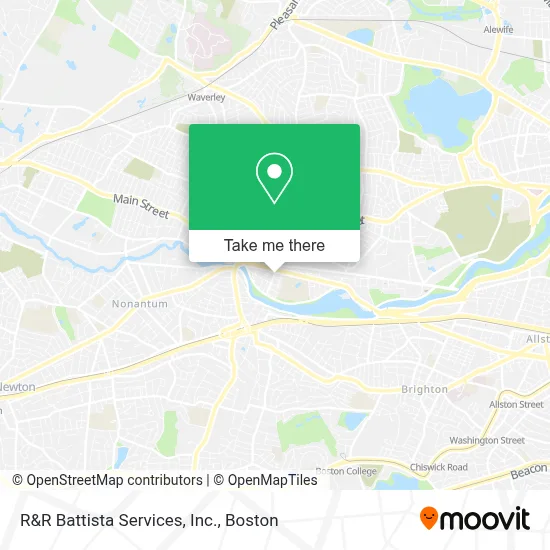
See R&R Battista Services, Inc., Watertown Town, on the map
Public Transit to R&R Battista Services, Inc. in Watertown Town
Wondering how to get to R&R Battista Services, Inc. in Watertown Town? Moovit helps you find the best way to get to R&R Battista Services, Inc. with step-by-step directions from the nearest public transit station.
Moovit provides free maps and live directions to help you navigate through your city. View schedules, routes, timetables, and find out how long does it take to get to R&R Battista Services, Inc. in real time.
Looking for the nearest stop or station to R&R Battista Services, Inc.? Check out this list of stops closest to your destination: Mt Auburn St @ Main St; Main St @ Merchants Row; Galen St @ Water St; Newtonville; Waverley; Chiswick Road.
Bus: 504, 52, 70, 71, 57.Train: FITCHBURG, FRAMINGHAM/WORCESTER.Subway: GREEN LINE B.
Want to see if there’s another route that gets you there at an earlier time? Moovit helps you find alternative routes or times. Get directions from and directions to R&R Battista Services, Inc. easily from the Moovit App or Website.
We make riding to R&R Battista Services, Inc. easy, which is why over 1.7 million users, including users in Watertown Town, trust Moovit as the best app for public transit. You don’t need to download an individual bus app or train app, Moovit is your all-in-one transit app that helps you find the best bus time or train time available.
For information on prices of bus, subway and train, costs and ride fares to R&R Battista Services, Inc., please check the Moovit app.
Use the app to navigate to popular places including to the airport, hospital, stadium, grocery store, mall, coffee shop, school, college, and university.
R&R Battista Services, Inc. Address: 90 Irving St street in Watertown Town
- Bostonian Towing,
- Imai Keller Moore,
- Watertown, MA,
- Perkins School,
- Alvarados Painting,
- Ecast Productions,
- Sanda Fighting Arts,
- Twin Tige 100 Parker S,
- Move & Groove Watertown,
- Extra Innings Watertown,
- Dal Contractors,
- Get Lively: Health & Fitness,
- Perkins School For the Blind,
- M&T Bank,
- Matthew Chen,
- People's United Bank,
- DUNKIN',
- STARBUCKS,
- SUBWAY,
- Luminous Dental
Places Near R&R Battista Services, Inc. (Watertown Town)
- Wang Theater, Boston,
- Massachusetts General Hospital, Boston,
- Cheers, Boston,
- Td Garden, Boston,
- Boston Medical Center, Boston,
- Quincy Market, Boston,
- North End, Boston,
- Seaport District, Boston,
- Faneuil Hall, Boston,
- Isabella Stewart Gardner Museum, Boston,
- Boston Convention & Exhibition Center, Boston,
- Museum Of Science, Boston,
- Boston Common, Boston,
- Leader Bank Pavilion (Leader Bank Pavillion), Boston,
- Wilbur Theatre, Boston,
- Mgm Music Hall, Boston,
- Prudential Center, Boston,
- Castle Island, Boston,
- House Of Blues, Boston,
- Boston Children's Hospital, Boston
How to get to popular places in Boston with public transit
Get around Watertown Town by public transit!
Traveling around Watertown Town has never been so easy. See step by step directions as you travel to any attraction, street or major public transit station. View bus and train schedules, arrival times, service alerts and detailed routes on a map, so you know exactly how to get to anywhere in Watertown Town.
When traveling to any destination around Watertown Town use Moovit's Live Directions with Get Off Notifications to know exactly where and how far to walk, how long to wait for your line, and how many stops are left. Moovit will alert you when it's time to get off — no need to constantly re-check whether yours is the next stop.
Wondering how to use public transit in Watertown Town or how to pay for public transit in Watertown Town? Moovit public transit app can help you navigate your way with public transit easily, and at minimum cost. It includes public transit fees, ticket prices, and costs. Looking for a map of Watertown Town public transit lines? Moovit public transit app shows all public transit maps in Watertown Town with all Bus, Train, Subway and Ferry routes and stops on an interactive map.
Boston has 4 transit type(s), including: Bus, Train, Subway and Ferry, operated by several transit agencies, including MBTA, Southeastern Regional Transit Authority, MetroWest Regional Transit Authority, Rhode Island Public Transit Authority, WRTA, Lowell Regional Transit Authority, Merrimack Valley Transit, Montachusett Regional Transit Authority, Cape Cod Regional Transit Authority, Brockton Area Transit Authority, Martha's Vineyard Transit Authority, the WAVE - Nantucket Regional Transit Authority, GATRA, Cape Ann Transportation Authority and Massport