Directions to Racinboys.Com (Independence) with public transportation
The following transit lines have routes that pass near Racinboys.Com
 Bus: 24, 28, 31, 47.
- Train: LINCOLN SERVICE MISSOURI RIVER RUNNER, MISSOURI RIVER RUNNER.
How to get to Racinboys.Com by bus?
Click on the bus route to see step by step directions with maps, line arrival times and updated time schedules.
Train station near Racinboys.Com in Independence
- Independence Amtrak Station, 28 min walk,VIEW
What are the closest stations to Racinboys.Com?
The closest stations to Racinboys.Com are:
- Independence Amtrak Station is 2403 yards away, 28 min walk.
Which bus lines stop near Racinboys.Com?
These bus lines stop near Racinboys.Com: 24, 28, 31, 47.
What’s the nearest train station to Racinboys.Com in Independence?
The nearest train station to Racinboys.Com in Independence is Independence Amtrak Station. It’s a 28 min walk away.
What time is the first train to Racinboys.Com in Independence?
The LINCOLN SERVICE MISSOURI RIVER RUNNER is the first train that goes to Racinboys.Com in Independence. It stops nearby at 8:59 AM.
What time is the last train to Racinboys.Com in Independence?
The LINCOLN SERVICE MISSOURI RIVER RUNNER is the last train that goes to Racinboys.Com in Independence. It stops nearby at 8:11 PM.
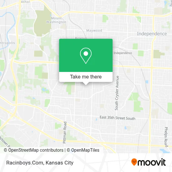
See Racinboys.Com, Independence, on the map
Public Transit to Racinboys.Com in Independence
Wondering how to get to Racinboys.Com in Independence? Moovit helps you find the best way to get to Racinboys.Com with step-by-step directions from the nearest public transit station.
Moovit provides free maps and live directions to help you navigate through your city. View schedules, routes, timetables, and find out how long does it take to get to Racinboys.Com in real time.
Looking for the nearest stop or station to Racinboys.Com? Check out this list of stops closest to your destination: Independence Amtrak Station.
Bus: 24, 28, 31, 47.Train: LINCOLN SERVICE MISSOURI RIVER RUNNER, MISSOURI RIVER RUNNER.
Want to see if there’s another route that gets you there at an earlier time? Moovit helps you find alternative routes or times. Get directions from and directions to Racinboys.Com easily from the Moovit App or Website.
We make riding to Racinboys.Com easy, which is why over 1.5 million users, including users in Independence, trust Moovit as the best app for public transit. You don’t need to download an individual bus app or train app, Moovit is your all-in-one transit app that helps you find the best bus time or train time available.
For information on prices of bus, costs and ride fares to Racinboys.Com, please check the Moovit app.
Use the app to navigate to popular places including to the airport, hospital, stadium, grocery store, mall, coffee shop, school, college, and university.
Racinboys.Com Address: 10841 E 28th St S street in Independence
- 23rd & Sterling,
- Hill Park,
- CHRYSLER Stadium,
- El Mercado Fresco,
- Don Chago Bakery,
- Quik Trip 205r,
- Moonlight Adult Boutique 2 (W Organization M2),
- truman rd and sterling,
- Blue Ridge Crossing,
- Hotel LOTUS,
- Walmart Supercenter,
- I 70 And I 435 interchange,
- Independence, Mo Stake Evening and Morning Star,
- LDS Independence Stake Center,
- Van Horn High School,
- Blue Ridge Tower Maintenance,
- Silverstein Eye Centers (Silverstein Hearing Centers),
- Intercity Bait and Tackle,
- Jackson County Shrine Club,
- Quik Trip 155r
Places Near Racinboys.Com (Independence)
- Kauffman Stadium,
- T-Mobile Center,
- Ku Medical Center, Kansas City,
- St. Luke's Hospital - Medical Plaza I,
- Worlds of Fun,
- Harrah's Casino, North Kansas City,
- Liberty, MO, Liberty,
- Legends Outlets Kansas City, Kansas City,
- Walmart, Kansas City,
- Kansas City International Airport (MCI) (Kansas City International Airport),
- The Glory Hole,
- Truman Medical Center,
- Amazon Fulfilment Center-MKC6, Kansas City,
- GEHA Field at Arrowhead Stadium,
- Arrowhead Stadium,
- Grandview, MO, Grandview,
- Country Club Plaza,
- Kansas City Zoo,
- Walmart Supercenter,
- Stans Glory Hole
How to get to popular places in Kansas City with public transit
Get around Independence by public transit!
Traveling around Independence has never been so easy. See step by step directions as you travel to any attraction, street or major public transit station. View bus and train schedules, arrival times, service alerts and detailed routes on a map, so you know exactly how to get to anywhere in Independence.
When traveling to any destination around Independence use Moovit's Live Directions with Get Off Notifications to know exactly where and how far to walk, how long to wait for your line, and how many stops are left. Moovit will alert you when it's time to get off — no need to constantly re-check whether yours is the next stop.
Wondering how to use public transit in Independence or how to pay for public transit in Independence? Moovit public transit app can help you navigate your way with public transit easily, and at minimum cost. It includes public transit fees, ticket prices, and costs. Looking for a map of Independence public transit lines? Moovit public transit app shows all public transit maps in Independence with all Bus, Train and Light Rail routes and stops on an interactive map.
Kansas City has 3 transit type(s), including: Bus, Train and Light Rail, operated by several transit agencies, including Kansas City Area Transportation Authority, Lawrence Transit, Topeka Metro, RideKC Johnson County, Amtrak, Greyhound-us and FlixBus-us