Directions to Racing Mart Llc (New Bedford) with public transportation
The following transit lines have routes that pass near Racing Mart Llc
 Bus: 201, 205, 9.
- Train: FALL RIVER/NEW BEDFORD.
- Ferry: SEASTREAK, SEASTREAK, CUTTYHUNK FERRY.
How to get to Racing Mart Llc by bus?
Click on the bus route to see step by step directions with maps, line arrival times and updated time schedules.
From RMV New Bedford, New Bedford
78 minFrom Lizzy Borden House, Fall River
72 minFrom B.M.C. Durfee High School, Fall River
85 minFrom Amazon Fulfillment Bos7, Fall River
126 minFrom Bedford Industrial Park, New Bedford
80 minFrom Bristol Community College, Fall River
87 minFrom Charlton Memorial Hospital, Fall River
105 minFrom Walmart Fall River Supercenter, Fall River
100 minFrom Falmouth MA USA, Falmouth
104 minFrom Mass Maritime Academy, Buzzards Bay
130 min
How to get to Racing Mart Llc by train?
Click on the train route to see step by step directions with maps, line arrival times and updated time schedules.
Bus stops near Racing Mart Llc in New Bedford
Train station near Racing Mart Llc in New Bedford
- New Bedford, 29 min walk,VIEW
Ferry stations near Racing Mart Llc in New Bedford
What are the closest stations to Racing Mart Llc?
The closest stations to Racing Mart Llc are:
- Pleasant St And Wing St is 178 yards away, 3 min walk.
- Macarthur Dr And South St is 295 yards away, 4 min walk.
- New Bedford is 2501 yards away, 29 min walk.
- New Bedford, MA is 3366 yards away, 40 min walk.
- Cuttyhunk Ferry Pier, New Bedford, MA is 3594 yards away, 42 min walk.
Which bus lines stop near Racing Mart Llc?
These bus lines stop near Racing Mart Llc: 201, 205, 9.
Which train line stops near Racing Mart Llc?
FALL RIVER/NEW BEDFORD (#2011 | New Bedford)
What’s the nearest train station to Racing Mart Llc in New Bedford?
The nearest train station to Racing Mart Llc in New Bedford is New Bedford. It’s a 29 min walk away.
What’s the nearest bus station to Racing Mart Llc in New Bedford?
The nearest bus station to Racing Mart Llc in New Bedford is Pleasant St And Wing St. It’s a 3 min walk away.
What time is the first train to Racing Mart Llc in New Bedford?
The FALL RIVER/NEW BEDFORD is the first train that goes to Racing Mart Llc in New Bedford. It stops nearby at 4:16 AM.
What time is the last train to Racing Mart Llc in New Bedford?
The FALL RIVER/NEW BEDFORD is the last train that goes to Racing Mart Llc in New Bedford. It stops nearby at 1:38 AM.
What time is the first bus to Racing Mart Llc in New Bedford?
The 201 is the first bus that goes to Racing Mart Llc in New Bedford. It stops nearby at 5:24 AM.
What time is the last bus to Racing Mart Llc in New Bedford?
The 201 is the last bus that goes to Racing Mart Llc in New Bedford. It stops nearby at 9:49 PM.
What time is the first ferry to Racing Mart Llc in New Bedford?
The SEASTREAK is the first ferry that goes to Racing Mart Llc in New Bedford. It stops nearby at 8:20 AM.
What time is the last ferry to Racing Mart Llc in New Bedford?
The SEASTREAK is the last ferry that goes to Racing Mart Llc in New Bedford. It stops nearby at 8:40 PM.
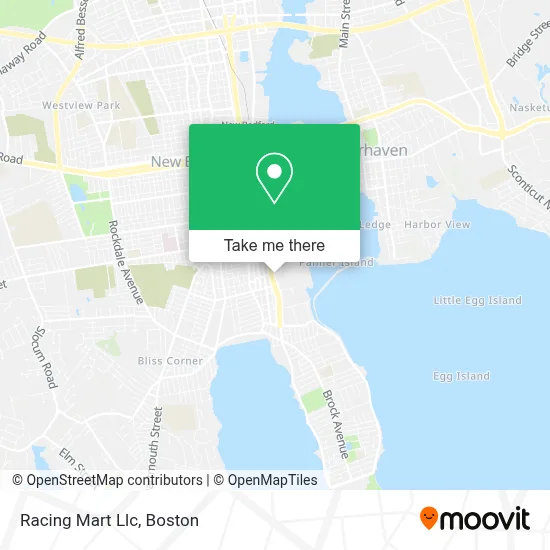
See Racing Mart Llc, New Bedford, on the map
Public Transit to Racing Mart Llc in New Bedford
Wondering how to get to Racing Mart Llc in New Bedford? Moovit helps you find the best way to get to Racing Mart Llc with step-by-step directions from the nearest public transit station.
Moovit provides free maps and live directions to help you navigate through your city. View schedules, routes, timetables, and find out how long does it take to get to Racing Mart Llc in real time.
Looking for the nearest stop or station to Racing Mart Llc? Check out this list of stops closest to your destination: Pleasant St And Wing St; Macarthur Dr And South St; New Bedford; New Bedford, MA; Cuttyhunk Ferry Pier.
Bus: 201, 205, 9.Train: FALL RIVER/NEW BEDFORD.Ferry: SEASTREAK, SEASTREAK, CUTTYHUNK FERRY.
Want to see if there’s another route that gets you there at an earlier time? Moovit helps you find alternative routes or times. Get directions from and directions to Racing Mart Llc easily from the Moovit App or Website.
We make riding to Racing Mart Llc easy, which is why over 1.7 million users, including users in New Bedford, trust Moovit as the best app for public transit. You don’t need to download an individual bus app or train app, Moovit is your all-in-one transit app that helps you find the best bus time or train time available.
For information on prices of bus and train, costs and ride fares to Racing Mart Llc, please check the Moovit app.
Use the app to navigate to popular places including to the airport, hospital, stadium, grocery store, mall, coffee shop, school, college, and university.
Racing Mart Llc Address: 56 Potomska St street in New Bedford
- Mutual Gas Station,
- Maaco Auto Body Shop & Painting,
- Knuckleheads Bar & Grill,
- Seven Hills Behavioral Health,
- NWD,
- Faith Beauty Center,
- C And P Bait,
- Shurtleff Automotive,
- Alfred J Gomes,
- Renaissance Community Innovation School,
- Vangels Heating A C & Refrig,
- Miss Lulu's Nail Boutique,
- Keyme Locksmiths,
- Hercules Slr Rigging Shop,
- Monte's Park,
- Coinstar,
- KeyMe,
- Coinstar - Bitcoin ATM,
- City Of New Bedford Emergency Management,
- All Ranks Academy
Places Near Racing Mart Llc (New Bedford)
- Boston Medical Center, Boston,
- Seaport District, Boston,
- Wang Theater, Boston,
- House Of Blues, Boston,
- Faneuil Hall, Boston,
- Boston Convention & Exhibition Center, Boston,
- Boston Common, Boston,
- Isabella Stewart Gardner Museum, Boston,
- Museum Of Science, Boston,
- Boston Children's Hospital, Boston,
- Quincy Market, Boston,
- Leader Bank Pavilion (Leader Bank Pavillion), Boston,
- North End, Boston,
- Wilbur Theatre, Boston,
- Castle Island, Boston,
- Massachusetts General Hospital, Boston,
- Mgm Music Hall, Boston,
- Cheers, Boston,
- Td Garden, Boston,
- Prudential Center, Boston
How to get to popular places in Boston with public transit
Get around New Bedford by public transit!
Traveling around New Bedford has never been so easy. See step by step directions as you travel to any attraction, street or major public transit station. View bus and train schedules, arrival times, service alerts and detailed routes on a map, so you know exactly how to get to anywhere in New Bedford.
When traveling to any destination around New Bedford use Moovit's Live Directions with Get Off Notifications to know exactly where and how far to walk, how long to wait for your line, and how many stops are left. Moovit will alert you when it's time to get off — no need to constantly re-check whether yours is the next stop.
Wondering how to use public transit in New Bedford or how to pay for public transit in New Bedford? Moovit public transit app can help you navigate your way with public transit easily, and at minimum cost. It includes public transit fees, ticket prices, and costs. Looking for a map of New Bedford public transit lines? Moovit public transit app shows all public transit maps in New Bedford with all Bus, Train, Subway and Ferry routes and stops on an interactive map.
Boston has 4 transit type(s), including: Bus, Train, Subway and Ferry, operated by several transit agencies, including MBTA, Southeastern Regional Transit Authority, MetroWest Regional Transit Authority, Rhode Island Public Transit Authority, WRTA, Lowell Regional Transit Authority, Merrimack Valley Transit, Montachusett Regional Transit Authority, Cape Cod Regional Transit Authority, Brockton Area Transit Authority, Martha's Vineyard Transit Authority, the WAVE - Nantucket Regional Transit Authority, GATRA, Cape Ann Transportation Authority and Massport