How to get to Racket Group by bus?
Click on the bus route to see step by step directions with maps, line arrival times and updated time schedules.
Bus stops near Racket Group in Kansas City
Light Rail stations near Racket Group in Kansas City
- Library (9th & Main St), 7 min walk,VIEW
Bus lines to Racket Group in Kansas City
- 85, 85 - Paseo/To 3rd And Grand,VIEW
- 201, 201 - North Oak / To 27th And Main,VIEW
- 210, 210-Front Street / To Downtown,VIEW
- 238, 238 - Eastvillage,VIEW
- 550, 550 - Lee's Summit/ To Lee's Summit,VIEW
- 24, 24 - Independenceto Independence,VIEW
- 404, Metcalf Walmart,VIEW
- 520, Pennsylvania/12th,VIEW
- PMAX, Prospect Max/To 11wyan,VIEW
- TMAX, Troost Max / To Downtown,VIEW
- 9, 9 - 9th Street/12th & Wyoming,VIEW
- 11, 11-Northeast-Westside/To Ku Med,VIEW
- 12, 12 - 12th Street/Nowlin/31st & Van Brunt,VIEW
- 18, 18 - Indiana/Kc Zoo,VIEW
- 23, 23 - To Downtown,VIEW
- 101, 101-State Ave / To Village West,VIEW
- 229, 229-Boardwalk / To Kci Airport,VIEW
What are the closest stations to Racket Group?
The closest stations to Racket Group are:
- On Grand at 9th Northbound Farside is 177 yards away, 3 min walk.
- On Grand at 9th Southbound Farside is 200 yards away, 3 min walk.
- On 8th Between Mcgee And Oak Eastbound Midblock is 244 yards away, 4 min walk.
- On 11th/Petticoat Lane at Main Westbound is 470 yards away, 6 min walk.
- Library (9th & Main St) is 577 yards away, 7 min walk.
Which bus lines stop near Racket Group?
These bus lines stop near Racket Group: 101, 11, 210, 238, 24, PMAX, TMAX.
Which light rail line stops near Racket Group?
STCR (Riverfront)
What’s the nearest light rail station to Racket Group in Kansas City?
The nearest light rail station to Racket Group in Kansas City is Library (9th & Main St). It’s a 7 min walk away.
What’s the nearest bus station to Racket Group in Kansas City?
The nearest bus stations to Racket Group in Kansas City are On Grand at 9th Northbound Farside and On Grand at 9th Southbound Farside. The closest one is a 3 min walk away.
What time is the first light rail to Racket Group in Kansas City?
The STCR is the first light rail that goes to Racket Group in Kansas City. It stops nearby at 5:20 AM.
What time is the last light rail to Racket Group in Kansas City?
The STCR is the last light rail that goes to Racket Group in Kansas City. It stops nearby at 12:19 AM.
What time is the first bus to Racket Group in Kansas City?
The 201 is the first bus that goes to Racket Group in Kansas City. It stops nearby at 4:39 AM.
What time is the last bus to Racket Group in Kansas City?
The 12 is the last bus that goes to Racket Group in Kansas City. It stops nearby at 2:00 AM.
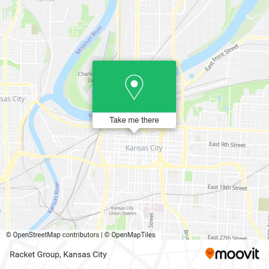
See Racket Group, Kansas City, on the map
Public Transit to Racket Group in Kansas City
Wondering how to get to Racket Group in Kansas City? Moovit helps you find the best way to get to Racket Group with step-by-step directions from the nearest public transit station.
Moovit provides free maps and live directions to help you navigate through your city. View schedules, routes, timetables, and find out how long does it take to get to Racket Group in real time.
Looking for the nearest stop or station to Racket Group? Check out this list of stops closest to your destination: On Grand at 9th Northbound Farside; On Grand at 9th Southbound Farside; On 8th Between Mcgee And Oak Eastbound Midblock; On 11th/Petticoat Lane at Main Westbound; Library (9th & Main St).
Bus: 101, 11, 210, 238, 24, PMAX, TMAX, 85, 201, 550, 404, 520, 9, 12.Light Rail: STCR.
Want to see if there’s another route that gets you there at an earlier time? Moovit helps you find alternative routes or times. Get directions from and directions to Racket Group easily from the Moovit App or Website.
We make riding to Racket Group easy, which is why over 1.5 million users, including users in Kansas City, trust Moovit as the best app for public transit. You don’t need to download an individual bus app or train app, Moovit is your all-in-one transit app that helps you find the best bus time or train time available.
For information on prices of bus and light rail, costs and ride fares to Racket Group, please check the Moovit app.
Use the app to navigate to popular places including to the airport, hospital, stadium, grocery store, mall, coffee shop, school, college, and university.
Racket Group Address: 713 Walnut St street in Kansas City
- Anthony's Restaurant & Lounge (Anthonys Restaurant & Lounge),
- Park University - Downtown Campus,
- Kansas City Public Library,
- KC Streetcar,
- River Market,
- City Market Lot,
- Betty Rae's Ice Cream,
- City Market,
- The Nelson-Atkins Museum of Art,
- Arabia Steamboat Museum,
- Parking-11th and Oak Garage,
- Lightwell,
- Bartle Hall,
- KC Ice Cream,
- Kansas City, MO,
- Twelve Wyandotte Plaza,
- Curio Collection by Hilton-Phillips Kansas City Curio Collection by Hilton,
- Kci Airport,
- Bryson's Farm Fresh Produce,
- Downtown Kansas City
Places Near Racket Group (Kansas City)
- Kansas City Zoo,
- Walmart, Kansas City,
- Stans Glory Hole,
- Truman Medical Center,
- Walmart Supercenter,
- Kansas City International Airport (MCI) (Kansas City International Airport),
- GEHA Field at Arrowhead Stadium,
- Liberty, MO, Liberty,
- T-Mobile Center,
- Grandview, MO, Grandview,
- Ku Medical Center, Kansas City,
- Harrah's Casino, North Kansas City,
- Arrowhead Stadium,
- Legends Outlets Kansas City, Kansas City,
- Amazon Fulfilment Center-MKC6, Kansas City,
- Kauffman Stadium,
- Worlds of Fun,
- The Glory Hole,
- Country Club Plaza,
- St. Luke's Hospital - Medical Plaza I
How to get to popular places in Kansas City with public transit
Get around Kansas City by public transit!
Traveling around Kansas City has never been so easy. See step by step directions as you travel to any attraction, street or major public transit station. View bus and train schedules, arrival times, service alerts and detailed routes on a map, so you know exactly how to get to anywhere in Kansas City.
When traveling to any destination around Kansas City use Moovit's Live Directions with Get Off Notifications to know exactly where and how far to walk, how long to wait for your line, and how many stops are left. Moovit will alert you when it's time to get off — no need to constantly re-check whether yours is the next stop.
Wondering how to use public transit in Kansas City or how to pay for public transit in Kansas City? Moovit public transit app can help you navigate your way with public transit easily, and at minimum cost. It includes public transit fees, ticket prices, and costs. Looking for a map of Kansas City public transit lines? Moovit public transit app shows all public transit maps in Kansas City with all Bus, Train and Light Rail routes and stops on an interactive map.
Kansas City has 3 transit type(s), including: Bus, Train and Light Rail, operated by several transit agencies, including Kansas City Area Transportation Authority, Lawrence Transit, Topeka Metro, RideKC Johnson County, Amtrak, Greyhound-us and FlixBus-us