Directions to Radio One (Quincy) with public transportation
The following transit lines have routes that pass near Radio One
 Bus: 201, 210, 211.
- Subway: RED LINE.
- Ferry: QUINCY FERRY, WINTHROP/QUINCY FERRY.
How to get to Radio One by bus?
Click on the bus route to see step by step directions with maps, line arrival times and updated time schedules.
From Inman Sq, Cambridge
127 minFrom Primark, Boston
100 minFrom Target, Somerville
144 minFrom Central Square, Cambridge
116 minFrom Chelsea District Court, Chelsea
116 minFrom DoubleTree Suites by Hilton Hotel Boston - Cambridge, Boston
130 minFrom Brigham & Women's Hospital, Boston
90 minFrom Inman Square, Cambridge
142 minFrom Allston, Boston
124 minFrom Laugh Boston, Boston
124 min
How to get to Radio One by subway?
Click on the subway route to see step by step directions with maps, line arrival times and updated time schedules.
From Inman Sq, Cambridge
75 minFrom Primark, Boston
52 minFrom Target, Somerville
81 minFrom Central Square, Cambridge
62 minFrom DoubleTree Suites by Hilton Hotel Boston - Cambridge, Boston
79 minFrom Brigham & Women's Hospital, Boston
84 minFrom Inman Square, Cambridge
77 minFrom Allston, Boston
87 minFrom Laugh Boston, Boston
67 min
Bus stop near Radio One in Quincy
- E Squantum St Opp Heath St, 16 min walk,VIEW
Subway station near Radio One in Quincy
- North Quincy, 36 min walk,VIEW
Ferry station near Radio One in Quincy
- Quincy, 51 min walk,VIEW
Bus lines to Radio One in Quincy
- 211, Quincy Center,VIEW
What are the closest stations to Radio One?
The closest stations to Radio One are:
- E Squantum St Opp Heath St is 1306 yards away, 16 min walk.
- North Quincy is 3100 yards away, 36 min walk.
- Quincy is 4379 yards away, 51 min walk.
Which bus lines stop near Radio One?
These bus lines stop near Radio One: 201, 210, 211.
Which subway line stops near Radio One?
RED LINE (Ashmont/Braintree)
Which ferry line stops near Radio One?
QUINCY FERRY (Quincy Loop)
What time is the first subway to Radio One in Quincy?
The RED LINE is the first subway that goes to Radio One in Quincy. It stops nearby at 5:20 AM.
What time is the last subway to Radio One in Quincy?
The RED LINE is the last subway that goes to Radio One in Quincy. It stops nearby at 1:47 AM.
What time is the first bus to Radio One in Quincy?
The 211 is the first bus that goes to Radio One in Quincy. It stops nearby at 5:48 AM.
What time is the last bus to Radio One in Quincy?
The 211 is the last bus that goes to Radio One in Quincy. It stops nearby at 8:16 PM.
What time is the first ferry to Radio One in Quincy?
The QUINCY FERRY is the first ferry that goes to Radio One in Quincy. It stops nearby at 6:15 AM.
What time is the last ferry to Radio One in Quincy?
The QUINCY FERRY is the last ferry that goes to Radio One in Quincy. It stops nearby at 8:55 PM.
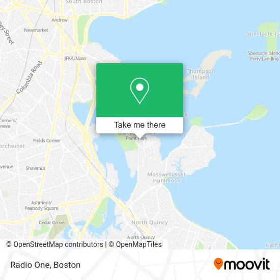
See Radio One, Quincy, on the map
Public Transit to Radio One in Quincy
Wondering how to get to Radio One in Quincy? Moovit helps you find the best way to get to Radio One with step-by-step directions from the nearest public transit station.
Moovit provides free maps and live directions to help you navigate through your city. View schedules, routes, timetables, and find out how long does it take to get to Radio One in real time.
Looking for the nearest stop or station to Radio One? Check out this list of stops closest to your destination: E Squantum St Opp Heath St; North Quincy; Quincy.
Bus: 201, 210, 211.Subway: RED LINE.Ferry: QUINCY FERRY, WINTHROP/QUINCY FERRY.
Want to see if there’s another route that gets you there at an earlier time? Moovit helps you find alternative routes or times. Get directions from and directions to Radio One easily from the Moovit App or Website.
We make riding to Radio One easy, which is why over 1.7 million users, including users in Quincy, trust Moovit as the best app for public transit. You don’t need to download an individual bus app or train app, Moovit is your all-in-one transit app that helps you find the best bus time or train time available.
For information on prices of bus, subway and ferry, costs and ride fares to Radio One, please check the Moovit app.
Use the app to navigate to popular places including to the airport, hospital, stadium, grocery store, mall, coffee shop, school, college, and university.
Radio One Address: 500 Victory Rd street in Quincy
- 3D Medical Aesthetics (3D Medical Direct Primary Care),
- Marina Bay,
- Weze,
- Marina Bay on Boston Harbor,
- Boston Scientific,
- Marina Bay,
- Venezia,
- Mobsters and Lobsters,
- Boston Winery,
- Boston Harbor Distillery,
- Quincy Animal Shelter,
- Ralph Dimattia Sailmakers, Inc.,
- 751 E Squantum St Parking,
- Reliable Locksmith,
- Victory Road Park,
- Walnut Street,
- Victory Road Park,
- Ramada Boston,
- Ramada Inn,
- Ramada by Wyndham Boston
Places Near Radio One (Quincy)
- North End, Boston,
- Boston Medical Center, Boston,
- Wilbur Theatre, Boston,
- Leader Bank Pavilion (Leader Bank Pavillion), Boston,
- Isabella Stewart Gardner Museum, Boston,
- Cheers, Boston,
- Mgm Music Hall, Boston,
- Prudential Center, Boston,
- Massachusetts General Hospital, Boston,
- Td Garden, Boston,
- Wang Theater, Boston,
- Castle Island, Boston,
- Boston Children's Hospital, Boston,
- Quincy Market, Boston,
- Faneuil Hall, Boston,
- House Of Blues, Boston,
- Boston Convention & Exhibition Center, Boston,
- Museum Of Science, Boston,
- Boston Common, Boston,
- Seaport District, Boston
How to get to popular places in Boston with public transit
Get around Quincy by public transit!
Traveling around Quincy has never been so easy. See step by step directions as you travel to any attraction, street or major public transit station. View bus and train schedules, arrival times, service alerts and detailed routes on a map, so you know exactly how to get to anywhere in Quincy.
When traveling to any destination around Quincy use Moovit's Live Directions with Get Off Notifications to know exactly where and how far to walk, how long to wait for your line, and how many stops are left. Moovit will alert you when it's time to get off — no need to constantly re-check whether yours is the next stop.
Wondering how to use public transit in Quincy or how to pay for public transit in Quincy? Moovit public transit app can help you navigate your way with public transit easily, and at minimum cost. It includes public transit fees, ticket prices, and costs. Looking for a map of Quincy public transit lines? Moovit public transit app shows all public transit maps in Quincy with all Bus, Train, Subway and Ferry routes and stops on an interactive map.
Boston has 4 transit type(s), including: Bus, Train, Subway and Ferry, operated by several transit agencies, including MBTA, Southeastern Regional Transit Authority, MetroWest Regional Transit Authority, Rhode Island Public Transit Authority, WRTA, Lowell Regional Transit Authority, Merrimack Valley Transit, Montachusett Regional Transit Authority, Cape Cod Regional Transit Authority, Brockton Area Transit Authority, Martha's Vineyard Transit Authority, the WAVE - Nantucket Regional Transit Authority, GATRA, Cape Ann Transportation Authority and Massport