Directions to Rady Children's Down Syndrome Center (Boston) with public transportation
The following transit lines have routes that pass near Rady Children's Down Syndrome Center
 Bus: 10, 354, 43, 501, EZRIDE.
- Train: HAVERHILL, KINGSTON, FITCHBURG, LOWELL, NEWBURYPORT/ROCKPORT.
- Subway: GREEN LINE E, RED LINE, BLUE LINE, HAVERHILL LINE SHUTTLE, HAVERHILL LINE SHUTTLE.
How to get to Rady Children's Down Syndrome Center by bus?
Click on the bus route to see step by step directions with maps, line arrival times and updated time schedules.
From Staybridge Suites Boston-Quincy, Quincy
114 minFrom Medford Square, Medford
39 minFrom Wollaston Beach, Quincy
135 minFrom Best Western Adams Inn Quincy - Boston, Quincy
102 minFrom Boston College, Boston
77 minFrom Newton, MA, Newton
60 minFrom MBTA Alewife Station, Cambridge
81 minFrom Melrose, MA, Melrose
77 minFrom Heartbreak Hill, Newton
59 minFrom Children's Hospital, Boston
65 min
How to get to Rady Children's Down Syndrome Center by train?
Click on the train route to see step by step directions with maps, line arrival times and updated time schedules.
How to get to Rady Children's Down Syndrome Center by subway?
Click on the subway route to see step by step directions with maps, line arrival times and updated time schedules.
From Staybridge Suites Boston-Quincy, Quincy
31 minFrom Medford Square, Medford
46 minFrom Wollaston Beach, Quincy
48 minFrom Best Western Adams Inn Quincy - Boston, Quincy
42 minFrom Boston College, Boston
63 minFrom Newton, MA, Newton
61 minFrom MBTA Alewife Station, Cambridge
22 minFrom Heartbreak Hill, Newton
61 minFrom Children's Hospital, Boston
26 min
Bus stops near Rady Children's Down Syndrome Center in Boston
- North Station - Haverhill St @ Causeway St, 4 min walk,VIEW
- Cambridge St @ Government Ctr Sta, 4 min walk,VIEW
- Charles/Mgh - 325 Cambridge St, 4 min walk,VIEW
- Portland St @ Causeway St, 4 min walk,VIEW
- Beacon St @ Park St, 5 min walk,VIEW
- Government Center - Cambridge St @ Sudbury St, 5 min walk,VIEW
- Science Park/West End - Martha Rd @ Amy Ct, 7 min walk,VIEW
- North Station, 10 min walk,VIEW
Subway stations near Rady Children's Down Syndrome Center in Boston
Train station near Rady Children's Down Syndrome Center in Boston
- North Station, 16 min walk,VIEW
Bus lines to Rady Children's Down Syndrome Center in Boston
- GREEN LINE SHUTTLE, North Station (Shuttle),VIEW
- ORANGE LINE SHUTTLE, North Station (Local Shuttle),VIEW
- ORANGE LINE SHUTTLE, Oak Grove (Express Shuttle),VIEW
- ORANGE LINE SHUTTLE, Oak Grove (Local Shuttle),VIEW
- ORANGE LINE SHUTTLE, Wellington (Express Shuttle),VIEW
- 116, Wonderland Via Maverick,VIEW
- 354, Burlington (Express) Via Woburn,VIEW
- BLUE LINE SHUTTLE, Orient Heights (Local Shuttle),VIEW
- BLUE LINE SHUTTLE, Government Center (Express Shuttle),VIEW
- BLUE LINE SHUTTLE, Orient Heights (Express Shuttle),VIEW
- BLUE LINE SHUTTLE, Wonderland (Shuttle),VIEW
- GREEN LINE E SHUTTLE, Medford/Tufts (Shuttle),VIEW
- GREEN LINE SHUTTLE, Medford/Tufts Via Union Square (Shuttle),VIEW
- GREEN LINE SHUTTLE, Union Square (Shuttle),VIEW
- RED LINE SHUTTLE, Kendall/MIT (Shuttle),VIEW
- RED LINE SHUTTLE, Harvard (Shuttle),VIEW
- RED LINE SHUTTLE, Broadway (Shuttle),VIEW
- RED LINE SHUTTLE, Jfk/Umass (Shuttle),VIEW
- RED LINE SHUTTLE, Alewife - Park Street,VIEW
- RED LINE SHUTTLE, Harvard - JFK/UMass via Congress Street,VIEW
What are the closest stations to Rady Children's Down Syndrome Center?
The closest stations to Rady Children's Down Syndrome Center are:
- North Station - Haverhill St @ Causeway St is 241 yards away, 4 min walk.
- Cambridge St @ Government Ctr Sta is 254 yards away, 4 min walk.
- Charles/Mgh - 325 Cambridge St is 277 yards away, 4 min walk.
- Portland St @ Causeway St is 279 yards away, 4 min walk.
- Charles/Mgh is 317 yards away, 4 min walk.
- Beacon St @ Park St is 353 yards away, 5 min walk.
- Government Center - Cambridge St @ Sudbury St is 369 yards away, 5 min walk.
- Bowdoin is 517 yards away, 7 min walk.
- Science Park/West End - Martha Rd @ Amy Ct is 558 yards away, 7 min walk.
- North Station is 830 yards away, 10 min walk.
- Causeway St (East) is 1278 yards away, 15 min walk.
Which bus lines stop near Rady Children's Down Syndrome Center?
These bus lines stop near Rady Children's Down Syndrome Center: 10, 354, 43, 501, EZRIDE, SL4.
Which train lines stop near Rady Children's Down Syndrome Center?
These train lines stop near Rady Children's Down Syndrome Center: HAVERHILL, KINGSTON.
Which subway lines stop near Rady Children's Down Syndrome Center?
These subway lines stop near Rady Children's Down Syndrome Center: GREEN LINE E, RED LINE.
What’s the nearest subway station to Rady Children's Down Syndrome Center in Boston?
The nearest subway station to Rady Children's Down Syndrome Center in Boston is Charles/Mgh. It’s a 4 min walk away.
What’s the nearest train station to Rady Children's Down Syndrome Center in Boston?
The nearest train station to Rady Children's Down Syndrome Center in Boston is North Station. It’s a 16 min walk away.
What’s the nearest bus station to Rady Children's Down Syndrome Center in Boston?
The nearest bus stations to Rady Children's Down Syndrome Center in Boston are North Station - Haverhill St @ Causeway St, Cambridge St @ Government Ctr Sta, Charles/Mgh - 325 Cambridge St and Portland St @ Causeway St. The closest one is a 4 min walk away.
What time is the first subway to Rady Children's Down Syndrome Center in Boston?
The GREEN LINE E is the first subway that goes to Rady Children's Down Syndrome Center in Boston. It stops nearby at 4:57 AM.
What time is the last subway to Rady Children's Down Syndrome Center in Boston?
The GREEN LINE E is the last subway that goes to Rady Children's Down Syndrome Center in Boston. It stops nearby at 2:28 AM.
What time is the first train to Rady Children's Down Syndrome Center in Boston?
The LOWELL is the first train that goes to Rady Children's Down Syndrome Center in Boston. It stops nearby at 5:20 AM.
What time is the last train to Rady Children's Down Syndrome Center in Boston?
The LOWELL is the last train that goes to Rady Children's Down Syndrome Center in Boston. It stops nearby at 12:34 AM.
What time is the first bus to Rady Children's Down Syndrome Center in Boston?
The 43 is the first bus that goes to Rady Children's Down Syndrome Center in Boston. It stops nearby at 5:09 AM.
What time is the last bus to Rady Children's Down Syndrome Center in Boston?
The 116 is the last bus that goes to Rady Children's Down Syndrome Center in Boston. It stops nearby at 1:58 AM.
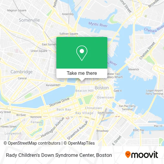
See Rady Children's Down Syndrome Center, Boston, on the map
Public Transit to Rady Children's Down Syndrome Center in Boston
Wondering how to get to Rady Children's Down Syndrome Center in Boston? Moovit helps you find the best way to get to Rady Children's Down Syndrome Center with step-by-step directions from the nearest public transit station.
Moovit provides free maps and live directions to help you navigate through your city. View schedules, routes, timetables, and find out how long does it take to get to Rady Children's Down Syndrome Center in real time.
Looking for the nearest stop or station to Rady Children's Down Syndrome Center? Check out this list of stops closest to your destination: North Station - Haverhill St @ Causeway St; Cambridge St @ Government Ctr Sta; Charles/Mgh - 325 Cambridge St; Portland St @ Causeway St; Charles/Mgh; Beacon St @ Park St; Government Center - Cambridge St @ Sudbury St; Bowdoin; Science Park/West End - Martha Rd @ Amy Ct; North Station; Causeway St (East).
Bus: 10, 354, 43, 501, EZRIDE, SL4, GREEN LINE SHUTTLE, ORANGE LINE SHUTTLE, ORANGE LINE SHUTTLE, ORANGE LINE SHUTTLE, ORANGE LINE SHUTTLE, RED LINE SHUTTLE, RED LINE SHUTTLE, RED LINE SHUTTLE, RED LINE SHUTTLE, RED LINE SHUTTLE.Train: HAVERHILL, KINGSTON, FITCHBURG, LOWELL, NEWBURYPORT/ROCKPORT, DOWNEASTER.Subway: GREEN LINE E, RED LINE, BLUE LINE, HAVERHILL LINE SHUTTLE, HAVERHILL LINE SHUTTLE, LOWELL LINE SHUTTLE, LOWELL LINE SHUTTLE, NEWBURYPORT/ROCKPORT LINE SHUTTLE.
Want to see if there’s another route that gets you there at an earlier time? Moovit helps you find alternative routes or times. Get directions from and directions to Rady Children's Down Syndrome Center easily from the Moovit App or Website.
We make riding to Rady Children's Down Syndrome Center easy, which is why over 1.7 million users, including users in Boston, trust Moovit as the best app for public transit. You don’t need to download an individual bus app or train app, Moovit is your all-in-one transit app that helps you find the best bus time or train time available.
For information on prices of subway, bus and train, costs and ride fares to Rady Children's Down Syndrome Center, please check the Moovit app.
Use the app to navigate to popular places including to the airport, hospital, stadium, grocery store, mall, coffee shop, school, college, and university.
Rady Children's Down Syndrome Center Address: 7920 Frost St Ste 200 street in Boston
- MGH Parking Yawkey Val,
- Massachusetts General Hospital / Harvard Medical School,
- Ether Dome,
- Prout George R Jr,
- Mgh Yawkey Center,
- Charlesbank Park,
- MEEI - ENT Clinic,
- Yawkey Center for Outpatient Care,
- Bigelow Amphitheater,
- Lehrich James R Phys (Dr James Warren May, MD),
- Massachusetts General Hospital - Wang Acc Lobby Valet,
- David Forcione,
- Massachusetts Infectious Disss Soc (Kuter David John MD - Massachusetts General Hospital),
- Andrew Oseran MD,
- Nina Shervin MD,
- 300 Longwood Ave,
- 15 Parkman Street,
- Massachusetts Eye And Ear,
- Mass Eye and Ear Infirmary,
- Mgh morgue - Warren 2 basement
Places Near Rady Children's Down Syndrome Center (Boston)
- Wang Theater, Boston,
- Isabella Stewart Gardner Museum, Boston,
- Td Garden, Boston,
- Faneuil Hall, Boston,
- Seaport District, Boston,
- Boston Medical Center, Boston,
- North End, Boston,
- Wilbur Theatre, Boston,
- Mgm Music Hall, Boston,
- Castle Island, Boston,
- Quincy Market, Boston,
- Boston Children's Hospital, Boston,
- House Of Blues, Boston,
- Prudential Center, Boston,
- Boston Common, Boston,
- Boston Convention & Exhibition Center, Boston,
- Leader Bank Pavilion (Leader Bank Pavillion), Boston,
- Massachusetts General Hospital, Boston,
- Cheers, Boston,
- Museum Of Science, Boston
How to get to popular places in Boston with public transit
Get around Boston by public transit!
Traveling around Boston has never been so easy. See step by step directions as you travel to any attraction, street or major public transit station. View bus and train schedules, arrival times, service alerts and detailed routes on a map, so you know exactly how to get to anywhere in Boston.
When traveling to any destination around Boston use Moovit's Live Directions with Get Off Notifications to know exactly where and how far to walk, how long to wait for your line, and how many stops are left. Moovit will alert you when it's time to get off — no need to constantly re-check whether yours is the next stop.
Wondering how to use public transit in Boston or how to pay for public transit in Boston? Moovit public transit app can help you navigate your way with public transit easily, and at minimum cost. It includes public transit fees, ticket prices, and costs. Looking for a map of Boston public transit lines? Moovit public transit app shows all public transit maps in Boston with all Bus, Train, Subway and Ferry routes and stops on an interactive map.
Boston has 4 transit type(s), including: Bus, Train, Subway and Ferry, operated by several transit agencies, including MBTA, Southeastern Regional Transit Authority, MetroWest Regional Transit Authority, Rhode Island Public Transit Authority, WRTA, Lowell Regional Transit Authority, Merrimack Valley Transit, Montachusett Regional Transit Authority, Cape Cod Regional Transit Authority, Brockton Area Transit Authority, Martha's Vineyard Transit Authority, the WAVE - Nantucket Regional Transit Authority, GATRA, Cape Ann Transportation Authority and Massport