How to get to Rag Rock by bus?
Click on the bus route to see step by step directions with maps, line arrival times and updated time schedules.
From Takeda, Lexington
97 minFrom MBTA Alewife Station, Cambridge
63 minFrom Sommerville Theatre, Somerville
70 minFrom Malden, MA, Malden
65 minFrom Chevalier Theatre (Chevalier Theater Show Line), Medford
40 minFrom Hanscom AFB, Hanscom Afb
101 minFrom MBTA / Alewife #6, Cambridge
66 minFrom Melrose, MA, Melrose
85 minFrom Regent Theatre, Arlington
49 min
Bus stops near Rag Rock in Woburn
Train station near Rag Rock in Woburn
- Winchester Center, 56 min walk,VIEW
Bus lines to Rag Rock in Woburn
What are the closest stations to Rag Rock?
The closest stations to Rag Rock are:
- Main St @ Mishawum Rd is 95 yards away, 2 min walk.
- Pleasant St @ Abbott St is 126 yards away, 2 min walk.
- Winchester Center is 4822 yards away, 56 min walk.
Which bus lines stop near Rag Rock?
These bus lines stop near Rag Rock: 134, 350, 354.
What’s the nearest bus station to Rag Rock in Woburn?
The nearest bus stations to Rag Rock in Woburn are Main St @ Mishawum Rd and Pleasant St @ Abbott St. The closest one is a 2 min walk away.
What time is the first train to Rag Rock in Woburn?
The LOWELL is the first train that goes to Rag Rock in Woburn. It stops nearby at 5:27 AM.
What time is the last train to Rag Rock in Woburn?
The LOWELL is the last train that goes to Rag Rock in Woburn. It stops nearby at 12:15 AM.
What time is the first bus to Rag Rock in Woburn?
The 134 is the first bus that goes to Rag Rock in Woburn. It stops nearby at 5:39 AM.
What time is the last bus to Rag Rock in Woburn?
The 354 is the last bus that goes to Rag Rock in Woburn. It stops nearby at 8:13 PM.
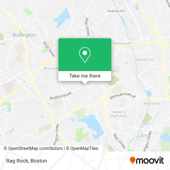
See Rag Rock, Woburn, on the map
Public Transit to Rag Rock in Woburn
Wondering how to get to Rag Rock in Woburn? Moovit helps you find the best way to get to Rag Rock with step-by-step directions from the nearest public transit station.
Moovit provides free maps and live directions to help you navigate through your city. View schedules, routes, timetables, and find out how long does it take to get to Rag Rock in real time.
Looking for the nearest stop or station to Rag Rock? Check out this list of stops closest to your destination: Main St @ Mishawum Rd; Pleasant St @ Abbott St; Winchester Center.
Bus: 134, 350, 354.Train: LOWELL.
Want to see if there’s another route that gets you there at an earlier time? Moovit helps you find alternative routes or times. Get directions from and directions to Rag Rock easily from the Moovit App or Website.
We make riding to Rag Rock easy, which is why over 1.7 million users, including users in Woburn, trust Moovit as the best app for public transit. You don’t need to download an individual bus app or train app, Moovit is your all-in-one transit app that helps you find the best bus time or train time available.
For information on prices of bus and subway, costs and ride fares to Rag Rock, please check the Moovit app.
Use the app to navigate to popular places including to the airport, hospital, stadium, grocery store, mall, coffee shop, school, college, and university.
Location: Woburn, Boston
- Patriot Coach,
- Woburn City Hall and Woburn District Courthouse,
- Bloom Automation Inc,
- Leica High Definition Scanners,
- Locks & Locksmith,
- All American Appearence and Reconditioning,
- K and M Hose,
- Susanne Alexander Consulting,
- Jack Marlowe Waterfall,
- Dan & Sons Plumbing Heating,
- Linda's House Cleaning,
- Chef Cyrille,
- Wing Squad,
- Boston Masonry and Construction,
- Mrbeast Burger,
- Guy Fieri's Flavortown Kitchen,
- Claudiane's Cleaning Service,
- CMT Towing and Repair,
- Touch Pro Cleaning Service,
- KLH Home Staging
Places Near Rag Rock (Woburn)
- Seaport District, Boston,
- House Of Blues, Boston,
- North End, Boston,
- Boston Medical Center, Boston,
- Boston Children's Hospital, Boston,
- Prudential Center, Boston,
- Cheers, Boston,
- Td Garden, Boston,
- Quincy Market, Boston,
- Boston Convention & Exhibition Center, Boston,
- Wilbur Theatre, Boston,
- Boston Common, Boston,
- Leader Bank Pavilion (Leader Bank Pavillion), Boston,
- Museum Of Science, Boston,
- Faneuil Hall, Boston,
- Wang Theater, Boston,
- Isabella Stewart Gardner Museum, Boston,
- Mgm Music Hall, Boston,
- Castle Island, Boston,
- Massachusetts General Hospital, Boston
How to get to popular places in Boston with public transit
Get around Woburn by public transit!
Traveling around Woburn has never been so easy. See step by step directions as you travel to any attraction, street or major public transit station. View bus and train schedules, arrival times, service alerts and detailed routes on a map, so you know exactly how to get to anywhere in Woburn.
When traveling to any destination around Woburn use Moovit's Live Directions with Get Off Notifications to know exactly where and how far to walk, how long to wait for your line, and how many stops are left. Moovit will alert you when it's time to get off — no need to constantly re-check whether yours is the next stop.
Wondering how to use public transit in Woburn or how to pay for public transit in Woburn? Moovit public transit app can help you navigate your way with public transit easily, and at minimum cost. It includes public transit fees, ticket prices, and costs. Looking for a map of Woburn public transit lines? Moovit public transit app shows all public transit maps in Woburn with all Bus, Train, Subway and Ferry routes and stops on an interactive map.
Boston has 4 transit type(s), including: Bus, Train, Subway and Ferry, operated by several transit agencies, including MBTA, Southeastern Regional Transit Authority, MetroWest Regional Transit Authority, Rhode Island Public Transit Authority, WRTA, Lowell Regional Transit Authority, Merrimack Valley Transit, Montachusett Regional Transit Authority, Cape Cod Regional Transit Authority, Brockton Area Transit Authority, Martha's Vineyard Transit Authority, the WAVE - Nantucket Regional Transit Authority, GATRA, Cape Ann Transportation Authority and Massport