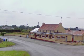
See Rahugh, Kilbeggan, on the map
Directions to Rahugh (Kilbeggan) with public transportation
The following transit lines have routes that pass near Rahugh
Bus:
Bus stations near Rahugh in Kilbeggan
- John Carroll Car Sales,81 min walk,
- Kilbeggan (Distillery Inn The Square),82 min walk,
Bus lines to Rahugh in Kilbeggan
- UM02,Birr,
- 847,Cathal Brugha Street,
- 845,County Council Offices,
- 70,Mullingar,
What are the closest stations to Rahugh?
The closest stations to Rahugh are:
- John Carroll Car Sales is 6417 meters away, 81 min walk.
- Kilbeggan (Distillery Inn The Square) is 6480 meters away, 82 min walk.
Which Bus lines stop near Rahugh?
These Bus lines stop near Rahugh: 20, 763
See Rahugh, Kilbeggan, on the map

Public Transit to Rahugh in Kilbeggan
Wondering how to get to Rahugh in Kilbeggan, Ireland? Moovit helps you find the best way to get to Rahugh with step-by-step directions from the nearest public transit station.
Moovit provides free maps and live directions to help you navigate through your city. View schedules, routes, timetables, and find out how long does it take to get to Rahugh in real time.
Looking for the nearest stop or station to Rahugh? Check out this list of stops closest to your destination: John Carroll Car Sales; Kilbeggan (Distillery Inn The Square).
Bus:
Want to see if there’s another route that gets you there at an earlier time? Moovit helps you find alternative routes or times. Get directions from and directions to Rahugh easily from the Moovit App or Website.
We make riding to Rahugh easy, which is why over 1.5 million users, including users in Kilbeggan, trust Moovit as the best app for public transit. You don’t need to download an individual bus app or train app, Moovit is your all-in-one transit app that helps you find the best bus time or train time available.
For information on prices of Bus, Train and Light Rail, costs and ride fares to Rahugh, please check the Moovit app.
Use the app to navigate to popular places including to the airport, hospital, stadium, grocery store, mall, coffee shop, school, college, and university.
Rahugh Address: Unnamed Road, Co. Westmeath, Ireland street in Kilbeggan

Attractions near Rahugh
- Lowertown Bridge
- Silver River Aquaduct
- Murphy’S Bridge
- Grange And Kiltober
- Grange Bridge
- Kiltober
- Bracklin Big Bridge
- Native Woodland Trust: Ardan Reserve
- Frevanagh
- Derrygolan
- Cappanrush
- Mann Bridge
- Wood Of 'O Bridge
- Newtownlow
- Brownscurragh
- Cumminstown
- Warehouse
- Canal Harbour
- Harbour Picnic Area
- Ballyteige Little Bridge
How to get to popular attractions in Kilbeggan with public transit
- Phoenix Park Visitors' Centre, Dublin
- Cork / Corcaigh
- Swan Leisure Centre, Dublin
- Raheny Dart Station, Dublin
- Liffey Valley Shopping Centre, Palmerston West
- Ballymun, Dublin
- Apple
- St. James's Hospital, Dublin
- Kildare Village, Kildare
- Carrigaline, Carrigaline
- The Square Shopping Centre, Tallaght
- Booterstown DART Station
- Dundrum Shopping Centre, Dundrum
- Dublin City University (DCU), Dublin
- Children's Health Ireland at Crumlin, Dublin
- Trim / Baile Átha Troim, Trim
- Clayton Hotel Leopardstown, Glencullen
- Guinness Storehouse, Dublin
- Kilmainham Gaol, Dublin
- Connolly Train Station, Dublin