Directions to Raintree Apartments (Kansas City) with public transportation
The following transit lines have routes that pass near Raintree Apartments
 Bus: 29.
How to get to Raintree Apartments by bus?
Click on the bus route to see step by step directions with maps, line arrival times and updated time schedules.
Bus stop near Raintree Apartments in Kansas City
- 29th @ Atwood (Gage), 2 min walk,VIEW
Bus lines to Raintree Apartments in Kansas City
- 29, West 29th To Downtown,VIEW
What are the closest stations to Raintree Apartments?
The closest stations to Raintree Apartments are:
- 29th @ Atwood (Gage) is 101 yards away, 2 min walk.
Which bus line stops near Raintree Apartments?
29 (West 29th To Urish Rd)
What’s the nearest bus station to Raintree Apartments in Kansas City?
The nearest bus station to Raintree Apartments in Kansas City is 29th @ Atwood (Gage). It’s a 2 min walk away.
What time is the first bus to Raintree Apartments in Kansas City?
The 29 is the first bus that goes to Raintree Apartments in Kansas City. It stops nearby at 6:25 AM.
What time is the last bus to Raintree Apartments in Kansas City?
The 29 is the last bus that goes to Raintree Apartments in Kansas City. It stops nearby at 5:50 PM.
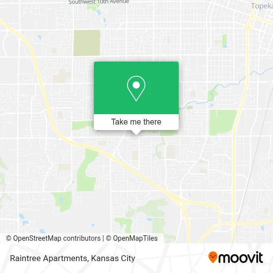
See Raintree Apartments, Kansas City, on the map
Public Transit to Raintree Apartments in Kansas City
Wondering how to get to Raintree Apartments in Kansas City? Moovit helps you find the best way to get to Raintree Apartments with step-by-step directions from the nearest public transit station.
Moovit provides free maps and live directions to help you navigate through your city. View schedules, routes, timetables, and find out how long does it take to get to Raintree Apartments in real time.
Looking for the nearest stop or station to Raintree Apartments? Check out this list of stops closest to your destination: 29th @ Atwood (Gage).
Bus: 29.
Want to see if there’s another route that gets you there at an earlier time? Moovit helps you find alternative routes or times. Get directions from and directions to Raintree Apartments easily from the Moovit App or Website.
We make riding to Raintree Apartments easy, which is why over 1.5 million users, including users in Kansas City, trust Moovit as the best app for public transit. You don’t need to download an individual bus app or train app, Moovit is your all-in-one transit app that helps you find the best bus time or train time available.
For information on prices of bus, costs and ride fares to Raintree Apartments, please check the Moovit app.
Use the app to navigate to popular places including to the airport, hospital, stadium, grocery store, mall, coffee shop, school, college, and university.
Raintree Apartments Address: 3500 SW 29th St street in Kansas City
- Arrowhead,
- Dellwood Acres,
- Parking Lot 6,
- Parking Lot E,
- B Building,
- D Building,
- E Building,
- Parking Lot J,
- Parking Lot K,
- U.S. Bank,
- 29th & Van Buren (Alorica),
- Aquablast Laundromat,
- Kwik Shop,
- College Hill Apartments,
- College Hill Apartments,
- College Hill Apartments,
- College Hill Apartments,
- College Hill Apartments,
- College Hill Apartments,
- College Hill Apartments
Places Near Raintree Apartments (Kansas City)
- Harrah's Casino, North Kansas City,
- St. Luke's Hospital - Medical Plaza I,
- GEHA Field at Arrowhead Stadium,
- Walmart Supercenter,
- Ku Medical Center, Kansas City,
- Kauffman Stadium,
- Legends Outlets Kansas City, Kansas City,
- Stans Glory Hole,
- Amazon Fulfilment Center-MKC6, Kansas City,
- Grandview, MO, Grandview,
- Liberty, MO, Liberty,
- Country Club Plaza,
- Worlds of Fun,
- Arrowhead Stadium,
- Kansas City International Airport (MCI) (Kansas City International Airport),
- Kansas City Zoo,
- Truman Medical Center,
- The Glory Hole,
- T-Mobile Center,
- Walmart, Kansas City
How to get to popular places in Kansas City with public transit
Get around Kansas City by public transit!
Traveling around Kansas City has never been so easy. See step by step directions as you travel to any attraction, street or major public transit station. View bus and train schedules, arrival times, service alerts and detailed routes on a map, so you know exactly how to get to anywhere in Kansas City.
When traveling to any destination around Kansas City use Moovit's Live Directions with Get Off Notifications to know exactly where and how far to walk, how long to wait for your line, and how many stops are left. Moovit will alert you when it's time to get off — no need to constantly re-check whether yours is the next stop.
Wondering how to use public transit in Kansas City or how to pay for public transit in Kansas City? Moovit public transit app can help you navigate your way with public transit easily, and at minimum cost. It includes public transit fees, ticket prices, and costs. Looking for a map of Kansas City public transit lines? Moovit public transit app shows all public transit maps in Kansas City with all Bus, Train and Light Rail routes and stops on an interactive map.
Kansas City has 3 transit type(s), including: Bus, Train and Light Rail, operated by several transit agencies, including Kansas City Area Transportation Authority, Lawrence Transit, Topeka Metro, RideKC Johnson County, Amtrak, Greyhound-us and FlixBus-us