Directions to Raising Stars Center (Dedham) with public transportation
The following transit lines have routes that pass near Raising Stars Center
 Bus: 34, 34E, 35, 52.
- Train: NEEDHAM, FRANKLIN/FOXBORO, PROVIDENCE/STOUGHTON.
How to get to Raising Stars Center by bus?
Click on the bus route to see step by step directions with maps, line arrival times and updated time schedules.
From Brigham & Women's Hospital, Boston
44 minFrom Brookline, MA, Brookline
68 minFrom Courtyard by Marriott Brookline, Brookline
68 minFrom Mission Hill, Boston
40 minFrom Homewood Suites by Hilton Boston Brookline-Longwood Medical, Brookline
49 minFrom Brigham and Women's, Boston
45 minFrom Brighton, Boston
64 minFrom 110 Francis Street Garage, Boston
49 minFrom Hebrew Rehab Center, Boston
36 minFrom Franklin Park, Boston
37 min
How to get to Raising Stars Center by train?
Click on the train route to see step by step directions with maps, line arrival times and updated time schedules.
Train stations near Raising Stars Center in Dedham
Bus stops near Raising Stars Center in Dedham
Bus lines to Raising Stars Center in Dedham
What are the closest stations to Raising Stars Center?
The closest stations to Raising Stars Center are:
- West Roxbury is 558 yards away, 7 min walk.
- 272 Washington St is 603 yards away, 8 min walk.
- Dedham Mall @ South Side is 1053 yards away, 13 min walk.
- Endicott is 2421 yards away, 29 min walk.
- Readville is 3319 yards away, 41 min walk.
Which bus lines stop near Raising Stars Center?
These bus lines stop near Raising Stars Center: 34, 34E, 35.
Which train line stops near Raising Stars Center?
NEEDHAM (#625 | Needham Heights)
What’s the nearest train station to Raising Stars Center in Dedham?
The nearest train station to Raising Stars Center in Dedham is West Roxbury. It’s a 7 min walk away.
What’s the nearest bus station to Raising Stars Center in Dedham?
The nearest bus station to Raising Stars Center in Dedham is 272 Washington St. It’s a 8 min walk away.
What time is the first train to Raising Stars Center in Dedham?
The PROVIDENCE/STOUGHTON is the first train that goes to Raising Stars Center in Dedham. It stops nearby at 5:05 AM.
What time is the last train to Raising Stars Center in Dedham?
The PROVIDENCE/STOUGHTON is the last train that goes to Raising Stars Center in Dedham. It stops nearby at 12:20 AM.
What time is the first bus to Raising Stars Center in Dedham?
The 34 is the first bus that goes to Raising Stars Center in Dedham. It stops nearby at 4:43 AM.
What time is the last bus to Raising Stars Center in Dedham?
The 34 is the last bus that goes to Raising Stars Center in Dedham. It stops nearby at 1:32 AM.
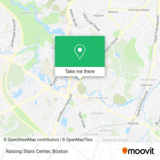
See Raising Stars Center, Dedham, on the map
Public Transit to Raising Stars Center in Dedham
Wondering how to get to Raising Stars Center in Dedham? Moovit helps you find the best way to get to Raising Stars Center with step-by-step directions from the nearest public transit station.
Moovit provides free maps and live directions to help you navigate through your city. View schedules, routes, timetables, and find out how long does it take to get to Raising Stars Center in real time.
Looking for the nearest stop or station to Raising Stars Center? Check out this list of stops closest to your destination: West Roxbury; 272 Washington St; Dedham Mall @ South Side; Endicott; Readville.
Bus: 34, 34E, 35, 52.Train: NEEDHAM, FRANKLIN/FOXBORO, PROVIDENCE/STOUGHTON.
Want to see if there’s another route that gets you there at an earlier time? Moovit helps you find alternative routes or times. Get directions from and directions to Raising Stars Center easily from the Moovit App or Website.
We make riding to Raising Stars Center easy, which is why over 1.7 million users, including users in Dedham, trust Moovit as the best app for public transit. You don’t need to download an individual bus app or train app, Moovit is your all-in-one transit app that helps you find the best bus time or train time available.
For information on prices of bus, subway and train, costs and ride fares to Raising Stars Center, please check the Moovit app.
Use the app to navigate to popular places including to the airport, hospital, stadium, grocery store, mall, coffee shop, school, college, and university.
Raising Stars Center Address: 109 Lower East St street in Dedham
- Day 2 Day Auto,
- Neponset Valley Oral and Maxillofacial Surgery Associates,
- Immigration & Business Law Group,
- Dedham Moose Lodge,
- Hazel Boone Dance Studio,
- Brown Robert N,
- In & Out Locksmith 01760,
- FedEx,
- Bojetax,
- Paul A. Church M.D. P.C.,
- Blushtan Dedham,
- Anthony Fredrick Salon,
- Greater Boston Performance Care,
- Rayus Radiology,
- Tesla,
- Ridge Family Daycare,
- Citizens Bank & Trust,
- Dedham Mall,
- STARBUCKS,
- Amazon Locker-Potassium
Places Near Raising Stars Center (Dedham)
- House Of Blues, Boston,
- Boston Common, Boston,
- Quincy Market, Boston,
- Wilbur Theatre, Boston,
- Cheers, Boston,
- Boston Children's Hospital, Boston,
- Faneuil Hall, Boston,
- Prudential Center, Boston,
- Seaport District, Boston,
- Massachusetts General Hospital, Boston,
- North End, Boston,
- Castle Island, Boston,
- Isabella Stewart Gardner Museum, Boston,
- Mgm Music Hall, Boston,
- Leader Bank Pavilion (Leader Bank Pavillion), Boston,
- Boston Convention & Exhibition Center, Boston,
- Museum Of Science, Boston,
- Td Garden, Boston,
- Boston Medical Center, Boston,
- Wang Theater, Boston
How to get to popular places in Boston with public transit
Get around Dedham by public transit!
Traveling around Dedham has never been so easy. See step by step directions as you travel to any attraction, street or major public transit station. View bus and train schedules, arrival times, service alerts and detailed routes on a map, so you know exactly how to get to anywhere in Dedham.
When traveling to any destination around Dedham use Moovit's Live Directions with Get Off Notifications to know exactly where and how far to walk, how long to wait for your line, and how many stops are left. Moovit will alert you when it's time to get off — no need to constantly re-check whether yours is the next stop.
Wondering how to use public transit in Dedham or how to pay for public transit in Dedham? Moovit public transit app can help you navigate your way with public transit easily, and at minimum cost. It includes public transit fees, ticket prices, and costs. Looking for a map of Dedham public transit lines? Moovit public transit app shows all public transit maps in Dedham with all Bus, Train, Subway and Ferry routes and stops on an interactive map.
Boston has 4 transit type(s), including: Bus, Train, Subway and Ferry, operated by several transit agencies, including MBTA, Southeastern Regional Transit Authority, MetroWest Regional Transit Authority, Rhode Island Public Transit Authority, WRTA, Lowell Regional Transit Authority, Merrimack Valley Transit, Montachusett Regional Transit Authority, Cape Cod Regional Transit Authority, Brockton Area Transit Authority, Martha's Vineyard Transit Authority, the WAVE - Nantucket Regional Transit Authority, GATRA, Cape Ann Transportation Authority and Massport