Directions to Ralph Tufano, M.B.A., M.D. (Baltimore) with public transportation
The following transit lines have routes that pass near Ralph Tufano, M.B.A., M.D.
 Bus: 56, CITYLINK BROWN, CITYLINK ORANGE, CITYLINK PINK, GREEN ROUTE.
- Train: MARC.
- Metro: METRO.
- Ferry: HC3, HC1.
How to get to Ralph Tufano, M.B.A., M.D. by bus?
Click on the bus route to see step by step directions with maps, line arrival times and updated time schedules.
From Falls Road Light Rail Station, Baltimore County
73 minFrom Curtis Bay, Baltimore
50 minFrom Brooklyn, Baltimore
46 minFrom O'Dea Building- St. Josephs Hospital, Baltimore County
49 minFrom G&M Restaurant and Lounge, Anne Arundel County
81 minFrom Whole Foods Market, Baltimore
63 minFrom Reisterstown Rd & Northern Pkwy, Baltimore
56 minFrom Patapsco Light Rail Station, Baltimore County
48 minFrom Arbutus, Maryland, Baltimore County
70 minFrom Walmart, Baltimore County
53 min
How to get to Ralph Tufano, M.B.A., M.D. by train?
Click on the train route to see step by step directions with maps, line arrival times and updated time schedules.
How to get to Ralph Tufano, M.B.A., M.D. by metro?
Click on the metro route to see step by step directions with maps, line arrival times and updated time schedules.
Bus stop near Ralph Tufano, M.B.A., M.D. in Baltimore
- Johns Hopkins Sb (Wb), 2 min walk,VIEW
Ferry stations near Ralph Tufano, M.B.A., M.D. in Baltimore
Metro station near Ralph Tufano, M.B.A., M.D. in Baltimore
- Johns Hopkins Metro, 29 min walk,VIEW
Bus lines to Ralph Tufano, M.B.A., M.D. in Baltimore
- GREEN ROUTE, Rutland Ave. (Wb),VIEW
What are the closest stations to Ralph Tufano, M.B.A., M.D.?
The closest stations to Ralph Tufano, M.B.A., M.D. are:
- Johns Hopkins Sb (Wb) is 105 yards away, 2 min walk.
- Federal Hill is 1515 yards away, 18 min walk.
- Johns Hopkins Metro is 2374 yards away, 29 min walk.
- Maritime Park is 5161 yards away, 61 min walk.
Which bus lines stop near Ralph Tufano, M.B.A., M.D.?
These bus lines stop near Ralph Tufano, M.B.A., M.D.: 56, CITYLINK BROWN, CITYLINK ORANGE, CITYLINK PINK.
Which train line stops near Ralph Tufano, M.B.A., M.D.?
MARC
Which metro line stops near Ralph Tufano, M.B.A., M.D.?
METRO
What’s the nearest metro station to Ralph Tufano, M.B.A., M.D. in Baltimore?
The nearest metro station to Ralph Tufano, M.B.A., M.D. in Baltimore is Johns Hopkins Metro. It’s a 29 min walk away.
What’s the nearest bus station to Ralph Tufano, M.B.A., M.D. in Baltimore?
The nearest bus station to Ralph Tufano, M.B.A., M.D. in Baltimore is Johns Hopkins Sb (Wb). It’s a 2 min walk away.
What’s the nearest ferry station to Ralph Tufano, M.B.A., M.D. in Baltimore?
The nearest ferry station to Ralph Tufano, M.B.A., M.D. in Baltimore is Federal Hill. It’s a 18 min walk away.
What time is the first metro to Ralph Tufano, M.B.A., M.D. in Baltimore?
The METRO is the first metro that goes to Ralph Tufano, M.B.A., M.D. in Baltimore. It stops nearby at 4:21 AM.
What time is the last metro to Ralph Tufano, M.B.A., M.D. in Baltimore?
The METRO is the last metro that goes to Ralph Tufano, M.B.A., M.D. in Baltimore. It stops nearby at 12:29 AM.
What time is the first bus to Ralph Tufano, M.B.A., M.D. in Baltimore?
The CITYLINK BROWN is the first bus that goes to Ralph Tufano, M.B.A., M.D. in Baltimore. It stops nearby at 3:00 AM.
What time is the last bus to Ralph Tufano, M.B.A., M.D. in Baltimore?
The CITYLINK PINK is the last bus that goes to Ralph Tufano, M.B.A., M.D. in Baltimore. It stops nearby at 3:03 AM.
What time is the first ferry to Ralph Tufano, M.B.A., M.D. in Baltimore?
The HC3 is the first ferry that goes to Ralph Tufano, M.B.A., M.D. in Baltimore. It stops nearby at 6:00 AM.
What time is the last ferry to Ralph Tufano, M.B.A., M.D. in Baltimore?
The HC3 is the last ferry that goes to Ralph Tufano, M.B.A., M.D. in Baltimore. It stops nearby at 8:07 PM.
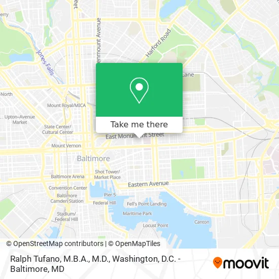
See Ralph Tufano, M.B.A., M.D., Baltimore, on the map
Public Transit to Ralph Tufano, M.B.A., M.D. in Baltimore
Wondering how to get to Ralph Tufano, M.B.A., M.D. in Baltimore? Moovit helps you find the best way to get to Ralph Tufano, M.B.A., M.D. with step-by-step directions from the nearest public transit station.
Moovit provides free maps and live directions to help you navigate through your city. View schedules, routes, timetables, and find out how long does it take to get to Ralph Tufano, M.B.A., M.D. in real time.
Looking for the nearest stop or station to Ralph Tufano, M.B.A., M.D.? Check out this list of stops closest to your destination: Johns Hopkins Sb (Wb); Federal Hill; Johns Hopkins Metro; Maritime Park.
Bus: 56, CITYLINK BROWN, CITYLINK ORANGE, CITYLINK PINK, GREEN ROUTE.Train: MARC.Metro: METRO.Ferry: HC3, HC1.
Want to see if there’s another route that gets you there at an earlier time? Moovit helps you find alternative routes or times. Get directions from and directions to Ralph Tufano, M.B.A., M.D. easily from the Moovit App or Website.
We make riding to Ralph Tufano, M.B.A., M.D. easy, which is why over 1.5 million users, including users in Baltimore, trust Moovit as the best app for public transit. You don’t need to download an individual bus app or train app, Moovit is your all-in-one transit app that helps you find the best bus time or train time available.
For information on prices of bus, metro, light rail and train, costs and ride fares to Ralph Tufano, M.B.A., M.D., please check the Moovit app.
Use the app to navigate to popular places including to the airport, hospital, stadium, grocery store, mall, coffee shop, school, college, and university.
Ralph Tufano, M.B.A., M.D. Address: 601 N Caroline St street in Baltimore
- Martin Makary, MD,
- 601 North Caroline Street,
- 550 Building,
- 550 N Broadway,
- Charm City Circulator Green Route - Johns Hopkins - #102,
- Reed Hall,
- Dunbar-Broadway,
- Johns Hopkins Parking,
- The Johns Hopkins Hospital,
- Johns Hopkins Hospital Marburg Pavilion,
- Wilmer Eye Institute,
- Marburg – Brady Urological Institute,
- Johns Hopkins Hospital Station,
- Broadway & Monument,
- Broadway & Monument St NB,
- Johns Hopkins Outpatient Center,
- Weinberg Outpatient Pharmacy,
- Bond Street Annex,
- 1529 E Monument St,
- Nilofer Azad MD
Places Near Ralph Tufano, M.B.A., M.D. (Baltimore)
- Westfield Montgomery Mall, Montgomery County,
- Amazon Hq2, Arlington County,
- M&T Bank Stadium, Baltimore,
- Museum Of The Bible, Washington,
- Marriott Marquis Washington, DC, Washington,
- Basilica of the National Shrine, Washington,
- Georgetown, Washington,
- Washington National Cathedral, Washington,
- National Theatre, Washington,
- Pennsylvania Ave NW (3rd st and pennsylvania), Washington,
- National Museum of African American History and Culture, Washington,
- Camden Yards, Baltimore,
- PG Mall, Prince George's County,
- Capital One Arena, Washington,
- Rock Creek Tennis Center, Washington,
- The Anthem, Washington,
- National Zoo, Washington,
- Washington DC VA Medical Center, Washington,
- Warner Theatre, Washington,
- Sibley Memorial Hospital, Washington
How to get to popular places in Washington, D.C. - Baltimore, MD with public transit
Get around Baltimore by public transit!
Traveling around Baltimore has never been so easy. See step by step directions as you travel to any attraction, street or major public transit station. View bus and train schedules, arrival times, service alerts and detailed routes on a map, so you know exactly how to get to anywhere in Baltimore.
When traveling to any destination around Baltimore use Moovit's Live Directions with Get Off Notifications to know exactly where and how far to walk, how long to wait for your line, and how many stops are left. Moovit will alert you when it's time to get off — no need to constantly re-check whether yours is the next stop.
Wondering how to use public transit in Baltimore or how to pay for public transit in Baltimore? Moovit public transit app can help you navigate your way with public transit easily, and at minimum cost. It includes public transit fees, ticket prices, and costs. Looking for a map of Baltimore public transit lines? Moovit public transit app shows all public transit maps in Baltimore with all Bus, Train, Metro, Light Rail and Ferry routes and stops on an interactive map.
Washington, D.C. - Baltimore, MD has 5 transit type(s), including: Bus, Train, Metro, Light Rail and Ferry, operated by several transit agencies, including WMATA, Montgomery County Ride On, Fairfax Connector, TheBus, PRTC, DASH - Alexandria, Arlington Transit (ART), RTA of Central Maryland, MDOT MTA, MDOT MTA Light RailLink, MDOT MTA Commuter Bus, MDOT MTA Local Bus, FXBGO!, Virginia Railway Express (VRE) and MARC