Directions to Ranchito Colombiano (Union City) with public transportation
The following transit lines have routes that pass near Ranchito Colombiano
How to get to Ranchito Colombiano by bus?
Click on the bus route to see step by step directions with maps, line arrival times and updated time schedules.
Bus stops near Ranchito Colombiano in Union City
Light Rail stations near Ranchito Colombiano in Union City
- Bergenline Ave, 26 min walk,VIEW
Ferry stations near Ranchito Colombiano in Union City
Bus lines to Ranchito Colombiano in Union City
What are the closest stations to Ranchito Colombiano?
The closest stations to Ranchito Colombiano are:
- Bergenline Ave at 23rd St is 39 yards away, 1 min walk.
- Summit Ave at 24th St is 117 yards away, 2 min walk.
- Palisade Ave at Shippen St is 273 yards away, 4 min walk.
- Hudson Ave & Shippen St is 447 yards away, 6 min walk.
- Bergenline Ave is 2103 yards away, 26 min walk.
- Lincoln Harbor is 2522 yards away, 30 min walk.
- Hoboken (14th Street) is 3233 yards away, 39 min walk.
Which bus lines stop near Ranchito Colombiano?
These bus lines stop near Ranchito Colombiano: 111, 123, 125, 154, 161, 167, 192.
What’s the nearest light rail station to Ranchito Colombiano in Union City?
The nearest light rail station to Ranchito Colombiano in Union City is Bergenline Ave. It’s a 26 min walk away.
What’s the nearest bus station to Ranchito Colombiano in Union City?
The nearest bus station to Ranchito Colombiano in Union City is Bergenline Ave at 23rd St. It’s a 1 min walk away.
What’s the nearest ferry station to Ranchito Colombiano in Union City?
The nearest ferry station to Ranchito Colombiano in Union City is Lincoln Harbor. It’s a 30 min walk away.
What time is the first light rail to Ranchito Colombiano in Union City?
The HBLR is the first light rail that goes to Ranchito Colombiano in Union City. It stops nearby at 4:46 AM.
What time is the last light rail to Ranchito Colombiano in Union City?
The HBLR is the last light rail that goes to Ranchito Colombiano in Union City. It stops nearby at 1:51 AM.
What time is the first bus to Ranchito Colombiano in Union City?
The 87 is the first bus that goes to Ranchito Colombiano in Union City. It stops nearby at 3:37 AM.
What time is the last bus to Ranchito Colombiano in Union City?
The 84 is the last bus that goes to Ranchito Colombiano in Union City. It stops nearby at 2:15 AM.
What time is the first ferry to Ranchito Colombiano in Union City?
The HOBOKEN / 14TH ST - MIDTOWN / W 39TH ST is the first ferry that goes to Ranchito Colombiano in Union City. It stops nearby at 6:20 AM.
What time is the last ferry to Ranchito Colombiano in Union City?
The HOBOKEN / 14TH ST - MIDTOWN / W 39TH ST is the last ferry that goes to Ranchito Colombiano in Union City. It stops nearby at 9:38 PM.
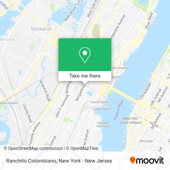
See Ranchito Colombiano, Union City, on the map
Public Transit to Ranchito Colombiano in Union City
Wondering how to get to Ranchito Colombiano in Union City? Moovit helps you find the best way to get to Ranchito Colombiano with step-by-step directions from the nearest public transit station.
Moovit provides free maps and live directions to help you navigate through your city. View schedules, routes, timetables, and find out how long does it take to get to Ranchito Colombiano in real time.
Looking for the nearest stop or station to Ranchito Colombiano? Check out this list of stops closest to your destination: Bergenline Ave at 23rd St; Summit Ave at 24th St; Palisade Ave at Shippen St; Hudson Ave & Shippen St; Bergenline Ave; Lincoln Harbor; Hoboken (14th Street).
Bus: 111, 123, 125, 154, 161, 167, 192, 22, 84, 86, 83, 85, 87, WEEHAWKEN TOWNSHIP SHUTTLE.Ferry: LINCOLN HARBOR - MIDTOWN / W 39TH ST, HOBOKEN / 14TH ST - BROOKFIELD PLACE, HOBOKEN / 14TH ST - PIER 11 / WALL ST, HOBOKEN / 14TH ST - MIDTOWN / W 39TH ST.
Want to see if there’s another route that gets you there at an earlier time? Moovit helps you find alternative routes or times. Get directions from and directions to Ranchito Colombiano easily from the Moovit App or Website.
We make riding to Ranchito Colombiano easy, which is why over 1.5 million users, including users in Union City, trust Moovit as the best app for public transit. You don’t need to download an individual bus app or train app, Moovit is your all-in-one transit app that helps you find the best bus time or train time available.
For information on prices of bus and subway, costs and ride fares to Ranchito Colombiano, please check the Moovit app.
Use the app to navigate to popular places including to the airport, hospital, stadium, grocery store, mall, coffee shop, school, college, and university.
Ranchito Colombiano Address: 419 24th St street in Union City
- Jaime's Help,
- Toro Boxing Fitness,
- El Parche,
- Iglesia Mision Principe De Paz,
- True Value (Lima Ferreteria),
- Heights Fitness Union City,
- Lima Hardware & Plumbing True,
- Esquina Catracha LLC,
- Diana Rodriguez,
- Panorama Live Poultry Market Corporation,
- Puffcity Franklin,
- Envios de Valores la Nacional,
- El Nuevo Cacheton,
- Grand Union Tours,
- Lia's Flowers,
- Hollywood Video & Electonics,
- Flajes Flowers,
- Rsc Sports Club,
- Bergenline Ave (25th bergenline),
- Genesis Bakery
Places Near Ranchito Colombiano (Union City)
- 911 Memorial, Manhattan,
- SoHo, Manhattan,
- Times Square, Manhattan,
- 376 Hudson Street, Manhattan,
- Katz's Deli, Manhattan,
- 66 John Street, Manhattan,
- 1 Police Plaza, Manhattan,
- 111 Centre New York City Supreme Court, Manhattan,
- qqqq, Manhattan,
- Hudson Yards, Manhattan,
- Rockefeller Center, Manhattan,
- 26 Federal Plaza, Manhattan,
- Bellevue Hospital, Manhattan,
- 3 Stone St, Manhattan,
- Chinatown, Manhattan,
- Pier 83, Manhattan,
- Mountainside Hospital, Glen Ridge,
- Queens Center Mall, Queens,
- Wall Street, Manhattan,
- San Gennaro Feast, Manhattan
How to get to popular places in New York - New Jersey with public transit
Get around Union City by public transit!
Traveling around Union City has never been so easy. See step by step directions as you travel to any attraction, street or major public transit station. View bus and train schedules, arrival times, service alerts and detailed routes on a map, so you know exactly how to get to anywhere in Union City.
When traveling to any destination around Union City use Moovit's Live Directions with Get Off Notifications to know exactly where and how far to walk, how long to wait for your line, and how many stops are left. Moovit will alert you when it's time to get off — no need to constantly re-check whether yours is the next stop.
Wondering how to use public transit in Union City or how to pay for public transit in Union City? Moovit public transit app can help you navigate your way with public transit easily, and at minimum cost. It includes public transit fees, ticket prices, and costs. Looking for a map of Union City public transit lines? Moovit public transit app shows all public transit maps in Union City with all Bus, Train, Subway, Light Rail, Ferry and Cable Car routes and stops on an interactive map.
New York - New Jersey has 6 transit type(s), including: Bus, Train, Subway, Light Rail, Ferry and Cable Car, operated by several transit agencies, including MTA Subway, Metro-North Railroad, LIRR, PATH, MTA New York City Transit - Express routes, MTA Bus, NJ Transit, NYC Ferry, NICE bus, Bee-Line Bus, NJ Transit Rail, Norwalk Transit District, Hartford Line, River Valley Transit and HART