How to get to Rancho High School Baseball Field by bus?
Click on the bus route to see step by step directions with maps, line arrival times and updated time schedules.
From Wicked Spoon, Paradise
71 minFrom Bellagio Employee Garage, Paradise
56 minFrom ARIA Express Bellagio Station, Paradise
51 minFrom Thomas & Mack Center, Paradise
70 minFrom Heather's Image Cleaning, Paradise
63 minFrom Horseshoe Las Vegas Hotel & Casino (Ballys Hotel in Las Vegas Nevada), Paradise
67 minFrom Circus Circus Hotel Casino Theme Park Las Vegas, Winchester
57 minFrom Mike O'Callaghan Military Medical Center - Nellis AFB, Nellis Afb
56 minFrom Vegas Valley Drive & South Hollywood Boulevard, Sunrise Manor
58 minFrom Ross Dress for Less, North Las Vegas
76 min
Bus stops near Rancho High School Baseball Field in North Las Vegas
Bus lines to Rancho High School Baseball Field in North Las Vegas
What are the closest stations to Rancho High School Baseball Field?
The closest stations to Rancho High School Baseball Field are:
- Sb Bruce After Searles is 317 yards away, 4 min walk.
- Sb Eastern After Owens is 349 yards away, 5 min walk.
- Wb Owens After Civic Center is 708 yards away, 9 min walk.
Which bus lines stop near Rancho High School Baseball Field?
These bus lines stop near Rancho High School Baseball Field: 110, 208, 209.
What’s the nearest bus station to Rancho High School Baseball Field in North Las Vegas?
The nearest bus station to Rancho High School Baseball Field in North Las Vegas is Sb Bruce After Searles. It’s a 4 min walk away.
What time is the first bus to Rancho High School Baseball Field in North Las Vegas?
The 110 is the first bus that goes to Rancho High School Baseball Field in North Las Vegas. It stops nearby at 3:21 AM.
What time is the last bus to Rancho High School Baseball Field in North Las Vegas?
The 110 is the last bus that goes to Rancho High School Baseball Field in North Las Vegas. It stops nearby at 3:21 AM.
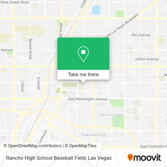
See Rancho High School Baseball Field, North Las Vegas, on the map
Public Transit to Rancho High School Baseball Field in North Las Vegas
Wondering how to get to Rancho High School Baseball Field in North Las Vegas? Moovit helps you find the best way to get to Rancho High School Baseball Field with step-by-step directions from the nearest public transit station.
Moovit provides free maps and live directions to help you navigate through your city. View schedules, routes, timetables, and find out how long does it take to get to Rancho High School Baseball Field in real time.
Looking for the nearest stop or station to Rancho High School Baseball Field? Check out this list of stops closest to your destination: Sb Bruce After Searles; Sb Eastern After Owens; Wb Owens After Civic Center.
Bus: 110, 208, 209.
Want to see if there’s another route that gets you there at an earlier time? Moovit helps you find alternative routes or times. Get directions from and directions to Rancho High School Baseball Field easily from the Moovit App or Website.
We make riding to Rancho High School Baseball Field easy, which is why over 1.7 million users, including users in North Las Vegas, trust Moovit as the best app for public transit. You don’t need to download an individual bus app or train app, Moovit is your all-in-one transit app that helps you find the best bus time or train time available.
For information on prices of bus, costs and ride fares to Rancho High School Baseball Field, please check the Moovit app.
Use the app to navigate to popular places including to the airport, hospital, stadium, grocery store, mall, coffee shop, school, college, and university.
Rancho High School Baseball Field Address: 1900 E Owens Ave street in North Las Vegas
- On Site Plumber & Leak Detection North Las Vegas,
- Owens @ Eastern ,
- Rancho High School,
- Blue Horizon Pool Services,
- J D Smith Ms,
- Francis Maloney Writes,
- Rancho Alumni Stadium,
- J D Smith Middle School,
- City Of North Las Vegas Parks,
- Rancho HS High School,
- Judah Family Community Church,
- JD Smith Middle School (Smith J D Middle School),
- Wolfx Liquidation,
- Aven Restoration Lasvegas,
- Llantera 3 Hermanos,
- El Molca Mariscos Y Tacos,
- El Buen Sabor,
- Llantera Brakes Tires,
- Us Tire Center And Auto Repair,
- Family Personal Care Llc
Places Near Rancho High School Baseball Field (North Las Vegas)
- Koolsville Tattoos, Las Vegas,
- Las Vegas South Premium Outlets, Enterprise,
- The Neon Museum, Las Vegas,
- Allegiant Stadium, Paradise,
- Meow Wolf - Las Vegas (Meow Wolf's Omega Mart), Las Vegas,
- The Palms Casino Resort, Paradise,
- Las Vegas Premium Outlets-North, Enterprise,
- Welcome To Fabulous Las Vegas Sign, Paradise,
- Las Vegas North Premium Outlets, Las Vegas,
- Trump International Hotel Las Vegas, Paradise,
- The Deuce Bus Stop at Fremont St, Las Vegas,
- Omega Mart, Las Vegas,
- Gold & Silver Pawn Shop, Las Vegas,
- Area15, Las Vegas,
- Town Square, Enterprise,
- Walmart Supercenter, Las Vegas,
- Zak Bagans Haunted Museum, Las Vegas,
- Walmart, Las Vegas,
- Arte Museum Las Vegas, Paradise,
- Lee Canyon, Las Vegas
How to get to popular places in Las Vegas with public transit
Get around North Las Vegas by public transit!
Traveling around North Las Vegas has never been so easy. See step by step directions as you travel to any attraction, street or major public transit station. View bus and train schedules, arrival times, service alerts and detailed routes on a map, so you know exactly how to get to anywhere in North Las Vegas.
When traveling to any destination around North Las Vegas use Moovit's Live Directions with Get Off Notifications to know exactly where and how far to walk, how long to wait for your line, and how many stops are left. Moovit will alert you when it's time to get off — no need to constantly re-check whether yours is the next stop.
Wondering how to use public transit in North Las Vegas or how to pay for public transit in North Las Vegas? Moovit public transit app can help you navigate your way with public transit easily, and at minimum cost. It includes public transit fees, ticket prices, and costs. Looking for a map of North Las Vegas public transit lines? Moovit public transit app shows all public transit maps in North Las Vegas with all Bus and Monorail routes and stops on an interactive map.
Las Vegas has 2 transit type(s), including: Bus and Monorail, operated by several transit agencies, including RTCSNV, City of Las Vegas, Alvand Transportation, Vegas Airporter, Las Vegas Monorail, FlixBus-us and Greyhound-us