Directions to Rank Boston (Cambridge) with public transportation
The following transit lines have routes that pass near Rank Boston
 Bus: 1, 109, 96, 68, 69.
- Train: FITCHBURG, FRAMINGHAM/WORCESTER.
- Subway: RED LINE, GREEN LINE B, GREEN LINE D, GREEN LINE E.
How to get to Rank Boston by bus?
Click on the bus route to see step by step directions with maps, line arrival times and updated time schedules.
From John F. Kennedy Presidential Library And Museum, Boston
67 minFrom Boston University Goldman School of Dental Medicine, Boston
36 minFrom Moakley Us Courthouse, Boston
72 minFrom Battery Wharf Hotel, Boston
54 minFrom VFW Parkway, Boston
68 minFrom Uscis Biometrics Office, Revere
81 minFrom Melrose, MA, Melrose
94 minFrom West Roxbury, Boston
77 minFrom Waltham, MA, Waltham
60 minFrom Spaulding Rehab, Boston
72 min
How to get to Rank Boston by train?
Click on the train route to see step by step directions with maps, line arrival times and updated time schedules.
From John F. Kennedy Presidential Library And Museum, Boston
106 minFrom Moakley Us Courthouse, Boston
75 minFrom Battery Wharf Hotel, Boston
62 minFrom VFW Parkway, Boston
112 minFrom Melrose, MA, Melrose
121 minFrom West Roxbury, Boston
99 minFrom Waltham, MA, Waltham
52 minFrom Spaulding Rehab, Boston
107 min
How to get to Rank Boston by subway?
Click on the subway route to see step by step directions with maps, line arrival times and updated time schedules.
Bus stops near Rank Boston in Cambridge
Subway stations near Rank Boston in Cambridge
Bus lines to Rank Boston in Cambridge
What are the closest stations to Rank Boston?
The closest stations to Rank Boston are:
- Massachusetts Ave @ Bay St is 19 yards away, 1 min walk.
- Babcock Street is 208 yards away, 3 min walk.
- 454 Broadway is 408 yards away, 5 min walk.
- Quincy St @ Harvard St is 495 yards away, 7 min walk.
- Broadway @ Felton St is 524 yards away, 7 min walk.
- Harvard Square is 673 yards away, 8 min walk.
- Union Square is 2107 yards away, 25 min walk.
Which bus lines stop near Rank Boston?
These bus lines stop near Rank Boston: 1, 109, 96.
Which train lines stop near Rank Boston?
These train lines stop near Rank Boston: FITCHBURG, FRAMINGHAM/WORCESTER.
Which subway line stops near Rank Boston?
RED LINE (Alewife)
What’s the nearest subway station to Rank Boston in Cambridge?
The nearest subway station to Rank Boston in Cambridge is Babcock Street. It’s a 3 min walk away.
What’s the nearest bus station to Rank Boston in Cambridge?
The nearest bus station to Rank Boston in Cambridge is Massachusetts Ave @ Bay St. It’s a 1 min walk away.
What time is the first subway to Rank Boston in Cambridge?
The GREEN LINE E is the first subway that goes to Rank Boston in Cambridge. It stops nearby at 4:50 AM.
What time is the last subway to Rank Boston in Cambridge?
The GREEN LINE B is the last subway that goes to Rank Boston in Cambridge. It stops nearby at 2:20 AM.
What time is the first bus to Rank Boston in Cambridge?
The 1 is the first bus that goes to Rank Boston in Cambridge. It stops nearby at 5:00 AM.
What time is the last bus to Rank Boston in Cambridge?
The 1 is the last bus that goes to Rank Boston in Cambridge. It stops nearby at 2:34 AM.
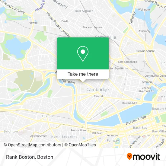
See Rank Boston, Cambridge, on the map
Public Transit to Rank Boston in Cambridge
Wondering how to get to Rank Boston in Cambridge? Moovit helps you find the best way to get to Rank Boston with step-by-step directions from the nearest public transit station.
Moovit provides free maps and live directions to help you navigate through your city. View schedules, routes, timetables, and find out how long does it take to get to Rank Boston in real time.
Looking for the nearest stop or station to Rank Boston? Check out this list of stops closest to your destination: Massachusetts Ave @ Bay St; Babcock Street; 454 Broadway; Quincy St @ Harvard St; Broadway @ Felton St; Harvard Square; Union Square.
Bus: 1, 109, 96, 68, 69.Train: FITCHBURG, FRAMINGHAM/WORCESTER.Subway: RED LINE, GREEN LINE B, GREEN LINE D, GREEN LINE E.
Want to see if there’s another route that gets you there at an earlier time? Moovit helps you find alternative routes or times. Get directions from and directions to Rank Boston easily from the Moovit App or Website.
We make riding to Rank Boston easy, which is why over 1.7 million users, including users in Cambridge, trust Moovit as the best app for public transit. You don’t need to download an individual bus app or train app, Moovit is your all-in-one transit app that helps you find the best bus time or train time available.
For information on prices of bus, subway and train, costs and ride fares to Rank Boston, please check the Moovit app.
Use the app to navigate to popular places including to the airport, hospital, stadium, grocery store, mall, coffee shop, school, college, and university.
Rank Boston Address: 1030 Massachusetts Ave street in Cambridge
- Potenza Therapeutics,
- Alden & Harlow,
- Harvard-Faculty-Arts & SCNCS,
- Philip Allen,
- Northstar News,
- Haigh & Company,
- Hiram Sands House,
- Michael A. Sullivan Square,
- Friends and Family,
- Jan and Kayla Real Estate Team,
- 1030 mass ave,
- 2a,
- VSM Services Inc,
- Circus Cooperative Cafe,
- Harvard Book Store,
- 8 Mta,
- Cambridge & Somerville Ma,
- Sarah Shimoff,
- Ristorante Villa Francesca,
- Keith W Michon, PC
Places Near Rank Boston (Cambridge)
- Boston Medical Center, Boston,
- Cheers, Boston,
- North End, Boston,
- Seaport District, Boston,
- Prudential Center, Boston,
- Boston Convention & Exhibition Center, Boston,
- Boston Children's Hospital, Boston,
- House Of Blues, Boston,
- Wilbur Theatre, Boston,
- Mgm Music Hall, Boston,
- Td Garden, Boston,
- Quincy Market, Boston,
- Boston Common, Boston,
- Leader Bank Pavilion (Leader Bank Pavillion), Boston,
- Faneuil Hall, Boston,
- Castle Island, Boston,
- Museum Of Science, Boston,
- Massachusetts General Hospital, Boston,
- Isabella Stewart Gardner Museum, Boston,
- Wang Theater, Boston
How to get to popular places in Boston with public transit
Get around Cambridge by public transit!
Traveling around Cambridge has never been so easy. See step by step directions as you travel to any attraction, street or major public transit station. View bus and train schedules, arrival times, service alerts and detailed routes on a map, so you know exactly how to get to anywhere in Cambridge.
When traveling to any destination around Cambridge use Moovit's Live Directions with Get Off Notifications to know exactly where and how far to walk, how long to wait for your line, and how many stops are left. Moovit will alert you when it's time to get off — no need to constantly re-check whether yours is the next stop.
Wondering how to use public transit in Cambridge or how to pay for public transit in Cambridge? Moovit public transit app can help you navigate your way with public transit easily, and at minimum cost. It includes public transit fees, ticket prices, and costs. Looking for a map of Cambridge public transit lines? Moovit public transit app shows all public transit maps in Cambridge with all Bus, Train, Subway and Ferry routes and stops on an interactive map.
Boston has 4 transit type(s), including: Bus, Train, Subway and Ferry, operated by several transit agencies, including MBTA, Southeastern Regional Transit Authority, MetroWest Regional Transit Authority, Rhode Island Public Transit Authority, WRTA, Lowell Regional Transit Authority, Merrimack Valley Transit, Montachusett Regional Transit Authority, Cape Cod Regional Transit Authority, Brockton Area Transit Authority, Martha's Vineyard Transit Authority, the WAVE - Nantucket Regional Transit Authority, GATRA, Cape Ann Transportation Authority and Massport