Directions to Rapidolight Info (Arlington County) with public transportation
The following transit lines have routes that pass near Rapidolight Info
 Bus: 35, 43, 697, 42, 87.
- Train: FREDERICKSBURG LINE, MANASSAS LINE.
- Metro: BLUE, YELLOW, METRO STATION CLOSURE SHUTTLE.
How to get to Rapidolight Info by bus?
Click on the bus route to see step by step directions with maps, line arrival times and updated time schedules.
From Children's National Columbia heights shuttle, Washington
83 minFrom Washington Costco DC, Washington
100 minFrom U.S. Census Bureau, Prince George's County
107 minFrom Abraham Lincoln Memorial Washington DC, Washington
88 minFrom Walmart Supercenter, Washington
108 minFrom Costco, Washington
101 minFrom St John's College High School, Washington
115 minFrom Franklin Hall, Washington
75 minFrom St Elizabeths Hospital, Washington
115 minFrom Dumbarton Oaks, Washington
49 min
How to get to Rapidolight Info by metro?
Click on the metro route to see step by step directions with maps, line arrival times and updated time schedules.
From Children's National Columbia heights shuttle, Washington
42 minFrom U.S. Census Bureau, Prince George's County
55 minFrom Abraham Lincoln Memorial Washington DC, Washington
54 minFrom Walmart Supercenter, Washington
77 minFrom Franklin Hall, Washington
47 minFrom St Elizabeths Hospital, Washington
56 minFrom Dumbarton Oaks, Washington
70 min
Bus stops near Rapidolight Info in Arlington County
- Pentagon Transit Center Bay U3, 18 min walk,VIEW
- Pentagon Metro @ Bay U3, 18 min walk,VIEW
- Metro Pentagon Bay L6, 18 min walk,VIEW
- Pentagon Transit Ctr + Bus Bay U5, 19 min walk,VIEW
- Pentagon Transit Center (Bay U1), 19 min walk,VIEW
- Pentagon+Bay U6, 19 min walk,VIEW
- Pentagon+Bay L3, 19 min walk,VIEW
- Pentagon Transit Ctr + Bus Bay U7, 19 min walk,VIEW
- Pentagon Station & Bus Bay U10, 19 min walk,VIEW
- Pentagon Bus Bay L6, 19 min walk,VIEW
- Metro Pentagon Bay L7, 20 min walk,VIEW
- Pentagon Station & Bus Bay U11, 20 min walk,VIEW
- Pentagon+Bay U13, 20 min walk,VIEW
- Pentagon Metro, 20 min walk,VIEW
- Pentagon Station & Bus Bay L4 (Hov), 21 min walk,VIEW
Train station near Rapidolight Info in Arlington County
- Crystal City, 24 min walk,VIEW
Metro station near Rapidolight Info in Arlington County
- Crystal City, 24 min walk,VIEW
Bus lines to Rapidolight Info in Arlington County
- 42, Ballston,VIEW
- 87, Pentagon,VIEW
- A11, North To Pentagon,VIEW
- A66, East To Pentagon,VIEW
- A27, North To Pentagon,VIEW
- 598, 598 Pentagon - Crystal City,VIEW
- 698, 698 Pentagon,VIEW
- 103, Braddock Road Station,VIEW
- 104, Pentagon Transit Center,VIEW
- A90, North To Pentagon,VIEW
- F81, West To Rolling Valley P+R,VIEW
- F83, East To Pentagon,VIEW
- 35, Pentagon Transit Center,VIEW
- 393, 393 Saratoga,VIEW
- 394, 394 Saratoga,VIEW
- 395, 395 Pentagon,VIEW
- 396, 396 Springfield,VIEW
- F44, East To Pentagon,VIEW
- 282, Crystal City Via Rosslyn & Pentagon,VIEW
- 284, Pentagon,VIEW
What are the closest stations to Rapidolight Info?
The closest stations to Rapidolight Info are:
- Pentagon Transit Center Bay U3 is 1452 yards away, 18 min walk.
- Pentagon Metro @ Bay U3 is 1483 yards away, 18 min walk.
- Pentagon Transit Ctr + Bus Bay U5 is 1511 yards away, 19 min walk.
- Metro Pentagon Bay L6 is 1516 yards away, 18 min walk.
- Pentagon Transit Center (Bay U1) is 1529 yards away, 19 min walk.
- Pentagon+Bay U6 is 1534 yards away, 19 min walk.
- Pentagon+Bay L3 is 1561 yards away, 19 min walk.
- Pentagon Transit Ctr + Bus Bay U7 is 1565 yards away, 19 min walk.
- Metro Pentagon Bay L7 is 1580 yards away, 20 min walk.
- Pentagon Station & Bus Bay U10 is 1585 yards away, 19 min walk.
- Pentagon Bus Bay L6 is 1586 yards away, 19 min walk.
- Pentagon Station & Bus Bay U11 is 1624 yards away, 20 min walk.
- Pentagon+Bay U13 is 1671 yards away, 20 min walk.
- Pentagon Metro is 1679 yards away, 20 min walk.
- Pentagon Station & Bus Bay L4 (Hov) is 1719 yards away, 21 min walk.
- Crystal City is 1963 yards away, 24 min walk.
Which bus lines stop near Rapidolight Info?
These bus lines stop near Rapidolight Info: 35, 43, 697.
Which metro lines stop near Rapidolight Info?
These metro lines stop near Rapidolight Info: BLUE, YELLOW.
What’s the nearest metro station to Rapidolight Info in Arlington County?
The nearest metro station to Rapidolight Info in Arlington County is Crystal City. It’s a 24 min walk away.
What’s the nearest train station to Rapidolight Info in Arlington County?
The nearest train station to Rapidolight Info in Arlington County is Crystal City. It’s a 24 min walk away.
What time is the first metro to Rapidolight Info in Arlington County?
The YELLOW is the first metro that goes to Rapidolight Info in Arlington County. It stops nearby at 5:11 AM.
What time is the last metro to Rapidolight Info in Arlington County?
The BLUE is the last metro that goes to Rapidolight Info in Arlington County. It stops nearby at 12:26 AM.
What time is the first train to Rapidolight Info in Arlington County?
The MANASSAS LINE is the first train that goes to Rapidolight Info in Arlington County. It stops nearby at 6:04 AM.
What time is the last train to Rapidolight Info in Arlington County?
The MANASSAS LINE is the last train that goes to Rapidolight Info in Arlington County. It stops nearby at 7:15 PM.
What time is the first bus to Rapidolight Info in Arlington County?
The 35 is the first bus that goes to Rapidolight Info in Arlington County. It stops nearby at 4:49 AM.
What time is the last bus to Rapidolight Info in Arlington County?
The 35 is the last bus that goes to Rapidolight Info in Arlington County. It stops nearby at 2:16 AM.
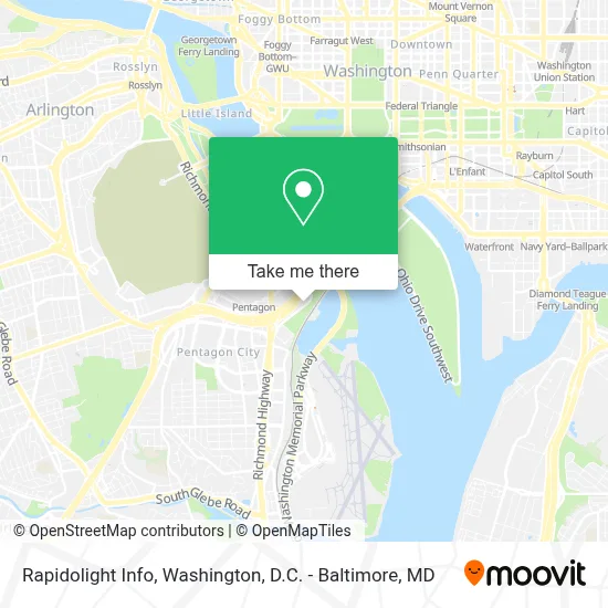
See Rapidolight Info, Arlington County, on the map
Public Transit to Rapidolight Info in Arlington County
Wondering how to get to Rapidolight Info in Arlington County? Moovit helps you find the best way to get to Rapidolight Info with step-by-step directions from the nearest public transit station.
Moovit provides free maps and live directions to help you navigate through your city. View schedules, routes, timetables, and find out how long does it take to get to Rapidolight Info in real time.
Looking for the nearest stop or station to Rapidolight Info? Check out this list of stops closest to your destination: Pentagon Transit Center Bay U3; Pentagon Metro @ Bay U3; Pentagon Transit Ctr + Bus Bay U5; Metro Pentagon Bay L6; Pentagon Transit Center (Bay U1); Pentagon+Bay U6; Pentagon+Bay L3; Pentagon Transit Ctr + Bus Bay U7; Metro Pentagon Bay L7; Pentagon Station & Bus Bay U10; Pentagon Bus Bay L6; Pentagon Station & Bus Bay U11; Pentagon+Bay U13; Pentagon Metro; Pentagon Station & Bus Bay L4 (Hov); Crystal City.
Bus: 35, 43, 697, 42, 87, A11, A66, 598, 698, 103, 104.Train: FREDERICKSBURG LINE, MANASSAS LINE.Metro: BLUE, YELLOW, METRO STATION CLOSURE SHUTTLE.
Want to see if there’s another route that gets you there at an earlier time? Moovit helps you find alternative routes or times. Get directions from and directions to Rapidolight Info easily from the Moovit App or Website.
We make riding to Rapidolight Info easy, which is why over 1.7 million users, including users in Arlington County, trust Moovit as the best app for public transit. You don’t need to download an individual bus app or train app, Moovit is your all-in-one transit app that helps you find the best bus time or train time available.
For information on prices of bus and metro, costs and ride fares to Rapidolight Info, please check the Moovit app.
Use the app to navigate to popular places including to the airport, hospital, stadium, grocery store, mall, coffee shop, school, college, and university.
Rapidolight Info Address: 398 Long Bridge Dr street in Arlington County
- Costco,
- Long Bridge Park,
- Pentagon Heating & Refrigeration Plant,
- Long Bridge Aquatics & Fitness Center,
- Pentagon Pass Office,
- Pentagon Connector Parking Lot,
- Marine Corps Marathon,
- Gravelly Point Park,
- Pentagon Transit Center,
- Pentagon-Navy Annex Shuttle Bus (OSBP),
- The Pentagon, Hall Of Heroes,
- Doubletree by Hilton,
- DoubleTree by Hilton Hotel Washington DC-Crystal City,
- The Pentagon,
- Exit 10C / George Wash Mem Pkwy N / S,
- The Boeing Company,
- Lenox Club,
- Pentagon Library and Conference Center,
- Earth Treks Crystal City,
- DiLorenzo Tricare Healthcare Clinic
Places Near Rapidolight Info (Arlington County)
- National Theatre, Washington,
- M&T Bank Stadium, Baltimore,
- Westfield Montgomery Mall, Montgomery County,
- Amazon Hq2, Arlington County,
- National Zoo, Washington,
- Pennsylvania Ave NW (3rd st and pennsylvania), Washington,
- Georgetown, Washington,
- Sibley Memorial Hospital, Washington,
- Washington National Cathedral, Washington,
- Washington DC VA Medical Center, Washington,
- Basilica of the National Shrine, Washington,
- Capital One Arena, Washington,
- PG Mall, Prince George's County,
- The Anthem, Washington,
- Warner Theatre, Washington,
- National Museum of African American History and Culture, Washington,
- Museum Of The Bible, Washington,
- Marriott Marquis Washington, DC, Washington,
- Rock Creek Tennis Center, Washington,
- Camden Yards, Baltimore
How to get to popular places in Washington, D.C. - Baltimore, MD with public transit
Get around Arlington County by public transit!
Traveling around Arlington County has never been so easy. See step by step directions as you travel to any attraction, street or major public transit station. View bus and train schedules, arrival times, service alerts and detailed routes on a map, so you know exactly how to get to anywhere in Arlington County.
When traveling to any destination around Arlington County use Moovit's Live Directions with Get Off Notifications to know exactly where and how far to walk, how long to wait for your line, and how many stops are left. Moovit will alert you when it's time to get off — no need to constantly re-check whether yours is the next stop.
Wondering how to use public transit in Arlington County or how to pay for public transit in Arlington County? Moovit public transit app can help you navigate your way with public transit easily, and at minimum cost. It includes public transit fees, ticket prices, and costs. Looking for a map of Arlington County public transit lines? Moovit public transit app shows all public transit maps in Arlington County with all Bus, Train, Metro, Light Rail and Ferry routes and stops on an interactive map.
Washington, D.C. - Baltimore, MD has 5 transit type(s), including: Bus, Train, Metro, Light Rail and Ferry, operated by several transit agencies, including WMATA, Montgomery County Ride On, Fairfax Connector, TheBus, PRTC, DASH - Alexandria, Arlington Transit (ART), RTA of Central Maryland, MDOT MTA, MDOT MTA Light RailLink, MDOT MTA Commuter Bus, MDOT MTA Local Bus, FXBGO!, Virginia Railway Express (VRE) and MARC