How to get to Raspberries Records by bus?
Click on the bus route to see step by step directions with maps, line arrival times and updated time schedules.
From South High Community School, Worcester
220 minFrom Dcu Center, Worcester
126 minFrom Registry Of Motor Vehicles (Rmv) Branch Office, Worcester
128 minFrom Foxwoods, Worcester
153 minFrom Worcester, MA, Worcester
124 minFrom Walmart Supercenter, Worcester
182 minFrom Palladium, Worcester
129 minFrom Polar Park, Worcester
125 min
Bus stops near Raspberries Records in Boston
Bus lines to Raspberries Records in Boston
What are the closest stations to Raspberries Records?
The closest stations to Raspberries Records are:
- Sewall / Winsor is 31 yards away, 1 min walk.
- East / Yale is 90 yards away, 2 min walk.
Which bus line stops near Raspberries Records?
B6 (Ludlow Big Y Via Bay/Berkshire/Pasco)
What’s the nearest bus station to Raspberries Records in Boston?
The nearest bus station to Raspberries Records in Boston is Sewall / Winsor. It’s a 1 min walk away.
What time is the first bus to Raspberries Records in Boston?
The B6 is the first bus that goes to Raspberries Records in Boston. It stops nearby at 5:38 AM.
What time is the last bus to Raspberries Records in Boston?
The B6 is the last bus that goes to Raspberries Records in Boston. It stops nearby at 10:12 PM.
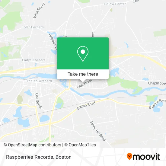
See Raspberries Records, Boston, on the map
Public Transit to Raspberries Records in Boston
Wondering how to get to Raspberries Records in Boston? Moovit helps you find the best way to get to Raspberries Records with step-by-step directions from the nearest public transit station.
Moovit provides free maps and live directions to help you navigate through your city. View schedules, routes, timetables, and find out how long does it take to get to Raspberries Records in real time.
Looking for the nearest stop or station to Raspberries Records? Check out this list of stops closest to your destination: Sewall / Winsor; East / Yale.
Bus: B6, X94.
Want to see if there’s another route that gets you there at an earlier time? Moovit helps you find alternative routes or times. Get directions from and directions to Raspberries Records easily from the Moovit App or Website.
We make riding to Raspberries Records easy, which is why over 1.7 million users, including users in Boston, trust Moovit as the best app for public transit. You don’t need to download an individual bus app or train app, Moovit is your all-in-one transit app that helps you find the best bus time or train time available.
For information on prices of bus, costs and ride fares to Raspberries Records, please check the Moovit app.
Use the app to navigate to popular places including to the airport, hospital, stadium, grocery store, mall, coffee shop, school, college, and university.
Raspberries Records Address: 207 Winsor St street in Boston
- Hub International,
- The UPS Store,
- El Nutrition,
- Mais Bello Zumba Studio,
- East Street School,
- Saint John the Baptist School,
- St. Elizabeth Parish,
- Blue Water Sushi,
- Vibrant Massage,
- Cumberland Farms,
- D & C Granite & Marble,
- Sewall & Winsor (Opposite),
- Loving Angels,
- Western Ma Family Services,
- Lash Hub,
- Monster Den,
- ATM,
- Zap Electric,
- Molta Florist Supply,
- Ludlow
Places Near Raspberries Records (Boston)
- North End, Boston,
- Mgm Music Hall, Boston,
- Isabella Stewart Gardner Museum, Boston,
- Boston Common, Boston,
- Boston Medical Center, Boston,
- Boston Convention & Exhibition Center, Boston,
- Faneuil Hall, Boston,
- Wang Theater, Boston,
- Castle Island, Boston,
- Prudential Center, Boston,
- Massachusetts General Hospital, Boston,
- House Of Blues, Boston,
- Museum Of Science, Boston,
- Leader Bank Pavilion (Leader Bank Pavillion), Boston,
- Quincy Market, Boston,
- Wilbur Theatre, Boston,
- Cheers, Boston,
- Seaport District, Boston,
- Boston Children's Hospital, Boston,
- Td Garden, Boston
How to get to popular places in Boston with public transit
Get around Boston by public transit!
Traveling around Boston has never been so easy. See step by step directions as you travel to any attraction, street or major public transit station. View bus and train schedules, arrival times, service alerts and detailed routes on a map, so you know exactly how to get to anywhere in Boston.
When traveling to any destination around Boston use Moovit's Live Directions with Get Off Notifications to know exactly where and how far to walk, how long to wait for your line, and how many stops are left. Moovit will alert you when it's time to get off — no need to constantly re-check whether yours is the next stop.
Wondering how to use public transit in Boston or how to pay for public transit in Boston? Moovit public transit app can help you navigate your way with public transit easily, and at minimum cost. It includes public transit fees, ticket prices, and costs. Looking for a map of Boston public transit lines? Moovit public transit app shows all public transit maps in Boston with all Bus, Train, Subway and Ferry routes and stops on an interactive map.
Boston has 4 transit type(s), including: Bus, Train, Subway and Ferry, operated by several transit agencies, including MBTA, Southeastern Regional Transit Authority, MetroWest Regional Transit Authority, Rhode Island Public Transit Authority, WRTA, Lowell Regional Transit Authority, Merrimack Valley Transit, Montachusett Regional Transit Authority, Cape Cod Regional Transit Authority, Brockton Area Transit Authority, Martha's Vineyard Transit Authority, the WAVE - Nantucket Regional Transit Authority, GATRA, Cape Ann Transportation Authority and Massport