How to get to Rats-Apotheke Brackenheim by bus?
Click on the bus route to see step by step directions with maps, line arrival times and updated time schedules.
From Antalya Pizza & Kebaphaus, Verwaltungsgemeinschaft Eppingen
131 minFrom H7, Heilbronn
57 minFrom Pflanzen Mauk, Verwaltungsgemeinschaft Lauffen am Neckar
52 minFrom Kaufland Heilbronn Olgastr., Heilbronn
60 minFrom Knorr Fabrikverkauf, Heilbronn
42 minFrom Wertwiesenpark, Sontheim
40 minFrom Freibad Neckarhalde, Heilbronn
44 minFrom Theresienwiese, Heilbronn
56 minFrom Christiane-Herzog-Schule, Böckingen
70 minFrom Frankenstadion, Heilbronn
69 min
Bus stops near Rats-Apotheke Brackenheim in Verwaltungsgemeinschaft Brackenheim
- Brackenheim Zob, 5 min walk,VIEW
Bus lines to Rats-Apotheke Brackenheim in Verwaltungsgemeinschaft Brackenheim
- 660, Brackenheim ZOB Bstg 1 - Heilbronn Hbf/Busbahnhof Bstg 8,VIEW
- 661, Ochsenburg Ortsmitte - Brackenheim ZOB Bstg 1,VIEW
- 662, Heilbronn Hbf/Busbahnhof Bstg 8 - Brackenheim ZOB Bstg 5,VIEW
- 663, Brackenheim ZOB Bstg 5 - Güglingen Schulzentrum,VIEW
- 664, Lauffen (N) Bahnhof - Brackenheim ZOB Bstg 4,VIEW
- 665, Brackenheim ZOB Bstg 3 - Brackenheim ZOB Bstg 3,VIEW
- 666, Bönnigheim Schulzentrum - Brackenheim ZOB Bstg 5,VIEW
- 667, Brackenheim ZOB Bstg 2 - Lauffen (N) Bahnhof,VIEW
- 668, Brackenheim ZOB Bstg 6 - Lauffen (N) Bahnhof,VIEW
- 666, Cleebronn Mitte,VIEW
What are the closest stations to Rats-Apotheke Brackenheim?
The closest stations to Rats-Apotheke Brackenheim are:
- Brackenheim Zob is 318 meters away, 5 min walk.
Which bus lines stop near Rats-Apotheke Brackenheim?
These bus lines stop near Rats-Apotheke Brackenheim: 661, 662, 664, 667.
What’s the nearest bus station to Rats-Apotheke Brackenheim in Verwaltungsgemeinschaft Brackenheim?
The nearest bus station to Rats-Apotheke Brackenheim in Verwaltungsgemeinschaft Brackenheim is Brackenheim Zob. It’s a 5 min walk away.
What time is the first bus to Rats-Apotheke Brackenheim in Verwaltungsgemeinschaft Brackenheim?
The 661 is the first bus that goes to Rats-Apotheke Brackenheim in Verwaltungsgemeinschaft Brackenheim. It stops nearby at 4:35 AM.
What time is the last bus to Rats-Apotheke Brackenheim in Verwaltungsgemeinschaft Brackenheim?
The 661 is the last bus that goes to Rats-Apotheke Brackenheim in Verwaltungsgemeinschaft Brackenheim. It stops nearby at 1:18 AM.
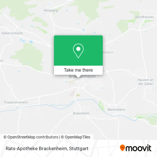
See Rats-Apotheke Brackenheim, Verwaltungsgemeinschaft Brackenheim, on the map
Public Transit to Rats-Apotheke Brackenheim in Verwaltungsgemeinschaft Brackenheim
Wondering how to get to Rats-Apotheke Brackenheim in Verwaltungsgemeinschaft Brackenheim? Moovit helps you find the best way to get to Rats-Apotheke Brackenheim with step-by-step directions from the nearest public transit station.
Moovit provides free maps and live directions to help you navigate through your city. View schedules, routes, timetables, and find out how long does it take to get to Rats-Apotheke Brackenheim in real time.
Looking for the nearest stop or station to Rats-Apotheke Brackenheim? Check out this list of stops closest to your destination: Brackenheim Zob.
Bus: 661, 662, 664, 667, 660, 663, 666.
Want to see if there’s another route that gets you there at an earlier time? Moovit helps you find alternative routes or times. Get directions from and directions to Rats-Apotheke Brackenheim easily from the Moovit App or Website.
We make riding to Rats-Apotheke Brackenheim easy, which is why over 1.5 million users, including users in Verwaltungsgemeinschaft Brackenheim, trust Moovit as the best app for public transit. You don’t need to download an individual bus app or train app, Moovit is your all-in-one transit app that helps you find the best bus time or train time available.
For information on prices of bus, train and light rail, costs and ride fares to Rats-Apotheke Brackenheim, please check the Moovit app.
Use the app to navigate to popular places including to the airport, hospital, stadium, grocery store, mall, coffee shop, school, college, and university.
Rats-Apotheke Brackenheim Address: Marktstraße 4 74336 Brackenheim street in Verwaltungsgemeinschaft Brackenheim
- City Döner,
- Ochsen am Markt,
- Hermes PaketShop,
- Wollladle Hein,
- Alltours Reisecenter,
- Reisebüro Leopold Deigner,
- Asia Imbiss Mai Anh,
- Stadtverwaltung Brackenheim,
- Zweckverband Wirtschaftsförderung Zabergäu,
- Kindergarten Brackenheim Kindergärten,
- Bürgerzentrum,
- Förderverein Krankenhaus Brackenheim,
- Startseite,
- Artig,
- Rokoko-Rathaus,
- Brackenheim Gemeindehalle Dürrenzimmern,
- Dipl.Psych. Hannah Lorenz,
- Franziska Köhler,
- Europäischen Union,
- Wagner und Stadtmüller
Places Near Rats-Apotheke Brackenheim (Verwaltungsgemeinschaft Brackenheim)
- Mercedes-Benz Museum, Bad Cannstatt,
- Waldfriedhof, Degerloch,
- Geilhaus Haus 33a, Reutlingen-Betzingen,
- Hauptbahnhof Stuttgart, Stuttgart-Mitte,
- Mercedes-Benz Museum (Mercedes Museum Stuttgart), Bad Cannstatt,
- Pariser Platz Stuttgart, Stuttgart-Mitte,
- Gleis 101/102 (tief), Stuttgart-Mitte,
- SI-Centrum, Möhringen,
- Hanns-Martin-Schleyer-Halle, Bad Cannstatt,
- Schleyerhalle, Bad Cannstatt,
- Wilhelma (U-Bahn Wilhelma), Bad Cannstatt,
- Klinikum Stuttgart - Katharinenhospital, Stuttgart-Mitte,
- FlixBus Haltestelle, Stuttgart,
- Hanns-Martin-Schleyer-Halle (Stuttgart Hans-Martin-Schleyerhalle), Bad Cannstatt,
- Porsche Museum, Zuffenhausen,
- Porsche-Arena, Bad Cannstatt,
- Mettingen Eros-Center Puff Laufhaus, Esslingen Am Neckar,
- Marmorsaal Im Weissenburgpark, Stuttgart-Süd,
- Gasometer Pforzheim, Pforzheim,
- Im Wizemann (Halle), Bad Cannstatt
How to get to popular places in Stuttgart with public transit
Get around Verwaltungsgemeinschaft Brackenheim by public transit!
Traveling around Verwaltungsgemeinschaft Brackenheim has never been so easy. See step by step directions as you travel to any attraction, street or major public transit station. View bus and train schedules, arrival times, service alerts and detailed routes on a map, so you know exactly how to get to anywhere in Verwaltungsgemeinschaft Brackenheim.
When traveling to any destination around Verwaltungsgemeinschaft Brackenheim use Moovit's Live Directions with Get Off Notifications to know exactly where and how far to walk, how long to wait for your line, and how many stops are left. Moovit will alert you when it's time to get off — no need to constantly re-check whether yours is the next stop.
Wondering how to use public transit in Verwaltungsgemeinschaft Brackenheim or how to pay for public transit in Verwaltungsgemeinschaft Brackenheim? Moovit public transit app can help you navigate your way with public transit easily, and at minimum cost. It includes public transit fees, ticket prices, and costs. Looking for a map of Verwaltungsgemeinschaft Brackenheim public transit lines? Moovit public transit app shows all public transit maps in Verwaltungsgemeinschaft Brackenheim with all Bus, Train, Subway, Light Rail, Ferry, S-Bahn and Funicular routes and stops on an interactive map.
Stuttgart has 7 transit type(s), including: Bus, Train, Subway, Light Rail, Ferry, S-Bahn and Funicular, operated by several transit agencies, including SSB - Stadtbahn, SSB, SSB - Seilbahn / Zacke, S-Bahn Stuttgart, Rhein-Neckar-Verkehr GmbH (rnv), Karlsruher Verkehrsverbund, DB AG, DB Regiobus BW, Arverio Baden-Württemberg GmbH, DB RegioNetz Verkehrs GmbH Westfrankenbahn, DB Regio AG Baden-Württemberg, Südwestdeutsche Verkehrs-AG, DB Regio AG Mitte Region Hessen, DB and Bodensee-Oberschwaben-Bahn