How to get to Rausch22 by bus?
Click on the bus route to see step by step directions with maps, line arrival times and updated time schedules.
From SAP Headquarters, Walldorf
61 minFrom Friedhof Käfertal, Käfertal
140 minFrom GRN-Klinik Schwetzingen, Schwetzingen
66 minFrom SAP Walldorf P18, Walldorf
76 minFrom Möbel Höffner, Schwetzingen
68 minFrom FH 1863, Neckarstadt-Ost/Wohlgelegen
132 minFrom MVV Energie Ladestation, Käfertal
137 minFrom SAP Campus, Walldorf
56 minFrom Hauptfeuerwache, Berufsfeuerwehr Mannheim, Neckarau
105 min
How to get to Rausch22 by train?
Click on the train route to see step by step directions with maps, line arrival times and updated time schedules.
Bus stop near Rausch22 in Weststadt
- Heidelberg, Alois-Link-Platz, 2 min walk,VIEW
Train station near Rausch22 in Weststadt
- Heidelberg, Weststadt/Südstadt, 3 min walk,VIEW
Light Rail stations near Rausch22 in Weststadt
- Heidelberg, Weststadt/Südstadt, 3 min walk,VIEW
Bus lines to Rausch22 in Weststadt
What are the closest stations to Rausch22?
The closest stations to Rausch22 are:
- Heidelberg, Alois-Link-Platz is 79 meters away, 2 min walk.
- Heidelberg, Weststadt/Südstadt is 207 meters away, 3 min walk.
Which bus lines stop near Rausch22?
These bus lines stop near Rausch22: 28, 717, RNV 39, RNV 39A.
Which train lines stop near Rausch22?
These train lines stop near Rausch22: S7, S8.
Which light rail lines stop near Rausch22?
These light rail lines stop near Rausch22: RNV 24, S1, S2.
What’s the nearest light rail station to Rausch22 in Weststadt?
The nearest light rail station to Rausch22 in Weststadt is Heidelberg, Weststadt/Südstadt. It’s a 3 min walk away.
What’s the nearest train station to Rausch22 in Weststadt?
The nearest train station to Rausch22 in Weststadt is Heidelberg, Weststadt/Südstadt. It’s a 3 min walk away.
What’s the nearest bus station to Rausch22 in Weststadt?
The nearest bus station to Rausch22 in Weststadt is Heidelberg, Alois-Link-Platz. It’s a 2 min walk away.
What time is the first light rail to Rausch22 in Weststadt?
The 23 is the first light rail that goes to Rausch22 in Weststadt. It stops nearby at 4:12 AM.
What time is the last light rail to Rausch22 in Weststadt?
The 23 is the last light rail that goes to Rausch22 in Weststadt. It stops nearby at 12:54 AM.
What time is the first train to Rausch22 in Weststadt?
The S7 is the first train that goes to Rausch22 in Weststadt. It stops nearby at 5:02 AM.
What time is the last train to Rausch22 in Weststadt?
The S7 is the last train that goes to Rausch22 in Weststadt. It stops nearby at 12:47 AM.
What time is the first bus to Rausch22 in Weststadt?
The RNV 29 is the first bus that goes to Rausch22 in Weststadt. It stops nearby at 5:13 AM.
What time is the last bus to Rausch22 in Weststadt?
The M1 is the last bus that goes to Rausch22 in Weststadt. It stops nearby at 1:29 AM.
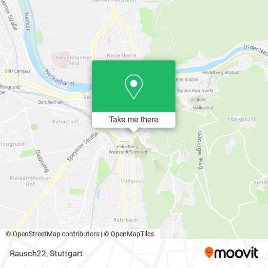
See Rausch22, Weststadt, on the map
Public Transit to Rausch22 in Weststadt
Wondering how to get to Rausch22 in Weststadt? Moovit helps you find the best way to get to Rausch22 with step-by-step directions from the nearest public transit station.
Moovit provides free maps and live directions to help you navigate through your city. View schedules, routes, timetables, and find out how long does it take to get to Rausch22 in real time.
Looking for the nearest stop or station to Rausch22? Check out this list of stops closest to your destination: Heidelberg; Heidelberg.
Bus: 28, 717, RNV 39, RNV 39A, RNV 1004.Train: S7, S8, S3.Light Rail: RNV 24, S1, S2.
Want to see if there’s another route that gets you there at an earlier time? Moovit helps you find alternative routes or times. Get directions from and directions to Rausch22 easily from the Moovit App or Website.
We make riding to Rausch22 easy, which is why over 1.5 million users, including users in Weststadt, trust Moovit as the best app for public transit. You don’t need to download an individual bus app or train app, Moovit is your all-in-one transit app that helps you find the best bus time or train time available.
For information on prices of bus, light rail and train, costs and ride fares to Rausch22, please check the Moovit app.
Use the app to navigate to popular places including to the airport, hospital, stadium, grocery store, mall, coffee shop, school, college, and university.
Rausch22 Address: Rohrbacher Straße 88 Weststadt, 69115 Heidelberg street in Weststadt
- Mother Earth Yoga,
- Bäckerei Riegler,
- Rauschzweizwei,
- Rausch Weinhandel und Tagesbar,
- Zwitscherstube,
- Gaisberg-Apotheke,
- Anatolien,
- Fethi Kirma,
- Turtle Beach Bungalows,
- Restaurant Löwenkeller,
- Löwenkeller,
- Jürgen Lipps Facharzt für Allgemeinmedizin Naturheilverfahren,
- Conrad-Bender-Haus,
- Betten OPEL,
- Krankengymnastik Schöller,
- Faktorgruen,
- Physiotherapie Wolf,
- Dr. Christine Herrmann-Flechtenmacher,
- Dr. med. Udo Heemann,
- Heidelberg Zahnmedizin
Places Near Rausch22 (Weststadt)
- Geilhaus Haus 33a, Reutlingen-Betzingen,
- Gleis 101/102 (tief), Stuttgart-Mitte,
- Mercedes-Benz Museum, Bad Cannstatt,
- Waldfriedhof, Degerloch,
- Klinikum Stuttgart - Katharinenhospital, Stuttgart-Mitte,
- Pariser Platz Stuttgart, Stuttgart-Mitte,
- Im Wizemann (Halle), Bad Cannstatt,
- Hanns-Martin-Schleyer-Halle, Bad Cannstatt,
- Porsche Museum, Zuffenhausen,
- FlixBus Haltestelle, Stuttgart,
- Mettingen Eros-Center Puff Laufhaus, Esslingen Am Neckar,
- Mercedes-Benz Museum (Mercedes Museum Stuttgart), Bad Cannstatt,
- Hauptbahnhof Stuttgart, Stuttgart-Mitte,
- Porsche-Arena, Bad Cannstatt,
- Hanns-Martin-Schleyer-Halle (Stuttgart Hans-Martin-Schleyerhalle), Bad Cannstatt,
- Gasometer Pforzheim, Pforzheim,
- SI-Centrum, Möhringen,
- Marmorsaal Im Weissenburgpark, Stuttgart-Süd,
- Wilhelma (U-Bahn Wilhelma), Bad Cannstatt,
- Schleyerhalle, Bad Cannstatt
How to get to popular places in Stuttgart with public transit
Get around Weststadt by public transit!
Traveling around Weststadt has never been so easy. See step by step directions as you travel to any attraction, street or major public transit station. View bus and train schedules, arrival times, service alerts and detailed routes on a map, so you know exactly how to get to anywhere in Weststadt.
When traveling to any destination around Weststadt use Moovit's Live Directions with Get Off Notifications to know exactly where and how far to walk, how long to wait for your line, and how many stops are left. Moovit will alert you when it's time to get off — no need to constantly re-check whether yours is the next stop.
Wondering how to use public transit in Weststadt or how to pay for public transit in Weststadt? Moovit public transit app can help you navigate your way with public transit easily, and at minimum cost. It includes public transit fees, ticket prices, and costs. Looking for a map of Weststadt public transit lines? Moovit public transit app shows all public transit maps in Weststadt with all Bus, Train, Subway, Light Rail, Ferry, S-Bahn and Funicular routes and stops on an interactive map.
Stuttgart has 7 transit type(s), including: Bus, Train, Subway, Light Rail, Ferry, S-Bahn and Funicular, operated by several transit agencies, including SSB - Stadtbahn, SSB, SSB - Seilbahn / Zacke, S-Bahn Stuttgart, Rhein-Neckar-Verkehr GmbH (rnv), Karlsruher Verkehrsverbund, DB AG, DB Regiobus BW, Arverio Baden-Württemberg GmbH, DB RegioNetz Verkehrs GmbH Westfrankenbahn, DB Regio AG Baden-Württemberg, Südwestdeutsche Verkehrs-AG, DB Regio AG Mitte Region Hessen, DB and Bodensee-Oberschwaben-Bahn