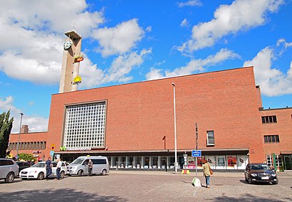
Directions to Rautatieasema E (Tampere) with public transportation
The following transit lines have routes that pass near Rautatieasema E
How to get to Rautatieasema E by bus?
Click on the bus route to see step by step directions with maps, line arrival times and updated time schedules.
Light Rail stations near Rautatieasema E in Tampere
- Rautatieasema B, 2 min walk,
Train stations near Rautatieasema E in Tampere
- Tampere, 2 min walk,
Bus stations near Rautatieasema E in Tampere
- Rautatieasema D, 3 min walk,
- Rongankatu 9, 5 min walk,
- Sorin Aukio E, 5 min walk,
- Koskipuisto C, 6 min walk,
- Sorin Aukio D, 6 min walk,
Bus lines to Rautatieasema E in Tampere
- 90, Keskustori,
- 90X, Kämmenniemi,
- 93, Mäntylä,
- 11, Pere,
- 12, Reuharinniemi,
- 13, Tays,
- 26, Höytämö,
- 29, Lamminpää,
- 103, Lentokenttä,
- 6, Vatiala,
- 42, Sorin Aukio,
- 2, Rauhaniemi - Särkänniemi,
- 4, Länsi-Hervanta - Keskustori - Tesoma - Lielahti,
- 5, Länsi-Hervanta - Vuores - Keskustori,
- 7, Tesoma - Kalkku - Keskustori - Hakametsä - Linnainmaa,
- 8, Kyösti - Pirkkala - Keskustori - Tesoma - Haukiluoma,
- 9, Annala - Keskustori - Lielahti - Lentävänniemi,
- 10, Kaukajärvi - Keskustori - Tahmela,
- 19, Hervanta - Rusko - Annala - Keskustori - Lentävänniemi,
- 31, Partola - Sarankulma - Keskustori,
What are the closest stations to Rautatieasema E?
The closest stations to Rautatieasema E are:
- Rautatieasema B is 90 meters away, 2 min walk.
- Tampere is 130 meters away, 2 min walk.
- Rautatieasema D is 149 meters away, 3 min walk.
- Rongankatu 9 is 310 meters away, 5 min walk.
- Sorin Aukio E is 328 meters away, 5 min walk.
- Koskipuisto C is 394 meters away, 6 min walk.
- Sorin Aukio D is 422 meters away, 6 min walk.
Which bus lines stop near Rautatieasema E?
These bus lines stop near Rautatieasema E: 12, 6, 7, 70Y, 8, 9.
Which light rail line stops near Rautatieasema E?
3
What’s the nearest light rail station to Rautatieasema E in Tampere?
The nearest light rail station to Rautatieasema E in Tampere is Rautatieasema B. It’s a 2 min walk away.
What’s the nearest train station to Rautatieasema E in Tampere?
The nearest train station to Rautatieasema E in Tampere is Tampere. It’s a 2 min walk away.
What’s the nearest bus stop to Rautatieasema E in Tampere?
The nearest bus stop to Rautatieasema E in Tampere is Rautatieasema D. It’s a 3 min walk away.
What time is the first light rail to Rautatieasema E in Tampere?
The 3 is the first light rail that goes to Rautatieasema E in Tampere. It stops nearby at 3:22 AM.
What time is the last light rail to Rautatieasema E in Tampere?
The 3 is the last light rail that goes to Rautatieasema E in Tampere. It stops nearby at 12:22 AM.
What time is the first bus to Rautatieasema E in Tampere?
The 6 is the first bus that goes to Rautatieasema E in Tampere. It stops nearby at 3:01 AM.
What time is the last bus to Rautatieasema E in Tampere?
The 103 is the last bus that goes to Rautatieasema E in Tampere. It stops nearby at 1:20 AM.
What time is the first train to Rautatieasema E in Tampere?
The TAMPERE-PORI is the first train that goes to Rautatieasema E in Tampere. It stops nearby at 8:37 AM.
What time is the last train to Rautatieasema E in Tampere?
The TAMPERE-PORI is the last train that goes to Rautatieasema E in Tampere. It stops nearby at 10:07 PM.
See Rautatieasema E, Tampere, on the map
Public Transit to Rautatieasema E in Tampere
Wondering how to get to Rautatieasema E in Tampere, Finland? Moovit helps you find the best way to get to Rautatieasema E with step-by-step directions from the nearest public transit station.
Moovit provides free maps and live directions to help you navigate through your city. View schedules, routes, timetables, and find out how long does it take to get to Rautatieasema E in real time.
Looking for the nearest stop or station to Rautatieasema E? Check out this list of stops closest to your destination: Rautatieasema B; Tampere; Rautatieasema D; Rongankatu 9; Sorin Aukio E; Koskipuisto C; Sorin Aukio D.
Bus: 12, 6, 7, 70Y, 8, 9, 90, 90X, 93, 11, 13, 26, 29, 42, 2, 4, 5, 27, 43U.Train: M.Light Rail: 3.
Want to see if there’s another route that gets you there at an earlier time? Moovit helps you find alternative routes or times. Get directions from and directions to Rautatieasema E easily from the Moovit App or Website.
We make riding to Rautatieasema E easy, which is why over 1.5 million users, including users in Tampere, trust Moovit as the best app for public transit. You don’t need to download an individual bus app or train app, Moovit is your all-in-one transit app that helps you find the best bus time or train time available.
For information on prices of bus and light rail, costs and ride fares to Rautatieasema E, please check the Moovit app.
Use the app to navigate to popular places including to the airport, hospital, stadium, grocery store, mall, coffee shop, school, college, and university.
Rautatieasema E Address: Rautatienkatu street in Tampere
Attractions near Rautatieasema E
Rautatieasema F,Bussipysäkki Rautatieasema F (0526),pikavuoropysäkki rautatieasema,Tampereen näkökeskus,Taksitolppa 6,Rautatieasema,Rautatienkadun parkkihalli,VR Pendolino S 94,Mr. Panini,Be Calm & Buzz On,Galaxie Center,apple store,Avainapteekki,Aurinko Tampere,Punnitse ja Säästä Rautatieasema,Taksi Tampere,Rautatieaseman parkkipaikka,Rautatieasema,Galaxie Center,Tampereen RautatieasemaHow to get to popular attractions in Tampere with public transit
Etelä-Hervannan Kotihoito, Tampere,Nuorten selviämisasema, Tampere,Leinola, Tampere,Hirvikallio, Tampere,Nokian Pingviini-jäätelökioski, Nokia,Pakkalankulman kenttä, Pirkkala,Vastavirta-klubi, Tampere,Laukontori, Tampere,Roninkärki, Kangasala,Oravapuisto, Tampere,Epilän roomalainen kylpylä (rauniot), Tampere,Ranta-Tampella, Tampere,Sorin Sirkus, Tampere,Koivistonkylän kotihoito, Tampere,Kierrätyskeskus Nekala, Tampere,TAYS Kuntosali, Tampere,Tampereen Yliopisto - Kaupin Kampus, Tampere,Fimlab Laboratoriot Oy Nokian laboratorio, Nokia,Tammerkosken Lukio, Tampere,Bullfarm Gym, TampereGet around Tampere by public transit!
Traveling around Tampere has never been so easy. See step by step directions as you travel to any attraction, street or major public transit station. View bus and train schedules, arrival times, service alerts and detailed routes on a map, so you know exactly how to get to anywhere in Tampere.
When traveling to any destination around Tampere use Moovit's Live Directions with Get Off Notifications to know exactly where and how far to walk, how long to wait for your line, and how many stops are left. Moovit will alert you when it's time to get off — no need to constantly re-check whether yours is the next stop.
Wondering how to use public transit in Tampere or how to pay for public transit in Tampere? Moovit public transit app can help you navigate your way with public transit easily, and at minimum cost. It includes public transit fees, ticket prices, and costs. Looking for a map of Tampere public transit lines? Moovit public transit app shows all public transit maps in Tampere with all Bus, Train and Light Rail routes and stops on an interactive map.
Tampere has 3 transit type(s), including: Bus, Train and Light Rail, operated by several transit agencies, including Nysse, Sastamalan paikallisliikenne, VR