Directions to Rayanny Silva (Ramos) with public transportation
The following transit lines have routes that pass near Rayanny Silva
 Bus: 483, 489L, 497, 630, 906.
- Train: RAMAL SARACURUNA.
- Funicular: IGREJA DA PENHA.
How to get to Rayanny Silva by bus?
Click on the bus route to see step by step directions with maps, line arrival times and updated time schedules.
From Doutor Laureano, Duque De Caxias
41 minFrom MetrôRio-São Cristóvão (Estação de Metrô São Cristóvão), Imperial De São Cristóvão
39 minFrom Rua do Ouvidor, Centro
45 minFrom Maracanãzinho, Maracanã
39 minFrom Rua Andre Cavalcanti, 28., Centro
48 minFrom Parque Lafaiete, Duque De Caxias
44 minFrom TRT-RJ Gomes Freire, Lapa
48 minFrom Centro, Centro
40 minFrom Linha 667 - Madureira / Méier, Encantado
59 minFrom Avenida Maracanã 987, Tijuca
45 min
How to get to Rayanny Silva by train?
Click on the train route to see step by step directions with maps, line arrival times and updated time schedules.
From Doutor Laureano, Duque De Caxias
55 minFrom MetrôRio-São Cristóvão (Estação de Metrô São Cristóvão), Imperial De São Cristóvão
31 minFrom Rua do Ouvidor, Centro
57 minFrom Maracanãzinho, Maracanã
36 minFrom Rua Andre Cavalcanti, 28., Centro
55 minFrom Parque Lafaiete, Duque De Caxias
56 minFrom TRT-RJ Gomes Freire, Lapa
53 minFrom Centro, Centro
39 minFrom Linha 667 - Madureira / Méier, Encantado
45 minFrom Avenida Maracanã 987, Tijuca
49 min
Bus stops near Rayanny Silva in Ramos
Train station near Rayanny Silva in Ramos
- Ramos, 11 min walk,VIEW
Funicular station near Rayanny Silva in Ramos
- Estação 4, 16 min walk,VIEW
Bus lines to Rayanny Silva in Ramos
- 940, Ramos,VIEW
- 448C, Central,VIEW
- 910, Bananal,VIEW
- 718D, Madureira,VIEW
- 350, Irajá - Castelo (Brs 4 - Via Praça das Nações),VIEW
- 483, Penha - Ipanema (Brs 3 - Via Bonsucesso / Expressa / Aterro),VIEW
- SN 483, Penha - Ipanema (Brs 3 - Via Central / Praia do Flamengo),VIEW
- 486L, Bar dos Cavaleiros - Largo da Cancela (Via Praça das Nações),VIEW
- 489L, Caxias - Saens Peña (Via Praça das Nações),VIEW
- 497, Penha - Largo do Machado (Brs 3 - Via Lapa / Laranjeiras),VIEW
- 498, Circular da Penha - Largo do Machado (Brs 3 - Via Túnel Santa Bárbara),VIEW
- 630, Iapi da Penha - Saens Peña (Brs 6 - Via Bonsucesso / Benfica),VIEW
- 905, Bonsucesso - Irajá (Via Brás de Pina),VIEW
- 906, Jardim América - Caju (Via Bonsucesso - Circular),VIEW
- 928, Marechal Hermes - Bonsucesso (Via Penha),VIEW
- 901, Bananal - Bonsucesso (via Ribeira / Jardim Guanabara),VIEW
- 915, Aeroporto ✈ - Bonsucesso (via Área de Apoio),VIEW
What are the closest stations to Rayanny Silva?
The closest stations to Rayanny Silva are:
- Rua Nossa Senhora Das Graças, 943-1039 is 136 meters away, 2 min walk.
- Rua Nossa Senhora Das Graças, 998 is 156 meters away, 3 min walk.
- R. Barreiros 597-657 - Ramos Rio De Janeiro is 387 meters away, 5 min walk.
- Rua Barreiros, 598-652 is 397 meters away, 6 min walk.
- Rua Barreiros, 450 is 512 meters away, 7 min walk.
- Ramos is 823 meters away, 11 min walk.
- Estação 4 is 1210 meters away, 16 min walk.
Which bus lines stop near Rayanny Silva?
These bus lines stop near Rayanny Silva: 483, 489L, 497, 630, 906, 940.
Which train line stops near Rayanny Silva?
RAMAL SARACURUNA (Gramacho)
What’s the nearest train station to Rayanny Silva in Ramos?
The nearest train station to Rayanny Silva in Ramos is Ramos. It’s a 11 min walk away.
What’s the nearest bus station to Rayanny Silva in Ramos?
The nearest bus station to Rayanny Silva in Ramos is Rua Nossa Senhora Das Graças, 943-1039. It’s a 2 min walk away.
What’s the nearest funicular station to Rayanny Silva in Ramos?
The nearest funicular station to Rayanny Silva in Ramos is Estação 4. It’s a 16 min walk away.
What time is the first train to Rayanny Silva in Ramos?
The RAMAL SARACURUNA is the first train that goes to Rayanny Silva in Ramos. It stops nearby at 4:50 AM.
What time is the last train to Rayanny Silva in Ramos?
The RAMAL SARACURUNA is the last train that goes to Rayanny Silva in Ramos. It stops nearby at 10:56 PM.
What time is the first bus to Rayanny Silva in Ramos?
The 483 is the first bus that goes to Rayanny Silva in Ramos. It stops nearby at 3:16 AM.
What time is the last bus to Rayanny Silva in Ramos?
The 483 is the last bus that goes to Rayanny Silva in Ramos. It stops nearby at 3:48 AM.
What time is the first funicular to Rayanny Silva in Ramos?
The IGREJA DA PENHA is the first funicular that goes to Rayanny Silva in Ramos. It stops nearby at 7:00 AM.
What time is the last funicular to Rayanny Silva in Ramos?
The IGREJA DA PENHA is the last funicular that goes to Rayanny Silva in Ramos. It stops nearby at 6:00 PM.
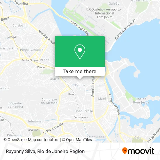
See Rayanny Silva, Ramos, on the map
Public Transit to Rayanny Silva in Ramos
Wondering how to get to Rayanny Silva in Ramos? Moovit helps you find the best way to get to Rayanny Silva with step-by-step directions from the nearest public transit station.
Moovit provides free maps and live directions to help you navigate through your city. View schedules, routes, timetables, and find out how long does it take to get to Rayanny Silva in real time.
Looking for the nearest stop or station to Rayanny Silva? Check out this list of stops closest to your destination: Rua Nossa Senhora Das Graças; Rua Nossa Senhora Das Graças; R. Barreiros 597-657 - Ramos Rio De Janeiro; Rua Barreiros; Rua Barreiros; Ramos; Estação 4.
Bus: 483, 489L, 497, 630, 906, 940, 448C, 910, 718D, 350, SN 483, 486L.Train: RAMAL SARACURUNA.Funicular: IGREJA DA PENHA.
Want to see if there’s another route that gets you there at an earlier time? Moovit helps you find alternative routes or times. Get directions from and directions to Rayanny Silva easily from the Moovit App or Website.
We make riding to Rayanny Silva easy, which is why over 1.5 million users, including users in Ramos, trust Moovit as the best app for public transit. You don’t need to download an individual bus app or train app, Moovit is your all-in-one transit app that helps you find the best bus time or train time available.
For information on prices of bus and train, costs and ride fares to Rayanny Silva, please check the Moovit app.
Use the app to navigate to popular places including to the airport, hospital, stadium, grocery store, mall, coffee shop, school, college, and university.
Rayanny Silva Address: Rua Nossa Senhora das Graças, 821 Ramos Rio de Janeiro-RJ 21031-611 street in Ramos
- Tesfa,
- Rua Carvalho Moutinho, 200,
- Casa Lotérica Barreiros da Sorte,
- Elicea Comercio e Representacoes Limitada.,
- Rufolo Empresa de Serviços Técnicos e Construções,
- Escola Municipal Edmundo Lins,
- Rua Nabor Do Rego,
- Igreja Nossa Senhora Da Conceição,
- Van (910) Vila Kosmos - Bananal,
- Rua Zacarias de Queiroz,
- Rua Barreiros,
- José Alexandre Galiaco Roiz,
- Rua Nossa Senhora das Graças, 1032,
- Dtx Comercio e Servicos,
- Rua Araguari 197,
- Rua Souza Lôbo 46,
- Naturativa Farmácia de Manipulação,
- Carol Brindes Personalizados,
- Carga e Descarga Caio e Matheus,
- Caribean Queen Termas
Places Near Rayanny Silva (Ramos)
- Feira Livre da Gloria, Glória,
- Shopping Nova América, Del Castilho,
- Hospital Federal Do Andaraí, Andaraí,
- Hospital Federal Cardoso Fontes, Jacarepaguá,
- Norte Shopping, Cachambi,
- Rua Ulysses Guimarães 16, Cidade Nova,
- Museu Do Amanhã, Centro,
- Rodoviária Novo Rio (Rodoviária do Rio de Janeiro), Santo Cristo,
- Hospital Municipal Ronaldo Gazolla, Acari,
- Praia do Arpoador, Ipanema,
- Hospital Pedro Ernesto, Vila Isabel,
- Shopping Downtown, Barra Da Tijuca,
- Rua Licínio Cardoso, São Francisco Xavier,
- Feirão De Malhas, Duque De Caxias,
- Niterói, Niterói,
- Avenida Venezuela 134, Saúde,
- Shopping Rio Sul, Botafogo,
- Shopping RioSul, Botafogo,
- Avenida Rio Branco, Centro,
- Rio De Janeiro
How to get to popular places in Rio de Janeiro Region with public transit
Get around Ramos by public transit!
Traveling around Ramos has never been so easy. See step by step directions as you travel to any attraction, street or major public transit station. View bus and train schedules, arrival times, service alerts and detailed routes on a map, so you know exactly how to get to anywhere in Ramos.
When traveling to any destination around Ramos use Moovit's Live Directions with Get Off Notifications to know exactly where and how far to walk, how long to wait for your line, and how many stops are left. Moovit will alert you when it's time to get off — no need to constantly re-check whether yours is the next stop.
Wondering how to use public transit in Ramos or how to pay for public transit in Ramos? Moovit public transit app can help you navigate your way with public transit easily, and at minimum cost. It includes public transit fees, ticket prices, and costs. Looking for a map of Ramos public transit lines? Moovit public transit app shows all public transit maps in Ramos with all Bus, Train, Metro, Light Rail, Ferry, Cable Car, Gondola and Funicular routes and stops on an interactive map.
Rio de Janeiro Region has 8 transit type(s), including: Bus, Train, Metro, Light Rail, Ferry, Cable Car, Gondola and Funicular, operated by several transit agencies, including TrensRJ, Metrô Rio, VLT Carioca, Barcas Rio, BRT MOBI-Rio, Auto Viação Alpha, Auto Viação Tijuca, Gire Transportes, Transurb, Viação Nossa Senhora das Graças, Consórcio INTERSUL, Braso Lisboa (Municipal), Caprichosa Auto Ônibus, Auto Viação Três Amigos and Rodoviária Âncora Matias