How to get to Rayburn Train by bus?
Click on the bus route to see step by step directions with maps, line arrival times and updated time schedules.
From FSI, Arlington County
85 minFrom Punch Bowl Social, Arlington County
73 minFrom Alfred Street Baptist Church, Alexandria
67 minFrom Tanger Outlets, Prince George's County
63 minFrom Fannie Mae, Washington
58 minFrom King St Metro - Kiss And Ride Lot, Alexandria
73 minFrom Riverdale, MD, Prince George's County
86 minFrom Sibley Memorial Hospital, Washington
69 minFrom Holiday Inn National Airport/Crystal City, Arlington County
67 minFrom Embassy Suites-Alexandria Old Town, Alexandria
74 min
How to get to Rayburn Train by train?
Click on the train route to see step by step directions with maps, line arrival times and updated time schedules.
How to get to Rayburn Train by metro?
Click on the metro route to see step by step directions with maps, line arrival times and updated time schedules.
From Punch Bowl Social, Arlington County
37 minFrom Alfred Street Baptist Church, Alexandria
54 minFrom Fannie Mae, Washington
45 minFrom King St Metro - Kiss And Ride Lot, Alexandria
32 minFrom Holiday Inn National Airport/Crystal City, Arlington County
36 minFrom Embassy Suites-Alexandria Old Town, Alexandria
33 min
Bus stops near Rayburn Train in Washington
Metro stations near Rayburn Train in Washington
Bus lines to Rayburn Train in Washington
- 230, 230/8 Severna Park,VIEW
- 250, 250/4 Washington Dc,VIEW
- D10, West To Foggy Bottom,VIEW
- 305, 305/6 Columbia,VIEW
- 325, 325/6 Columbia,VIEW
- 335, 335/1 Washington Dc,VIEW
- 345, 345/2 Washington Dc,VIEW
- 630, 630/10 La Plata,VIEW
- 725, 725/4 California,VIEW
- 810, 810/2 Washington Dc,VIEW
- 820, 820/2 Washington Dc,VIEW
- 830, 830/3 Washington Dc,VIEW
- 840, 840/7 Prince Frederick / St Leonard,VIEW
- D1X, East To Naylor Rd,VIEW
- 315, 315/1 Washington Dc,VIEW
- 735, 735/4 Washington Dc,VIEW
- 850, 850/2 Suitland / Washington Dc,VIEW
What are the closest stations to Rayburn Train?
The closest stations to Rayburn Train are:
- Independence Ave & New Jersey Ave SE Eb is 194 yards away, 4 min walk.
- Independence Av Se+New Jersey Av SE is 194 yards away, 4 min walk.
- Capital South is 489 yards away, 7 min walk.
- Independence Ave & 1st St SE Wb is 498 yards away, 7 min walk.
- Independence Av Se+1 St SE is 499 yards away, 7 min walk.
- Independence Ave & 4th & 3rd St SW Eb is 611 yards away, 9 min walk.
- 4th St & C St SW Nb is 682 yards away, 9 min walk.
- Judiciary Square is 689 yards away, 9 min walk.
- L'Enfant Plaza is 1130 yards away, 15 min walk.
Which bus lines stop near Rayburn Train?
These bus lines stop near Rayburn Train: 612-WAR, D10, D24.
Which train lines stop near Rayburn Train?
These train lines stop near Rayburn Train: MARC, NORTHEAST REGIONAL.
Which metro lines stop near Rayburn Train?
These metro lines stop near Rayburn Train: BLUE, ORANGE, SILVER.
What’s the nearest metro station to Rayburn Train in Washington?
The nearest metro station to Rayburn Train in Washington is Capital South. It’s a 7 min walk away.
What’s the nearest bus station to Rayburn Train in Washington?
The nearest bus stations to Rayburn Train in Washington are Independence Ave & New Jersey Ave SE Eb and Independence Av Se+New Jersey Av SE. The closest one is a 4 min walk away.
What time is the first metro to Rayburn Train in Washington?
The BLUE is the first metro that goes to Rayburn Train in Washington. It stops nearby at 5:14 AM.
What time is the last metro to Rayburn Train in Washington?
The GREEN is the last metro that goes to Rayburn Train in Washington. It stops nearby at 12:18 AM.
What time is the first train to Rayburn Train in Washington?
The MANASSAS LINE is the first train that goes to Rayburn Train in Washington. It stops nearby at 6:12 AM.
What time is the last train to Rayburn Train in Washington?
The MANASSAS LINE is the last train that goes to Rayburn Train in Washington. It stops nearby at 7:08 PM.
What time is the first bus to Rayburn Train in Washington?
The D10 is the first bus that goes to Rayburn Train in Washington. It stops nearby at 3:02 AM.
What time is the last bus to Rayburn Train in Washington?
The D10 is the last bus that goes to Rayburn Train in Washington. It stops nearby at 3:14 AM.
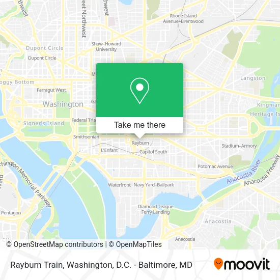
See Rayburn Train, Washington, on the map
Public Transit to Rayburn Train in Washington
Wondering how to get to Rayburn Train in Washington? Moovit helps you find the best way to get to Rayburn Train with step-by-step directions from the nearest public transit station.
Moovit provides free maps and live directions to help you navigate through your city. View schedules, routes, timetables, and find out how long does it take to get to Rayburn Train in real time.
Looking for the nearest stop or station to Rayburn Train? Check out this list of stops closest to your destination: Independence Ave & New Jersey Ave SE Eb; Independence Av Se+New Jersey Av SE; Capital South; Independence Ave & 1st St SE Wb; Independence Av Se+1 St SE; Independence Ave & 4th & 3rd St SW Eb; 4th St & C St SW Nb; Judiciary Square; L'Enfant Plaza.
Bus: 612-WAR, D10, D24, 230, 250, D1X.Train: MARC, NORTHEAST REGIONAL.Metro: BLUE, ORANGE, SILVER, RED, GREEN, YELLOW, FREDERICKSBURG LINE, MANASSAS LINE.
Want to see if there’s another route that gets you there at an earlier time? Moovit helps you find alternative routes or times. Get directions from and directions to Rayburn Train easily from the Moovit App or Website.
We make riding to Rayburn Train easy, which is why over 1.5 million users, including users in Washington, trust Moovit as the best app for public transit. You don’t need to download an individual bus app or train app, Moovit is your all-in-one transit app that helps you find the best bus time or train time available.
For information on prices of bus, metro and train, costs and ride fares to Rayburn Train, please check the Moovit app.
Use the app to navigate to popular places including to the airport, hospital, stadium, grocery store, mall, coffee shop, school, college, and university.
Rayburn Train Address: Rayburn House Office Building street in Washington
- Rayburn House Office Building,
- Rayburn Foyer,
- Rayburn Cafeteria,
- Rayburn House Staff Fitness Center,
- Dunkin Donuts - Longworth,
- Longworth House Office Building,
- Bartholdi Fountain,
- The Porch @ Speaker's Balcony,
- American Veterans Disabled for Life Memorial,
- United States Botanic Garden,
- Botanical Gardens,
- O'Neill House Office Building,
- 174,
- H-140 The Capitol,
- U.S. Botanic Garden,
- U.S. Capitol - West Terrace,
- DNC downtown office,
- 2nd St SW & D St SW,
- A Capitol Fourth,
- Patient Portal Account (The Jordan's Place Pediatrics Patient Portal)
Places Near Rayburn Train (Washington)
- Sibley Memorial Hospital, Washington,
- Museum Of The Bible, Washington,
- PG Mall, Prince George's County,
- Amazon Hq2, Arlington County,
- Camden Yards, Baltimore,
- National Museum of African American History and Culture, Washington,
- Washington DC VA Medical Center, Washington,
- Capital One Arena, Washington,
- Georgetown, Washington,
- National Mall, Washington,
- Marriott Marquis Washington, DC, Washington,
- Westfield Montgomery Mall, Montgomery County,
- Basilica of the National Shrine, Washington,
- The Anthem, Washington,
- National Zoo, Washington,
- Rock Creek Tennis Center, Washington,
- Pennsylvania Ave NW (3rd st and pennsylvania), Washington,
- Warner Theatre, Washington,
- Washington National Cathedral, Washington,
- M&T Bank Stadium, Baltimore
How to get to popular places in Washington, D.C. - Baltimore, MD with public transit
Get around Washington by public transit!
Traveling around Washington has never been so easy. See step by step directions as you travel to any attraction, street or major public transit station. View bus and train schedules, arrival times, service alerts and detailed routes on a map, so you know exactly how to get to anywhere in Washington.
When traveling to any destination around Washington use Moovit's Live Directions with Get Off Notifications to know exactly where and how far to walk, how long to wait for your line, and how many stops are left. Moovit will alert you when it's time to get off — no need to constantly re-check whether yours is the next stop.
Wondering how to use public transit in Washington or how to pay for public transit in Washington? Moovit public transit app can help you navigate your way with public transit easily, and at minimum cost. It includes public transit fees, ticket prices, and costs. Looking for a map of Washington public transit lines? Moovit public transit app shows all public transit maps in Washington with all Bus, Train, Metro, Light Rail and Ferry routes and stops on an interactive map.
Washington, D.C. - Baltimore, MD has 5 transit type(s), including: Bus, Train, Metro, Light Rail and Ferry, operated by several transit agencies, including WMATA, Montgomery County Ride On, Fairfax Connector, TheBus, PRTC, DASH - Alexandria, Arlington Transit (ART), RTA of Central Maryland, MDOT MTA, MDOT MTA Light RailLink, MDOT MTA Commuter Bus, MDOT MTA Local Bus, FXBGO!, Virginia Railway Express (VRE) and MARC