How to get to Raymond's Home by bus?
Click on the bus route to see step by step directions with maps, line arrival times and updated time schedules.
From Agganis Arena, Boston
46 minFrom Harvard Stadium, Boston
49 minFrom COURTYARD-Boston Cambridge (Cambridge Marriott), Cambridge
57 minFrom Christian A Herter Park, Boston
47 minFrom Brighton District Court, Boston
36 minFrom Allston, Boston
45 minFrom Harvard Square, Cambridge
66 minFrom Prometric Testing Center, Boston
46 minFrom Micro Center (Micro Elecronics), Cambridge
59 minFrom Watertown Mall, Watertown Town
36 min
How to get to Raymond's Home by train?
Click on the train route to see step by step directions with maps, line arrival times and updated time schedules.
Bus stops near Raymond's Home in Waltham
Train station near Raymond's Home in Waltham
- Newtonville, 23 min walk,VIEW
Bus lines to Raymond's Home in Waltham
What are the closest stations to Raymond's Home?
The closest stations to Raymond's Home are:
- Moody St @ Main St is 155 yards away, 3 min walk.
- Moody St @ Pine St is 319 yards away, 4 min walk.
- Waltham is 347 yards away, 6 min walk.
- Carter St @ Waltham Comm Rail Sta is 400 yards away, 5 min walk.
- Newtonville is 1889 yards away, 23 min walk.
Which bus lines stop near Raymond's Home?
These bus lines stop near Raymond's Home: 558, 70.
Which train lines stop near Raymond's Home?
These train lines stop near Raymond's Home: FITCHBURG, FRAMINGHAM/WORCESTER.
What’s the nearest train station to Raymond's Home in Waltham?
The nearest train station to Raymond's Home in Waltham is Newtonville. It’s a 23 min walk away.
What’s the nearest bus station to Raymond's Home in Waltham?
The nearest bus station to Raymond's Home in Waltham is Moody St @ Main St. It’s a 3 min walk away.
What time is the first train to Raymond's Home in Waltham?
The FRAMINGHAM/WORCESTER is the first train that goes to Raymond's Home in Waltham. It stops nearby at 5:19 AM.
What time is the last train to Raymond's Home in Waltham?
The FRAMINGHAM/WORCESTER is the last train that goes to Raymond's Home in Waltham. It stops nearby at 12:22 AM.
What time is the first bus to Raymond's Home in Waltham?
The 70 is the first bus that goes to Raymond's Home in Waltham. It stops nearby at 4:53 AM.
What time is the last bus to Raymond's Home in Waltham?
The 70 is the last bus that goes to Raymond's Home in Waltham. It stops nearby at 12:40 AM.
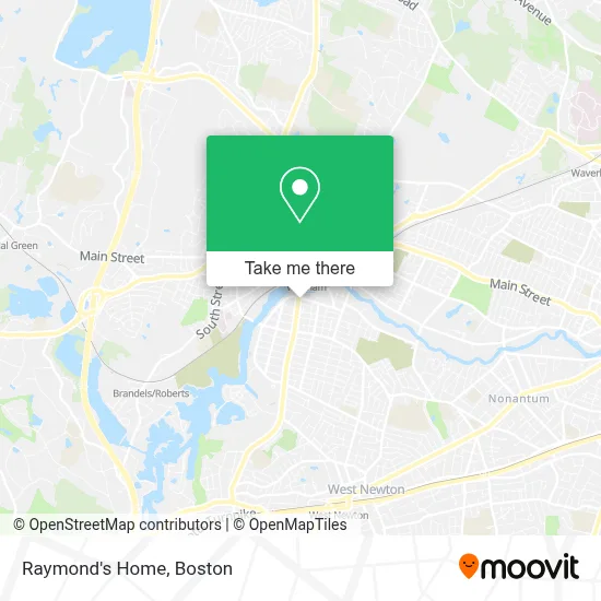
See Raymond's Home, Waltham, on the map
Public Transit to Raymond's Home in Waltham
Wondering how to get to Raymond's Home in Waltham? Moovit helps you find the best way to get to Raymond's Home with step-by-step directions from the nearest public transit station.
Moovit provides free maps and live directions to help you navigate through your city. View schedules, routes, timetables, and find out how long does it take to get to Raymond's Home in real time.
Looking for the nearest stop or station to Raymond's Home? Check out this list of stops closest to your destination: Moody St @ Main St; Moody St @ Pine St; Waltham; Carter St @ Waltham Comm Rail Sta; Newtonville.
Bus: 558, 70, 61, 505, 553, 554, 556, W1, FITCHBURG LINE SHUTTLE, FITCHBURG.Train: FITCHBURG, FRAMINGHAM/WORCESTER.
Want to see if there’s another route that gets you there at an earlier time? Moovit helps you find alternative routes or times. Get directions from and directions to Raymond's Home easily from the Moovit App or Website.
We make riding to Raymond's Home easy, which is why over 1.7 million users, including users in Waltham, trust Moovit as the best app for public transit. You don’t need to download an individual bus app or train app, Moovit is your all-in-one transit app that helps you find the best bus time or train time available.
For information on prices of bus, train and subway, costs and ride fares to Raymond's Home, please check the Moovit app.
Use the app to navigate to popular places including to the airport, hospital, stadium, grocery store, mall, coffee shop, school, college, and university.
Raymond's Home Address: 280 Moody St street in Waltham
- Mehandi by Mahi,
- A & A Discount Locksmith 24/7,
- Bodywork+,
- G Enterprises,
- Lifestyles Bargain Basement Outlet,
- Blaine the Beauty Career Schools,
- Dominion Assemblies International Ministries,
- Total Wireless,
- Boston Rhythmic,
- Mesotherapy and Biorevitalization,
- Iguana Catina Licensing,
- Multicultural Neurobehavioral Rehabilitation Center,
- Senior Solutions,
- Moody Street Historic District,
- Vls Livery Service,
- Succor Primary Care,
- KUMON,
- Plumbing & Heating,
- A.Noel Master Electrician,
- Phantom Gourmet Food Festival 2021
Places Near Raymond's Home (Waltham)
- Wang Theater, Boston,
- Isabella Stewart Gardner Museum, Boston,
- Leader Bank Pavilion (Leader Bank Pavillion), Boston,
- North End, Boston,
- Castle Island, Boston,
- Quincy Market, Boston,
- Boston Common, Boston,
- Boston Children's Hospital, Boston,
- Prudential Center, Boston,
- Faneuil Hall, Boston,
- Seaport District, Boston,
- House Of Blues, Boston,
- Boston Medical Center, Boston,
- Museum Of Science, Boston,
- Cheers, Boston,
- Mgm Music Hall, Boston,
- Boston Convention & Exhibition Center, Boston,
- Wilbur Theatre, Boston,
- Td Garden, Boston,
- Massachusetts General Hospital, Boston
How to get to popular places in Boston with public transit
Get around Waltham by public transit!
Traveling around Waltham has never been so easy. See step by step directions as you travel to any attraction, street or major public transit station. View bus and train schedules, arrival times, service alerts and detailed routes on a map, so you know exactly how to get to anywhere in Waltham.
When traveling to any destination around Waltham use Moovit's Live Directions with Get Off Notifications to know exactly where and how far to walk, how long to wait for your line, and how many stops are left. Moovit will alert you when it's time to get off — no need to constantly re-check whether yours is the next stop.
Wondering how to use public transit in Waltham or how to pay for public transit in Waltham? Moovit public transit app can help you navigate your way with public transit easily, and at minimum cost. It includes public transit fees, ticket prices, and costs. Looking for a map of Waltham public transit lines? Moovit public transit app shows all public transit maps in Waltham with all Bus, Train, Subway and Ferry routes and stops on an interactive map.
Boston has 4 transit type(s), including: Bus, Train, Subway and Ferry, operated by several transit agencies, including MBTA, Southeastern Regional Transit Authority, MetroWest Regional Transit Authority, Rhode Island Public Transit Authority, WRTA, Lowell Regional Transit Authority, Merrimack Valley Transit, Montachusett Regional Transit Authority, Cape Cod Regional Transit Authority, Brockton Area Transit Authority, Martha's Vineyard Transit Authority, the WAVE - Nantucket Regional Transit Authority, GATRA, Cape Ann Transportation Authority and Massport