How to get to Rb Europa by bus?
Click on the bus route to see step by step directions with maps, line arrival times and updated time schedules.
From Perales Del Río, Área Metropolitana De Madrid Y Corredor Del Henares
63 minFrom Calle de los Angeles 9, Fuenlabrada
60 minFrom CIUDAD DEL AUTOMOVIL, Leganés
77 minFrom La Cubierta de Leganés, Leganés
69 minFrom Calle Laguna Dalga, Madrid
67 minFrom Ciudad Del Automóvil De Leganés, Leganés
76 minFrom Avenida de las Arcas del Agua, Getafe
61 minFrom Hospital Infanta Cristina., Área Metropolitana De Madrid Y Corredor Del Henares
47 minFrom Centro Comercial PARQUESUR, Leganés
86 minFrom Fuenlabrada-Madrid, Fuenlabrada
73 min
How to get to Rb Europa by train?
Click on the train route to see step by step directions with maps, line arrival times and updated time schedules.
From Calle de los Angeles 9, Fuenlabrada
76 minFrom La Cubierta de Leganés, Leganés
75 minFrom Calle Laguna Dalga, Madrid
38 minFrom Ciudad Del Automóvil De Leganés, Leganés
77 minFrom Avenida de las Arcas del Agua, Getafe
69 minFrom Fuenlabrada-Madrid, Fuenlabrada
62 minFrom Centro Comercial PARQUESUR, Leganés
72 min
Bus stops near Rb Europa in Pinto
Bus lines to Rb Europa in Pinto
- 1A, Circular Pinto,VIEW
- 1B, Circular Pinto,VIEW
- 421, Madrid (Legazpi) - Pinto,VIEW
- 428, Getafe - Valdemoro,VIEW
- 471, Humanes - Fuenlabrada - Parla - Pinto,VIEW
- N401, Madrid (Atocha) - Pinto - Valdemoro,VIEW
- 455, Av. Libertad - Hospital De Getafe,VIEW
- 412, Parque De Ocio,VIEW
- 413, Av. Alcalde A. Chapado - El Quiñón,VIEW
- 414, Av. Andalucía - Villaverde Bajo Cruce,VIEW
- 426, Urbanización Parque Olimpia - Av. Belén,VIEW
- N403, Av. Alcalde A. Chapado - París,VIEW
- VAC231, Seseña (Urb. Quiñón),VIEW
- VAC-231, La Puebla De Almoradiel,VIEW
- 423, Estación Sur De Autobuses,VIEW
- C3, Pinto,VIEW
- C3, Madrid-Villaverde Bajo,VIEW
What are the closest stations to Rb Europa?
The closest stations to Rb Europa are:
- Alpujarras - C. C. Plaza Éboli is 221 meters away, 3 min walk.
- Cataluña - Aragón is 387 meters away, 6 min walk.
- Av. España - Molino is 407 meters away, 6 min walk.
- Pinto - Guardia Civil is 559 meters away, 8 min walk.
- Ctra. A-4 - Ctra. M-841 is 1048 meters away, 14 min walk.
- Pinto is 2388 meters away, 31 min walk.
Which bus lines stop near Rb Europa?
These bus lines stop near Rb Europa: 421, 428, 471.
Which train line stops near Rb Europa?
C3 (Aranjuez)
What’s the nearest bus station to Rb Europa in Pinto?
The nearest bus station to Rb Europa in Pinto is Alpujarras - C. C. Plaza Éboli. It’s a 3 min walk away.
What time is the first train to Rb Europa in Pinto?
The C3 is the first train that goes to Rb Europa in Pinto. It stops nearby at 5:34 AM.
What time is the last train to Rb Europa in Pinto?
The C3 is the last train that goes to Rb Europa in Pinto. It stops nearby at 12:15 AM.
What time is the first bus to Rb Europa in Pinto?
The N401 is the first bus that goes to Rb Europa in Pinto. It stops nearby at 3:10 AM.
What time is the last bus to Rb Europa in Pinto?
The N401 is the last bus that goes to Rb Europa in Pinto. It stops nearby at 2:55 AM.
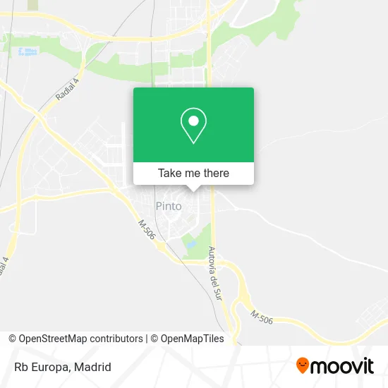
See Rb Europa, Pinto, on the map
Public Transit to Rb Europa in Pinto
Wondering how to get to Rb Europa in Pinto? Moovit helps you find the best way to get to Rb Europa with step-by-step directions from the nearest public transit station.
Moovit provides free maps and live directions to help you navigate through your city. View schedules, routes, timetables, and find out how long does it take to get to Rb Europa in real time.
Looking for the nearest stop or station to Rb Europa? Check out this list of stops closest to your destination: Alpujarras - C. C. Plaza Éboli; Cataluña - Aragón; Av. España - Molino; Pinto - Guardia Civil; Ctra. A-4 - Ctra. M-841; Pinto.
Bus: 421, 428, 471, 1A, 1B, N401, 455, 412, 413, 414, 426, N403, 423.Train: C3.
Want to see if there’s another route that gets you there at an earlier time? Moovit helps you find alternative routes or times. Get directions from and directions to Rb Europa easily from the Moovit App or Website.
We make riding to Rb Europa easy, which is why over 1.5 million users, including users in Pinto, trust Moovit as the best app for public transit. You don’t need to download an individual bus app or train app, Moovit is your all-in-one transit app that helps you find the best bus time or train time available.
For information on prices of train, bus and metro, costs and ride fares to Rb Europa, please check the Moovit app.
Use the app to navigate to popular places including to the airport, hospital, stadium, grocery store, mall, coffee shop, school, college, and university.
Rb Europa Address: Calle San Juan, 18 28320 Pinto street in Pinto
- Restaurante Doñana,
- Calle San Juan, 18,
- Constructora de Pinto - Grupo Egido,
- Calle de Cádiz 28,
- Calle de San Francisco de Asís 13,
- Plaza Asunción / Calle Alfaro,
- Liberbank,
- Únicaja,
- Sainero Fernández, antonio,
- Barrio Los Umbrales de Pinto,
- Quiromasaje y Osteopatia,
- Egido Villa De Pinto Hotel,
- Kiosco de Prensa Egido,
- Calle del Barco 10,
- Calle Alfaro,
- Germán Martín Carrera,
- Acc Instalaciones Electricas,
- Caral Ocio,
- Bankia Caixabank,
- Dimsport Madrid
Places Near Rb Europa (Pinto)
- Centro Comercial Islazul, Área Metropolitana De Madrid Y Corredor Del Henares,
- Estadio Wanda Metropolitano, Área Metropolitana De Madrid Y Corredor Del Henares,
- Palacio De Vistalegre, Área Metropolitana De Madrid Y Corredor Del Henares,
- Mendez Alvaro, Madrid,
- Sala La Riviera, Madrid,
- Hospital Universitario La Paz, Madrid,
- Estacion de Chamartin, Madrid,
- Plaza Mayor, Madrid,
- Hospital Universitario Ramón y Cajal, Madrid,
- Nassica, Área Metropolitana De Madrid Y Corredor Del Henares,
- Calle de López de Hoyos 169, Madrid,
- Tres Aguas, Alcorcón,
- Mercadillo de Majadahonda, Majadahonda,
- Hospital Clínico Universitario San Carlos, Madrid,
- Rastro De Madrid, Área Metropolitana De Madrid Y Corredor Del Henares,
- Centro Comercial La Gavia, Área Metropolitana De Madrid Y Corredor Del Henares,
- Plenilunio, Área Metropolitana De Madrid Y Corredor Del Henares,
- Centro Comercial La Vaguada, Área Metropolitana De Madrid Y Corredor Del Henares,
- Centro Comercial Oasiz Madrid, Área Metropolitana De Madrid Y Corredor Del Henares,
- Wizink Center, Madrid
How to get to popular places in Madrid with public transit
Get around Pinto by public transit!
Traveling around Pinto has never been so easy. See step by step directions as you travel to any attraction, street or major public transit station. View bus and train schedules, arrival times, service alerts and detailed routes on a map, so you know exactly how to get to anywhere in Pinto.
When traveling to any destination around Pinto use Moovit's Live Directions with Get Off Notifications to know exactly where and how far to walk, how long to wait for your line, and how many stops are left. Moovit will alert you when it's time to get off — no need to constantly re-check whether yours is the next stop.
Wondering how to use public transit in Pinto or how to pay for public transit in Pinto? Moovit public transit app can help you navigate your way with public transit easily, and at minimum cost. It includes public transit fees, ticket prices, and costs. Looking for a map of Pinto public transit lines? Moovit public transit app shows all public transit maps in Pinto with all Bus, Train, Metro and Light Rail routes and stops on an interactive map.
Madrid has 4 transit type(s), including: Bus, Train, Metro and Light Rail, operated by several transit agencies, including Metro de Madrid, Metro Ligero, Tranvía de Parla, Renfe Cercanías - Servicios de Autobús especiales, Renfe Cercanias, Renfe Cercanías, EMT, Interurbanos, Urbanos de Alcalá de Henares, Urbanos de Alcobendas, Urbanos de Alcorcón, Urbanos de Algete, Urbanos de Aranjuez, Urbanos de Arganda del Rey and Urbanos de Arroyomolinos