Directions to Rbc Plaza (Minneapolis) with public transportation
The following transit lines have routes that pass near Rbc Plaza
 Bus: 10, 17, 22, 61, 645.
- Light Rail: METRO BLUE LINE, METRO GREEN LINE.
How to get to Rbc Plaza by bus?
Click on the bus route to see step by step directions with maps, line arrival times and updated time schedules.
From Venn Brewing, Minneapolis
45 minFrom Totino Fine Arts Center, Roseville
82 minFrom Roseville Area High School, Roseville
46 minFrom General Mills World HQ, Golden Valley
36 minFrom Marathon, Minneapolis
58 minFrom Grand Old Days, St. Paul
43 minFrom Costco Wholesale, St. Louis Park
25 minFrom Texa-Tonka Strip Mall, St. Louis Park
41 minFrom Chabad Lubavitch Jewish Educational Center, St. Paul
42 minFrom Rosedale Center, Roseville
50 min
Bus stops near Rbc Plaza in Minneapolis
- Marquette Ave & 6th St - Stop Group A, 3 min walk,VIEW
- 6th St S & Marquette Ave, 3 min walk,VIEW
- 6th St S & Nicollet Mall, 4 min walk,VIEW
- 7th St S & Nicollet Mall, 4 min walk,VIEW
- Marquette Ave & 6th St - Stop Group D, 4 min walk,VIEW
- Nicollet Mall & 7th St S, 4 min walk,VIEW
- Marquette Ave & 7th St - Stop Group B, 5 min walk,VIEW
- Marquette Av S At 5 St S Sw Corner, 5 min walk,VIEW
- Marquette Av S at 5 St S SW Corner, 5 min walk,VIEW
- 4th St S & Marquette Ave, 7 min walk,VIEW
Light Rail stations near Rbc Plaza in Minneapolis
- Government Plaza, 19 min walk,VIEW
Bus lines to Rbc Plaza in Minneapolis
- 156, Express / 56st-Xerxes,VIEW
- 747, Station 73 / Xenium Ln,VIEW
- 774, Plymouth / Sta73 / Greenway,VIEW
- 776, Plymouth / St Phillp / Greenway,VIEW
- 777, Plymouth / Sta73 / Reserve,VIEW
- 790, Plymouth / Nathan Ln,VIEW
- 795, East Town / Mpls / Sta73 / Plymouth,VIEW
- 134, Ltd Stop / Cleveland / Minneapolis,VIEW
- 355, Express / Woodbury,VIEW
- 363, Express / St Paul / Minneapolis,VIEW
- 764, Express / Winnetka / Starlite Ctr,VIEW
- 7, Plymouth / Theo Wirth,VIEW
- 14, Broadway / Robbinsdale / Via France,VIEW
- 94, Express / I-94 / Downtown St Paul,VIEW
- 9, Downtown,VIEW
- 22, Brklyn Ctr Tc / N Lyndale / Via Penn Av,VIEW
- 755, Ltd Stop / Gold Vall Rd / Rsrchctrboone,VIEW
- 578, Express / Minn Dr / Southdale,VIEW
- 600, Express / Southdale / Goldtri / Swsta / Ecrk,VIEW
- 698, Express / Uofm / Mpls / Swsta / Swvill / Ecrk,VIEW
What are the closest stations to Rbc Plaza?
The closest stations to Rbc Plaza are:
- Marquette Ave & 6th St - Stop Group A is 226 yards away, 3 min walk.
- 6th St S & Marquette Ave is 241 yards away, 3 min walk.
- 6th St S & Nicollet Mall is 261 yards away, 4 min walk.
- 7th St S & Nicollet Mall is 292 yards away, 4 min walk.
- Marquette Ave & 6th St - Stop Group D is 299 yards away, 4 min walk.
- Nicollet Mall & 7th St S is 302 yards away, 4 min walk.
- Marquette Ave & 7th St - Stop Group B is 349 yards away, 5 min walk.
- Marquette Av S At 5 St S Sw Corner is 358 yards away, 5 min walk.
- Marquette Av S at 5 St S SW Corner is 372 yards away, 5 min walk.
- 4th St S & Marquette Ave is 545 yards away, 7 min walk.
- Government Plaza is 1597 yards away, 19 min walk.
Which bus lines stop near Rbc Plaza?
These bus lines stop near Rbc Plaza: 10, 17, 22, 61, 645, 9, 94.
Which light rail lines stop near Rbc Plaza?
These light rail lines stop near Rbc Plaza: METRO BLUE LINE, METRO GREEN LINE.
What’s the nearest light rail station to Rbc Plaza in Minneapolis?
The nearest light rail station to Rbc Plaza in Minneapolis is Government Plaza. It’s a 19 min walk away.
What’s the nearest bus station to Rbc Plaza in Minneapolis?
The nearest bus stations to Rbc Plaza in Minneapolis are Marquette Ave & 6th St - Stop Group A and 6th St S & Marquette Ave. The closest one is a 3 min walk away.
What time is the first light rail to Rbc Plaza in Minneapolis?
The METRO BLUE LINE is the first light rail that goes to Rbc Plaza in Minneapolis. It stops nearby at 4:26 AM.
What time is the last light rail to Rbc Plaza in Minneapolis?
The METRO BLUE LINE is the last light rail that goes to Rbc Plaza in Minneapolis. It stops nearby at 12:50 AM.
What time is the first bus to Rbc Plaza in Minneapolis?
The 18 is the first bus that goes to Rbc Plaza in Minneapolis. It stops nearby at 4:11 AM.
What time is the last bus to Rbc Plaza in Minneapolis?
The 3 is the last bus that goes to Rbc Plaza in Minneapolis. It stops nearby at 2:03 AM.
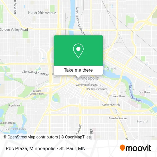
See Rbc Plaza, Minneapolis, on the map
Public Transit to Rbc Plaza in Minneapolis
Wondering how to get to Rbc Plaza in Minneapolis? Moovit helps you find the best way to get to Rbc Plaza with step-by-step directions from the nearest public transit station.
Moovit provides free maps and live directions to help you navigate through your city. View schedules, routes, timetables, and find out how long does it take to get to Rbc Plaza in real time.
Looking for the nearest stop or station to Rbc Plaza? Check out this list of stops closest to your destination: Marquette Ave & 6th St - Stop Group A; 6th St S & Marquette Ave; 6th St S & Nicollet Mall; 7th St S & Nicollet Mall; Marquette Ave & 6th St - Stop Group D; Nicollet Mall & 7th St S; Marquette Ave & 7th St - Stop Group B; Marquette Av S At 5 St S Sw Corner; Marquette Av S at 5 St S SW Corner; 4th St S & Marquette Ave; Government Plaza.
Bus: 10, 17, 22, 61, 645, 9, 94, 156, 747, 774, 776, 777, 134, 355, 363, 764, 7, 14, 755, 578, 600, 698, 760, 766, 11, 18, 25.Light Rail: METRO BLUE LINE, METRO GREEN LINE.
Want to see if there’s another route that gets you there at an earlier time? Moovit helps you find alternative routes or times. Get directions from and directions to Rbc Plaza easily from the Moovit App or Website.
We make riding to Rbc Plaza easy, which is why over 1.7 million users, including users in Minneapolis, trust Moovit as the best app for public transit. You don’t need to download an individual bus app or train app, Moovit is your all-in-one transit app that helps you find the best bus time or train time available.
For information on prices of bus and light rail, costs and ride fares to Rbc Plaza, please check the Moovit app.
Use the app to navigate to popular places including to the airport, hospital, stadium, grocery store, mall, coffee shop, school, college, and university.
Rbc Plaza Address: Nicollet Mall street in Minneapolis
- The Westin Minneapolis,
- Nicollet Mall Station,
- Kqql Kool 108 Radio,
- WESTIN-Minneapolis,
- The Oceanaire Seafood Room,
- R.F. Moeller Jeweler,
- Juut Salon and Spa,
- YMCA - Headquarters,
- Wells Fargo Center MN USA,
- M Cecilia Ray Attorney,
- Leonard Street & Deinard Pa,
- Wells Fargo Center,
- North Memorial Health,
- The Passport Office,
- Xcel Energy,
- Korn Ferry,
- Beedem Law,
- Quetico Partners,
- Creative Circle,
- Halleland Law
Places Near Rbc Plaza (Minneapolis)
- Orpheum Theatre (Minneapolis, Minnesota), Minneapolis,
- Minnesota State Capitol, St. Paul,
- Mpls. Convention Center, Minneapolis,
- Surly Brewing Co., Minneapolis,
- Minneapolis Institute of Art, Minneapolis,
- Minneapolis Sculpture Garden, Minneapolis,
- Target Field, Minneapolis,
- St. Paul College, St. Paul,
- Northrop Auditorium, Minneapolis,
- Minnehaha Falls, Minneapolis,
- Abbott Northwestern Piper Building, Minneapolis,
- Harriet Island Regional Park, St. Paul,
- Mystic lake casino bus, Minneapolis,
- 3m Arena at Mariucci, Minneapolis,
- Grand Casino Hinckley,MN, Minneapolis,
- Huntington Bank Stadium, Minneapolis,
- Bishop Henry Whipple Federal Building,
- Target Center, Minneapolis,
- Treasure Island Resort & Casino, St. Paul,
- Xcel Energy Center, St. Paul
How to get to popular places in Minneapolis - St. Paul, MN with public transit
Get around Minneapolis by public transit!
Traveling around Minneapolis has never been so easy. See step by step directions as you travel to any attraction, street or major public transit station. View bus and train schedules, arrival times, service alerts and detailed routes on a map, so you know exactly how to get to anywhere in Minneapolis.
When traveling to any destination around Minneapolis use Moovit's Live Directions with Get Off Notifications to know exactly where and how far to walk, how long to wait for your line, and how many stops are left. Moovit will alert you when it's time to get off — no need to constantly re-check whether yours is the next stop.
Wondering how to use public transit in Minneapolis or how to pay for public transit in Minneapolis? Moovit public transit app can help you navigate your way with public transit easily, and at minimum cost. It includes public transit fees, ticket prices, and costs. Looking for a map of Minneapolis public transit lines? Moovit public transit app shows all public transit maps in Minneapolis with all Bus, Train and Light Rail routes and stops on an interactive map.
Minneapolis - St. Paul, MN has 3 transit type(s), including: Bus, Train and Light Rail, operated by several transit agencies, including Metro Transit , Metro Transit, MVTA, Plymouth Metrolink, SouthWest Transit, Maple Grove, University of Minnesota, Airport (MAC), Amtrak, Mankato Transit System, SMART, FlixBus-us and Greyhound-us