How to get to Rc Organize & Design by bus?
Click on the bus route to see step by step directions with maps, line arrival times and updated time schedules.
From Citizenm Boston Back Bay Hotel, Boston
47 minFrom TJ Maxx, Boston
46 minFrom Residence Inn by Marriott Boston Harbor on Tudor Wharf, Boston
53 minFrom Beth Israel Deaconess Medical Center (Shapiro Garage), Boston
70 minFrom Assembly Square, Somerville
38 minFrom Warren Tavern, Boston
56 minFrom Watertown Mall, Watertown Town
52 minFrom Burlington, MA, Burlington
43 minFrom Guitar Center, Boston
57 minFrom Stone Zoo, Stoneham
93 min
How to get to Rc Organize & Design by train?
Click on the train route to see step by step directions with maps, line arrival times and updated time schedules.
How to get to Rc Organize & Design by subway?
Click on the subway route to see step by step directions with maps, line arrival times and updated time schedules.
From Citizenm Boston Back Bay Hotel, Boston
85 minFrom TJ Maxx, Boston
80 minFrom Residence Inn by Marriott Boston Harbor on Tudor Wharf, Boston
90 minFrom Beth Israel Deaconess Medical Center (Shapiro Garage), Boston
99 minFrom Assembly Square, Somerville
87 minFrom Warren Tavern, Boston
88 minFrom Guitar Center, Boston
96 min
Bus stops near Rc Organize & Design in Arlington
Train stations near Rc Organize & Design in Arlington
Subway station near Rc Organize & Design in Arlington
- Alewife, 43 min walk,VIEW
Bus lines to Rc Organize & Design in Arlington
What are the closest stations to Rc Organize & Design?
The closest stations to Rc Organize & Design are:
- Mill St @ Mill Brook Dr is 46 yards away, 1 min walk.
- Massachusetts Ave @ Willow Ct is 309 yards away, 4 min walk.
- Belmont is 926 yards away, 11 min walk.
- Wedgemere is 3507 yards away, 41 min walk.
- Alewife is 3692 yards away, 43 min walk.
Which bus lines stop near Rc Organize & Design?
These bus lines stop near Rc Organize & Design: 77, 80.
Which train lines stop near Rc Organize & Design?
These train lines stop near Rc Organize & Design: FITCHBURG, LOWELL.
Which subway line stops near Rc Organize & Design?
RED LINE (Alewife)
What’s the nearest train station to Rc Organize & Design in Arlington?
The nearest train station to Rc Organize & Design in Arlington is Belmont. It’s a 11 min walk away.
What’s the nearest bus station to Rc Organize & Design in Arlington?
The nearest bus station to Rc Organize & Design in Arlington is Mill St @ Mill Brook Dr. It’s a 1 min walk away.
What time is the first subway to Rc Organize & Design in Arlington?
The RED LINE is the first subway that goes to Rc Organize & Design in Arlington. It stops nearby at 5:15 AM.
What time is the last subway to Rc Organize & Design in Arlington?
The RED LINE is the last subway that goes to Rc Organize & Design in Arlington. It stops nearby at 2:06 AM.
What time is the first train to Rc Organize & Design in Arlington?
The LOWELL is the first train that goes to Rc Organize & Design in Arlington. It stops nearby at 5:29 AM.
What time is the last train to Rc Organize & Design in Arlington?
The LOWELL is the last train that goes to Rc Organize & Design in Arlington. It stops nearby at 12:20 AM.
What time is the first bus to Rc Organize & Design in Arlington?
The 77 is the first bus that goes to Rc Organize & Design in Arlington. It stops nearby at 4:51 AM.
What time is the last bus to Rc Organize & Design in Arlington?
The 77 is the last bus that goes to Rc Organize & Design in Arlington. It stops nearby at 1:24 AM.
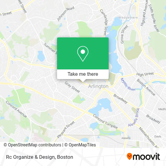
See Rc Organize & Design, Arlington, on the map
Public Transit to Rc Organize & Design in Arlington
Wondering how to get to Rc Organize & Design in Arlington? Moovit helps you find the best way to get to Rc Organize & Design with step-by-step directions from the nearest public transit station.
Moovit provides free maps and live directions to help you navigate through your city. View schedules, routes, timetables, and find out how long does it take to get to Rc Organize & Design in real time.
Looking for the nearest stop or station to Rc Organize & Design? Check out this list of stops closest to your destination: Mill St @ Mill Brook Dr; Massachusetts Ave @ Willow Ct; Belmont; Wedgemere; Alewife.
Bus: 77, 80, 67.Train: FITCHBURG, LOWELL.Subway: RED LINE.
Want to see if there’s another route that gets you there at an earlier time? Moovit helps you find alternative routes or times. Get directions from and directions to Rc Organize & Design easily from the Moovit App or Website.
We make riding to Rc Organize & Design easy, which is why over 1.7 million users, including users in Arlington, trust Moovit as the best app for public transit. You don’t need to download an individual bus app or train app, Moovit is your all-in-one transit app that helps you find the best bus time or train time available.
For information on prices of bus, subway and train, costs and ride fares to Rc Organize & Design, please check the Moovit app.
Use the app to navigate to popular places including to the airport, hospital, stadium, grocery store, mall, coffee shop, school, college, and university.
Location: Arlington, Boston
- Regina Gifts,
- Proud Isne Agent Insurance Services of New England, LLC,
- Arlington Bosch Factory Certified Appliance Repair,
- Coinstar - Bitcoin ATM,
- American Locksmith,
- Lexington Energy Partners,
- Astound Broadband Powered by RCN,
- Grove Street Tennis Courts,
- Nesf Boston,
- Mass BJJ,
- Robin's Nest Pet Salon (Robins Nest Pet Salon),
- Philips Electric,
- Wellington Tennis Courts,
- DWM,
- Tech Electric,
- Brown & Associates,
- Provo Financial Services,
- FedEx,
- Macingenius,
- Arlington High School Track
Places Near Rc Organize & Design (Arlington)
- Seaport District, Boston,
- House Of Blues, Boston,
- North End, Boston,
- Boston Medical Center, Boston,
- Boston Children's Hospital, Boston,
- Prudential Center, Boston,
- Cheers, Boston,
- Td Garden, Boston,
- Quincy Market, Boston,
- Boston Convention & Exhibition Center, Boston,
- Wilbur Theatre, Boston,
- Boston Common, Boston,
- Leader Bank Pavilion (Leader Bank Pavillion), Boston,
- Museum Of Science, Boston,
- Faneuil Hall, Boston,
- Wang Theater, Boston,
- Isabella Stewart Gardner Museum, Boston,
- Mgm Music Hall, Boston,
- Castle Island, Boston,
- Massachusetts General Hospital, Boston
How to get to popular places in Boston with public transit
Get around Arlington by public transit!
Traveling around Arlington has never been so easy. See step by step directions as you travel to any attraction, street or major public transit station. View bus and train schedules, arrival times, service alerts and detailed routes on a map, so you know exactly how to get to anywhere in Arlington.
When traveling to any destination around Arlington use Moovit's Live Directions with Get Off Notifications to know exactly where and how far to walk, how long to wait for your line, and how many stops are left. Moovit will alert you when it's time to get off — no need to constantly re-check whether yours is the next stop.
Wondering how to use public transit in Arlington or how to pay for public transit in Arlington? Moovit public transit app can help you navigate your way with public transit easily, and at minimum cost. It includes public transit fees, ticket prices, and costs. Looking for a map of Arlington public transit lines? Moovit public transit app shows all public transit maps in Arlington with all Bus, Train, Subway and Ferry routes and stops on an interactive map.
Boston has 4 transit type(s), including: Bus, Train, Subway and Ferry, operated by several transit agencies, including MBTA, Southeastern Regional Transit Authority, MetroWest Regional Transit Authority, Rhode Island Public Transit Authority, WRTA, Lowell Regional Transit Authority, Merrimack Valley Transit, Montachusett Regional Transit Authority, Cape Cod Regional Transit Authority, Brockton Area Transit Authority, Martha's Vineyard Transit Authority, the WAVE - Nantucket Regional Transit Authority, GATRA, Cape Ann Transportation Authority and Massport