Directions to Reading Memorial High School with public transportation
The following transit lines have routes that pass near Reading Memorial High School
How to get to Reading Memorial High School by bus?
Click on the bus route to see step by step directions with maps, line arrival times and updated time schedules.
How to get to Reading Memorial High School by train?
Click on the train route to see step by step directions with maps, line arrival times and updated time schedules.
Bus stations near Reading Memorial High School
- Woburn St @ Lowell St - Reading Sq, 20 min walk,
Train stations near Reading Memorial High School
- Reading, 23 min walk,
Bus lines to Reading Memorial High School
- 137, Malden,
What are the closest stations to Reading Memorial High School?
The closest stations to Reading Memorial High School are:
- Woburn St @ Lowell St - Reading Sq is 1646 yards away, 20 min walk.
- Reading is 1862 yards away, 23 min walk.
Which bus lines stop near Reading Memorial High School?
These bus lines stop near Reading Memorial High School: 136, 137.
Which train line stops near Reading Memorial High School?
HAVERHILL LINE
What’s the nearest train station to Reading Memorial High School?
The nearest train station to Reading Memorial High School is Reading. It’s a 23 min walk away.
See Reading Memorial High School on the map
Public Transportation to Reading Memorial High School
Wondering how to get to Reading Memorial High School, United States? Moovit helps you find the best way to get to Reading Memorial High School with step-by-step directions from the nearest public transit station.
Moovit provides free maps and live directions to help you navigate through your city. View schedules, routes, timetables, and find out how long does it take to get to Reading Memorial High School in real time.
Looking for the nearest stop or station to Reading Memorial High School? Check out this list of stops closest to your destination: Woburn St @ Lowell St - Reading Sq; Reading.
Bus: 136, 137.Train: HAVERHILL LINE, HAVERHILL.
Want to see if there’s another route that gets you there at an earlier time? Moovit helps you find alternative routes or times. Get directions from and directions to Reading Memorial High School easily from the Moovit App or Website.
We make riding to Reading Memorial High School easy, which is why over 1.5 million users, including users in Reading, trust Moovit as the best app for public transit. You don’t need to download an individual bus app or train app, Moovit is your all-in-one transit app that helps you find the best bus time or train time available.
For information on prices of bus, train and subway, costs and ride fares to Reading Memorial High School, please check the Moovit app.
Use the app to navigate to popular places including to the airport, hospital, stadium, grocery store, mall, coffee shop, school, college, and university.
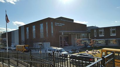
Reading Memorial High School Address: Oakland Road street in Reading
Attractions near Reading Memorial High School
Hawkes Fieldhouse,Library,RMHS Basketball Court,Reading Extended Day Activities Program,Reading School District,62 Oakland Rd,Memorial High School,Rugelus Enterprises,1,Coolidge Junior High School,Coolidge Middle School,Ocean Marine Assistance C,Arthur W. Coolidge Middle School,John Scott Seamless Gutter,Library,Camber Corporation,Waverly Rd,Birch Meadow Complex,Burbank Ymca,Burbank Branch YMCAHow to get to popular attractions in Reading with public transit
Plum Island,Brockton, MA, Brockton,Blue Hills Bank Pavilion, Boston,Columbus Ave, Boston,Hatch Shell, Boston,Royal Sonesta, Cambridge,Umass Dartmouth,New England Aquarium, Boston,Sheraton-Needham Hotel , Needham,One Federal, Boston,Royale Boston, Boston,Middlesex Superior Court, Woburn,MBTA-Museum of Fine Arts, Boston,Winter Street, Boston,Boch Center, Boston,Charlie Card, Boston,Gloucester, MA, Gloucester,H Mart, Cambridge,Rental Car Center - Logan Airport, Boston,West Newton, MA, NewtonGet around Boston by public transit!
Traveling around Boston has never been so easy. See step by step directions as you travel to any attraction, street or major public transit station. View bus and train schedules, arrival times, service alerts and detailed routes on a map, so you know exactly how to get to anywhere in Boston.
When traveling to any destination around Boston use Moovit's Live Directions with Get Off Notifications to know exactly where and how far to walk, how long to wait for your line, and how many stops are left. Moovit will alert you when it's time to get off — no need to constantly re-check whether yours is the next stop.
Wondering how to use public transit in Boston or how to pay for public transit in Boston? Moovit public transit app can help you navigate your way with public transit easily, and at minimum cost. It includes public transit fees, ticket prices, and costs. Looking for a map of Boston public transit lines? Moovit public transit app shows all public transit maps in Boston with all Bus, Train, Subway and Ferry routes and stops on an interactive map.
Boston has 4 transit type(s), including: Bus, Train, Subway and Ferry, operated by several transit agencies, including MBTA, Southeastern Regional Transit Authority, MetroWest Regional Transit Authority, Rhode Island Public Transit Authority, WRTA, Lowell Regional Transit Authority, Merrimack Valley Transit, Montachusett Regional Transit Authority, Cape Cod Regional Transit Authority, Brockton Area Transit Authority, Martha's Vineyard Transit Authority, the WAVE - Nantucket Regional Transit Authority, GATRA, Cape Ann Transportation Authority, Massport