Directions to Ready, Set, Kids (Arlington) with public transportation
The following transit lines have routes that pass near Ready, Set, Kids
 Bus: 77, 87, 95, 67.
- Train: LOWELL, FITCHBURG.
- Subway: RED LINE, GREEN LINE B, GREEN LINE C, GREEN LINE E.
How to get to Ready, Set, Kids by bus?
Click on the bus route to see step by step directions with maps, line arrival times and updated time schedules.
From Marina Bay, Boston
72 minFrom Financial District, Boston
68 minFrom Beehive, Boston
67 minFrom Doubletree by Hilton Hotel Boston - Downtown, Boston
64 minFrom Inman Sq, Cambridge
38 minFrom MGH, Boston
55 minFrom Mass Lottery, Boston
53 minFrom Boston Latin School, Boston
69 minFrom 31 St. James Street, Boston
57 minFrom Mr Dooley's Boston Tavern, Boston
70 min
How to get to Ready, Set, Kids by train?
Click on the train route to see step by step directions with maps, line arrival times and updated time schedules.
How to get to Ready, Set, Kids by subway?
Click on the subway route to see step by step directions with maps, line arrival times and updated time schedules.
From Marina Bay, Boston
70 minFrom Financial District, Boston
61 minFrom Beehive, Boston
70 minFrom Doubletree by Hilton Hotel Boston - Downtown, Boston
63 minFrom Inman Sq, Cambridge
59 minFrom MGH, Boston
59 minFrom Mass Lottery, Boston
70 minFrom Boston Latin School, Boston
81 minFrom 31 St. James Street, Boston
64 minFrom Mr Dooley's Boston Tavern, Boston
64 min
Bus stops near Ready, Set, Kids in Arlington
Train stations near Ready, Set, Kids in Arlington
Subway stations near Ready, Set, Kids in Arlington
Bus lines to Ready, Set, Kids in Arlington
What are the closest stations to Ready, Set, Kids?
The closest stations to Ready, Set, Kids are:
- Broadway @ Massachusetts Ave is 156 yards away, 2 min walk.
- Massachusetts Ave @ Mystic St is 160 yards away, 3 min walk.
- Massachusetts Ave @ Wyman Terr is 258 yards away, 4 min walk.
- Medford St Opp Warren St is 302 yards away, 4 min walk.
- Belmont is 1342 yards away, 16 min walk.
- West Medford is 2287 yards away, 28 min walk.
- Alewife is 3104 yards away, 37 min walk.
- Medford/Tufts Station is 4208 yards away, 50 min walk.
Which bus lines stop near Ready, Set, Kids?
These bus lines stop near Ready, Set, Kids: 77, 87, 95.
Which train line stops near Ready, Set, Kids?
LOWELL (#327 | Lowell)
Which subway line stops near Ready, Set, Kids?
RED LINE (Alewife)
What’s the nearest train station to Ready, Set, Kids in Arlington?
The nearest train station to Ready, Set, Kids in Arlington is Belmont. It’s a 16 min walk away.
What’s the nearest bus station to Ready, Set, Kids in Arlington?
The nearest bus station to Ready, Set, Kids in Arlington is Broadway @ Massachusetts Ave. It’s a 2 min walk away.
What time is the first subway to Ready, Set, Kids in Arlington?
The GREEN LINE E is the first subway that goes to Ready, Set, Kids in Arlington. It stops nearby at 4:57 AM.
What time is the last subway to Ready, Set, Kids in Arlington?
The GREEN LINE E is the last subway that goes to Ready, Set, Kids in Arlington. It stops nearby at 2:41 AM.
What time is the first train to Ready, Set, Kids in Arlington?
The LOWELL is the first train that goes to Ready, Set, Kids in Arlington. It stops nearby at 5:31 AM.
What time is the last train to Ready, Set, Kids in Arlington?
The LOWELL is the last train that goes to Ready, Set, Kids in Arlington. It stops nearby at 12:20 AM.
What time is the first bus to Ready, Set, Kids in Arlington?
The 77 is the first bus that goes to Ready, Set, Kids in Arlington. It stops nearby at 4:54 AM.
What time is the last bus to Ready, Set, Kids in Arlington?
The 87 is the last bus that goes to Ready, Set, Kids in Arlington. It stops nearby at 1:43 AM.
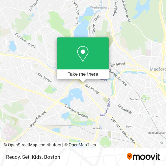
See Ready, Set, Kids, Arlington, on the map
Public Transit to Ready, Set, Kids in Arlington
Wondering how to get to Ready, Set, Kids in Arlington? Moovit helps you find the best way to get to Ready, Set, Kids with step-by-step directions from the nearest public transit station.
Moovit provides free maps and live directions to help you navigate through your city. View schedules, routes, timetables, and find out how long does it take to get to Ready, Set, Kids in real time.
Looking for the nearest stop or station to Ready, Set, Kids? Check out this list of stops closest to your destination: Broadway @ Massachusetts Ave; Massachusetts Ave @ Mystic St; Massachusetts Ave @ Wyman Terr; Medford St Opp Warren St; Belmont; West Medford; Alewife; Medford/Tufts Station.
Bus: 77, 87, 95, 67.Train: LOWELL, FITCHBURG.Subway: RED LINE, GREEN LINE B, GREEN LINE C, GREEN LINE E.
Want to see if there’s another route that gets you there at an earlier time? Moovit helps you find alternative routes or times. Get directions from and directions to Ready, Set, Kids easily from the Moovit App or Website.
We make riding to Ready, Set, Kids easy, which is why over 1.7 million users, including users in Arlington, trust Moovit as the best app for public transit. You don’t need to download an individual bus app or train app, Moovit is your all-in-one transit app that helps you find the best bus time or train time available.
For information on prices of bus, subway and train, costs and ride fares to Ready, Set, Kids, please check the Moovit app.
Use the app to navigate to popular places including to the airport, hospital, stadium, grocery store, mall, coffee shop, school, college, and university.
Ready, Set, Kids Address: 284 Broadway street in Arlington
- Ammon Embry-Pelrine, LMT,
- Pegasus Consulting, Assessment, & Psychological Services, LLC,
- Summer Dey Kuempel,
- Dey Summer,
- Arlington, Ma Fire,
- Dr Catherine Glenn,
- Arlington Acupuncture Wellness,
- Charlie's Barkery,
- Walkinshaw John A,
- Flat Price Locksmith,
- Perreault Law Offices,
- Arlington Center,
- Arlington Civil War Monument,
- MBTA Bus Stop 77/79/350,
- Brizuela Fitness,
- Thai Style Combination,
- Citizens Bank & Trust,
- DUNKIN',
- Danny Miller Massage Therapist,
- Arlington Aveto Parts
Places Near Ready, Set, Kids (Arlington)
- Prudential Center, Boston,
- Td Garden, Boston,
- Boston Medical Center, Boston,
- House Of Blues, Boston,
- North End, Boston,
- Mgm Music Hall, Boston,
- Wang Theater, Boston,
- Boston Common, Boston,
- Boston Convention & Exhibition Center, Boston,
- Quincy Market, Boston,
- Cheers, Boston,
- Castle Island, Boston,
- Wilbur Theatre, Boston,
- Isabella Stewart Gardner Museum, Boston,
- Leader Bank Pavilion (Leader Bank Pavillion), Boston,
- Museum Of Science, Boston,
- Faneuil Hall, Boston,
- Seaport District, Boston,
- Boston Children's Hospital, Boston,
- Massachusetts General Hospital, Boston
How to get to popular places in Boston with public transit
Get around Arlington by public transit!
Traveling around Arlington has never been so easy. See step by step directions as you travel to any attraction, street or major public transit station. View bus and train schedules, arrival times, service alerts and detailed routes on a map, so you know exactly how to get to anywhere in Arlington.
When traveling to any destination around Arlington use Moovit's Live Directions with Get Off Notifications to know exactly where and how far to walk, how long to wait for your line, and how many stops are left. Moovit will alert you when it's time to get off — no need to constantly re-check whether yours is the next stop.
Wondering how to use public transit in Arlington or how to pay for public transit in Arlington? Moovit public transit app can help you navigate your way with public transit easily, and at minimum cost. It includes public transit fees, ticket prices, and costs. Looking for a map of Arlington public transit lines? Moovit public transit app shows all public transit maps in Arlington with all Bus, Train, Subway and Ferry routes and stops on an interactive map.
Boston has 4 transit type(s), including: Bus, Train, Subway and Ferry, operated by several transit agencies, including MBTA, Southeastern Regional Transit Authority, MetroWest Regional Transit Authority, Rhode Island Public Transit Authority, WRTA, Lowell Regional Transit Authority, Merrimack Valley Transit, Montachusett Regional Transit Authority, Cape Cod Regional Transit Authority, Brockton Area Transit Authority, Martha's Vineyard Transit Authority, the WAVE - Nantucket Regional Transit Authority, GATRA, Cape Ann Transportation Authority and Massport