Directions to Realtor Marcela C Diaz (Boston) with public transportation
The following transit lines have routes that pass near Realtor Marcela C Diaz
 Bus: 01, 11, 10, NCS.
- Train: FRAMINGHAM/WORCESTER, LAKE SHORE LIMITED.
How to get to Realtor Marcela C Diaz by bus?
Click on the bus route to see step by step directions with maps, line arrival times and updated time schedules.
From Hopkinton, MA, Hopkinton
55 minFrom Wellesley, MA, Wellesley
78 minFrom Boston Marriott Newton, Newton
107 minFrom Staples Corporate HQ, Framingham
66 minFrom Bose Corp, Framingham
72 minFrom Newton Wellesley Hospital Green Building, Newton
84 minFrom I-95 / Route 128 & Route 16 Interchange (Exit 21), Newton
80 minFrom Newton-Wellesley Hospital, Newton
84 minFrom Babson College, Wellesley
75 min
How to get to Realtor Marcela C Diaz by train?
Click on the train route to see step by step directions with maps, line arrival times and updated time schedules.
Bus stops near Realtor Marcela C Diaz in Boston
Train stations near Realtor Marcela C Diaz in Boston
Bus lines to Realtor Marcela C Diaz in Boston
What are the closest stations to Realtor Marcela C Diaz?
The closest stations to Realtor Marcela C Diaz are:
- Roche Bros. is 805 yards away, 10 min walk.
- West Natick Mbta Station is 1156 yards away, 14 min walk.
- Framingham is 3440 yards away, 41 min walk.
- Framingham Amtrak is 3440 yards away, 41 min walk.
Which bus lines stop near Realtor Marcela C Diaz?
These bus lines stop near Realtor Marcela C Diaz: 01, 11.
Which train line stops near Realtor Marcela C Diaz?
FRAMINGHAM/WORCESTER (#521 | Worcester)
What’s the nearest bus station to Realtor Marcela C Diaz in Boston?
The nearest bus station to Realtor Marcela C Diaz in Boston is Roche Bros.. It’s a 10 min walk away.
What time is the first train to Realtor Marcela C Diaz in Boston?
The FRAMINGHAM/WORCESTER is the first train that goes to Realtor Marcela C Diaz in Boston. It stops nearby at 4:54 AM.
What time is the last train to Realtor Marcela C Diaz in Boston?
The LAKE SHORE LIMITED is the last train that goes to Realtor Marcela C Diaz in Boston. It stops nearby at 8:00 PM.
What time is the first bus to Realtor Marcela C Diaz in Boston?
The 10 is the first bus that goes to Realtor Marcela C Diaz in Boston. It stops nearby at 6:33 AM.
What time is the last bus to Realtor Marcela C Diaz in Boston?
The 11 is the last bus that goes to Realtor Marcela C Diaz in Boston. It stops nearby at 8:28 PM.
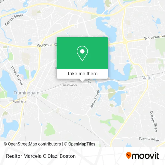
See Realtor Marcela C Diaz, Boston, on the map
Public Transit to Realtor Marcela C Diaz in Boston
Wondering how to get to Realtor Marcela C Diaz in Boston? Moovit helps you find the best way to get to Realtor Marcela C Diaz with step-by-step directions from the nearest public transit station.
Moovit provides free maps and live directions to help you navigate through your city. View schedules, routes, timetables, and find out how long does it take to get to Realtor Marcela C Diaz in real time.
Looking for the nearest stop or station to Realtor Marcela C Diaz? Check out this list of stops closest to your destination: Roche Bros.; West Natick Mbta Station; Framingham; Framingham Amtrak.
Bus: 01, 11, 10, NCS.Train: FRAMINGHAM/WORCESTER, LAKE SHORE LIMITED.
Want to see if there’s another route that gets you there at an earlier time? Moovit helps you find alternative routes or times. Get directions from and directions to Realtor Marcela C Diaz easily from the Moovit App or Website.
We make riding to Realtor Marcela C Diaz easy, which is why over 1.7 million users, including users in Boston, trust Moovit as the best app for public transit. You don’t need to download an individual bus app or train app, Moovit is your all-in-one transit app that helps you find the best bus time or train time available.
For information on prices of bus and train, costs and ride fares to Realtor Marcela C Diaz, please check the Moovit app.
Use the app to navigate to popular places including to the airport, hospital, stadium, grocery store, mall, coffee shop, school, college, and university.
Realtor Marcela C Diaz Address: 209 W Central St street in Boston
- Jocelyn Barrett,
- Safeguard Security,
- Glow Touch Spa,
- Achieve TMS East,
- Bahwan Cybertek,
- Home Instead,
- G&N Insurance,
- Natick Visiting Nurse Association,
- Van Grace Associates,
- Natick Office Park Associates,
- Cinco Chiles Taqueria,
- Lewis & Joyce Real Estate,
- Burrito Spice,
- Natick Smiles,
- Hess,
- Elizabeth & Co Salon,
- Milestone Church,
- Multi Locks Locksmith,
- Gallagher Insurance, Risk Management & Consulting,
- Stonegate Group LLC
Places Near Realtor Marcela C Diaz (Boston)
- Isabella Stewart Gardner Museum, Boston,
- Mgm Music Hall, Boston,
- Wilbur Theatre, Boston,
- Boston Medical Center, Boston,
- Quincy Market, Boston,
- Leader Bank Pavilion (Leader Bank Pavillion), Boston,
- Cheers, Boston,
- Castle Island, Boston,
- House Of Blues, Boston,
- Wang Theater, Boston,
- Boston Children's Hospital, Boston,
- Seaport District, Boston,
- Faneuil Hall, Boston,
- Boston Convention & Exhibition Center, Boston,
- Massachusetts General Hospital, Boston,
- Prudential Center, Boston,
- North End, Boston,
- Td Garden, Boston,
- Museum Of Science, Boston,
- Boston Common, Boston
How to get to popular places in Boston with public transit
Get around Boston by public transit!
Traveling around Boston has never been so easy. See step by step directions as you travel to any attraction, street or major public transit station. View bus and train schedules, arrival times, service alerts and detailed routes on a map, so you know exactly how to get to anywhere in Boston.
When traveling to any destination around Boston use Moovit's Live Directions with Get Off Notifications to know exactly where and how far to walk, how long to wait for your line, and how many stops are left. Moovit will alert you when it's time to get off — no need to constantly re-check whether yours is the next stop.
Wondering how to use public transit in Boston or how to pay for public transit in Boston? Moovit public transit app can help you navigate your way with public transit easily, and at minimum cost. It includes public transit fees, ticket prices, and costs. Looking for a map of Boston public transit lines? Moovit public transit app shows all public transit maps in Boston with all Bus, Train, Subway and Ferry routes and stops on an interactive map.
Boston has 4 transit type(s), including: Bus, Train, Subway and Ferry, operated by several transit agencies, including MBTA, Southeastern Regional Transit Authority, MetroWest Regional Transit Authority, Rhode Island Public Transit Authority, WRTA, Lowell Regional Transit Authority, Merrimack Valley Transit, Montachusett Regional Transit Authority, Cape Cod Regional Transit Authority, Brockton Area Transit Authority, Martha's Vineyard Transit Authority, the WAVE - Nantucket Regional Transit Authority, GATRA, Cape Ann Transportation Authority and Massport