Directions to Red Lantern (Cambridge) with public transportation
The following transit lines have routes that pass near Red Lantern
 Bus: 74, 78, FLIXBUS 2610, FLIXBUS 2619, 62.
- Train: FITCHBURG.
- Subway: RED LINE, GREEN LINE B, GREEN LINE C, GREEN LINE E.
How to get to Red Lantern by bus?
Click on the bus route to see step by step directions with maps, line arrival times and updated time schedules.
From Hampton Inn & Suites Boston Crosstown Ctr, Boston
59 minFrom Fire + Ice, Boston
52 minFrom City Hall To Go, Boston
91 minFrom Aloft-Boston Seaport Dist, Boston
90 minFrom Massachusetts Water Resource Authority (MWRA), Chelsea
92 minFrom I-93 South, Boston
59 minFrom Best Buy, Boston
80 minFrom Element Boston Seaport, Boston
89 minFrom Puttshack, Boston
99 minFrom The Mapparium, Boston
45 min
How to get to Red Lantern by train?
Click on the train route to see step by step directions with maps, line arrival times and updated time schedules.
How to get to Red Lantern by subway?
Click on the subway route to see step by step directions with maps, line arrival times and updated time schedules.
From Hampton Inn & Suites Boston Crosstown Ctr, Boston
67 minFrom Fire + Ice, Boston
53 minFrom City Hall To Go, Boston
65 minFrom Aloft-Boston Seaport Dist, Boston
66 minFrom Massachusetts Water Resource Authority (MWRA), Chelsea
83 minFrom I-93 South, Boston
54 minFrom Best Buy, Boston
61 minFrom Element Boston Seaport, Boston
64 minFrom Puttshack, Boston
60 minFrom The Mapparium, Boston
60 min
Bus stops near Red Lantern in Cambridge
Subway stations near Red Lantern in Cambridge
Train station near Red Lantern in Cambridge
- Belmont, 45 min walk,VIEW
Bus lines to Red Lantern in Cambridge
- 74, Harvard - Belmont Center,VIEW
- 78, Harvard - Arlmont Village,VIEW
- FLIXBUS 2610, NYC - Boston,VIEW
- FLIXBUS 2619, Boston - NYC - Philadelphia,VIEW
- 62, Bedford Va,VIEW
- 67, Turkey Hill Via Arlington Center,VIEW
- 76, Lincoln Lab,VIEW
- 350, Alewife via Mall Rd - North Burlington via Mall Rd,VIEW
- FITCHBURG LINE SHUTTLE, Littleton/Route 495 - Alewife (Local),VIEW
- FITCHBURG LINE SHUTTLE, Littleton/Route 495 - Alewife (Express),VIEW
- RED LINE SHUTTLE, Alewife - Park Street,VIEW
- RED LINE SHUTTLE, Alewife - Kendall/MIT via Porter (Express),VIEW
- RED LINE SHUTTLE, Alewife - Harvard via Brattle Street,VIEW
- RED LINE SHUTTLE, Alewife - Davis,VIEW
- RED LINE SHUTTLE, Alewife - Kendall/MIT,VIEW
- RED LINE SHUTTLE, Alewife - Harvard via Holyoke Street,VIEW
- R1, Rev Bus - R1,VIEW
- R2, Rev Bus - R2 Inbound,VIEW
What are the closest stations to Red Lantern?
The closest stations to Red Lantern are:
- Concord Ave @ Smith Pl is 350 yards away, 5 min walk.
- Cambridge (Ma) is 1663 yards away, 20 min walk.
- Opp 10 Acorn Park Dr is 1694 yards away, 20 min walk.
- Alewife is 1754 yards away, 21 min walk.
- Alewife Station (Arrive) is 1755 yards away, 21 min walk.
- Davis Sq. is 3548 yards away, 43 min walk.
- Belmont is 3813 yards away, 45 min walk.
- Medford/Tufts Station is 3979 yards away, 47 min walk.
Which bus lines stop near Red Lantern?
These bus lines stop near Red Lantern: 74, 78.
Which train line stops near Red Lantern?
FITCHBURG (#413 | Wachusett)
Which subway line stops near Red Lantern?
RED LINE (Alewife)
What’s the nearest bus station to Red Lantern in Cambridge?
The nearest bus station to Red Lantern in Cambridge is Concord Ave @ Smith Pl. It’s a 5 min walk away.
What time is the first subway to Red Lantern in Cambridge?
The GREEN LINE E is the first subway that goes to Red Lantern in Cambridge. It stops nearby at 4:57 AM.
What time is the last subway to Red Lantern in Cambridge?
The GREEN LINE E is the last subway that goes to Red Lantern in Cambridge. It stops nearby at 2:41 AM.
What time is the first train to Red Lantern in Cambridge?
The FITCHBURG is the first train that goes to Red Lantern in Cambridge. It stops nearby at 5:41 AM.
What time is the last train to Red Lantern in Cambridge?
The FITCHBURG is the last train that goes to Red Lantern in Cambridge. It stops nearby at 12:17 AM.
What time is the first bus to Red Lantern in Cambridge?
The 62 is the first bus that goes to Red Lantern in Cambridge. It stops nearby at 5:10 AM.
What time is the last bus to Red Lantern in Cambridge?
The 74 is the last bus that goes to Red Lantern in Cambridge. It stops nearby at 1:22 AM.
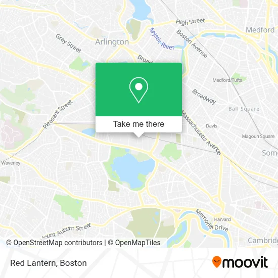
See Red Lantern, Cambridge, on the map
Public Transit to Red Lantern in Cambridge
Wondering how to get to Red Lantern in Cambridge? Moovit helps you find the best way to get to Red Lantern with step-by-step directions from the nearest public transit station.
Moovit provides free maps and live directions to help you navigate through your city. View schedules, routes, timetables, and find out how long does it take to get to Red Lantern in real time.
Looking for the nearest stop or station to Red Lantern? Check out this list of stops closest to your destination: Concord Ave @ Smith Pl; Cambridge (Ma); Opp 10 Acorn Park Dr; Alewife; Alewife Station (Arrive); Davis Sq.; Belmont; Medford/Tufts Station.
Bus: 74, 78, FLIXBUS 2610, FLIXBUS 2619, 62, 67, 76.Train: FITCHBURG.Subway: RED LINE, GREEN LINE B, GREEN LINE C, GREEN LINE E.
Want to see if there’s another route that gets you there at an earlier time? Moovit helps you find alternative routes or times. Get directions from and directions to Red Lantern easily from the Moovit App or Website.
We make riding to Red Lantern easy, which is why over 1.7 million users, including users in Cambridge, trust Moovit as the best app for public transit. You don’t need to download an individual bus app or train app, Moovit is your all-in-one transit app that helps you find the best bus time or train time available.
For information on prices of bus, subway and train, costs and ride fares to Red Lantern, please check the Moovit app.
Use the app to navigate to popular places including to the airport, hospital, stadium, grocery store, mall, coffee shop, school, college, and university.
Red Lantern Address: 68 Moulton St street in Cambridge
- Artisan Interiors,
- Wilson-Cambridge Realty Trust,
- Oasys Water,
- Moulton Realty Company,
- 155 Fawccett Street Cambridge Art Scene Shop Shop,
- Iggy's Bread (Iggy's Near You),
- Atmark Cambridge,
- Kyper,
- Smal Camera Technologies,
- Kendall Kitchen at,
- Blink Charging,
- Corporate Chefs BBN Cafe,
- Kyper,
- Carmine Therapeutics,
- Quickbase,
- Emc,
- Windsor at Cambridge Park,
- Vanu,
- Laurent,
- Dellbrook Construction
Places Near Red Lantern (Cambridge)
- Castle Island, Boston,
- Boston Convention & Exhibition Center, Boston,
- Seaport District, Boston,
- Prudential Center, Boston,
- Wilbur Theatre, Boston,
- Museum Of Science, Boston,
- Mgm Music Hall, Boston,
- Wang Theater, Boston,
- Faneuil Hall, Boston,
- Td Garden, Boston,
- Quincy Market, Boston,
- Massachusetts General Hospital, Boston,
- Boston Medical Center, Boston,
- North End, Boston,
- Leader Bank Pavilion (Leader Bank Pavillion), Boston,
- Cheers, Boston,
- Boston Children's Hospital, Boston,
- House Of Blues, Boston,
- Boston Common, Boston,
- Isabella Stewart Gardner Museum, Boston
How to get to popular places in Boston with public transit
Get around Cambridge by public transit!
Traveling around Cambridge has never been so easy. See step by step directions as you travel to any attraction, street or major public transit station. View bus and train schedules, arrival times, service alerts and detailed routes on a map, so you know exactly how to get to anywhere in Cambridge.
When traveling to any destination around Cambridge use Moovit's Live Directions with Get Off Notifications to know exactly where and how far to walk, how long to wait for your line, and how many stops are left. Moovit will alert you when it's time to get off — no need to constantly re-check whether yours is the next stop.
Wondering how to use public transit in Cambridge or how to pay for public transit in Cambridge? Moovit public transit app can help you navigate your way with public transit easily, and at minimum cost. It includes public transit fees, ticket prices, and costs. Looking for a map of Cambridge public transit lines? Moovit public transit app shows all public transit maps in Cambridge with all Bus, Train, Subway and Ferry routes and stops on an interactive map.
Boston has 4 transit type(s), including: Bus, Train, Subway and Ferry, operated by several transit agencies, including MBTA, Southeastern Regional Transit Authority, MetroWest Regional Transit Authority, Rhode Island Public Transit Authority, WRTA, Lowell Regional Transit Authority, Merrimack Valley Transit, Montachusett Regional Transit Authority, Cape Cod Regional Transit Authority, Brockton Area Transit Authority, Martha's Vineyard Transit Authority, the WAVE - Nantucket Regional Transit Authority, GATRA, Cape Ann Transportation Authority and Massport