Directions to Red, White And Brew (Boston) with public transportation
The following transit lines have routes that pass near Red, White And Brew
 Bus: 1, 20, 66, 14.
- Train: PROVIDENCE/STOUGHTON.
How to get to Red, White And Brew by bus?
Click on the bus route to see step by step directions with maps, line arrival times and updated time schedules.
How to get to Red, White And Brew by train?
Click on the train route to see step by step directions with maps, line arrival times and updated time schedules.
Bus stops near Red, White And Brew in Boston
Train station near Red, White And Brew in Boston
- T.F. Green Airport, 43 min walk,VIEW
Bus lines to Red, White And Brew in Boston
What are the closest stations to Red, White And Brew?
The closest stations to Red, White And Brew are:
- Post Before Airport Rd (Opposite Elkland) is 117 yards away, 2 min walk.
- 380 Jefferson is 339 yards away, 5 min walk.
- Post at Sky Bridge is 630 yards away, 8 min walk.
- T.F. Green Airport is 3649 yards away, 43 min walk.
Which bus lines stop near Red, White And Brew?
These bus lines stop near Red, White And Brew: 1, 20, 66.
Which train line stops near Red, White And Brew?
PROVIDENCE/STOUGHTON (#827 | Wickford Junction)
What’s the nearest bus station to Red, White And Brew in Boston?
The nearest bus station to Red, White And Brew in Boston is Post Before Airport Rd (Opposite Elkland). It’s a 2 min walk away.
What time is the first train to Red, White And Brew in Boston?
The PROVIDENCE/STOUGHTON is the first train that goes to Red, White And Brew in Boston. It stops nearby at 6:00 AM.
What time is the last train to Red, White And Brew in Boston?
The PROVIDENCE/STOUGHTON is the last train that goes to Red, White And Brew in Boston. It stops nearby at 7:56 PM.
What time is the first bus to Red, White And Brew in Boston?
The 20 is the first bus that goes to Red, White And Brew in Boston. It stops nearby at 5:43 AM.
What time is the last bus to Red, White And Brew in Boston?
The 20 is the last bus that goes to Red, White And Brew in Boston. It stops nearby at 12:41 AM.
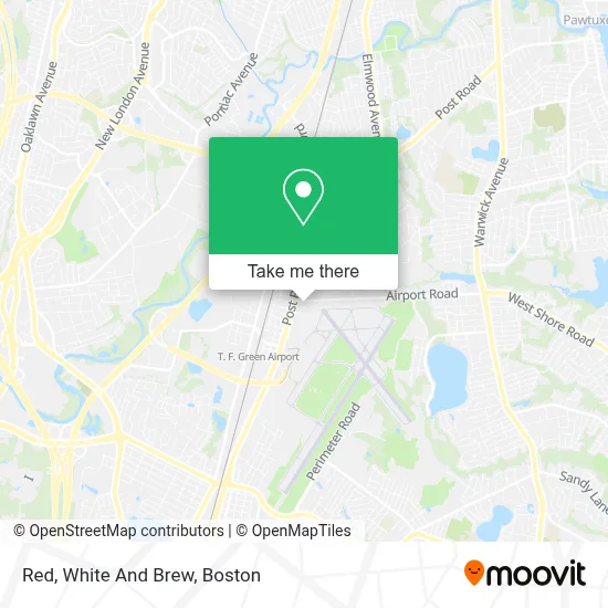
See Red, White And Brew, Boston, on the map
Public Transit to Red, White And Brew in Boston
Wondering how to get to Red, White And Brew in Boston? Moovit helps you find the best way to get to Red, White And Brew with step-by-step directions from the nearest public transit station.
Moovit provides free maps and live directions to help you navigate through your city. View schedules, routes, timetables, and find out how long does it take to get to Red, White And Brew in real time.
Looking for the nearest stop or station to Red, White And Brew? Check out this list of stops closest to your destination: Post Before Airport Rd (Opposite Elkland); 380 Jefferson; Post at Sky Bridge; T.F. Green Airport.
Bus: 1, 20, 66, 14.Train: PROVIDENCE/STOUGHTON.
Want to see if there’s another route that gets you there at an earlier time? Moovit helps you find alternative routes or times. Get directions from and directions to Red, White And Brew easily from the Moovit App or Website.
We make riding to Red, White And Brew easy, which is why over 1.7 million users, including users in Boston, trust Moovit as the best app for public transit. You don’t need to download an individual bus app or train app, Moovit is your all-in-one transit app that helps you find the best bus time or train time available.
For information on prices of bus and train, costs and ride fares to Red, White And Brew, please check the Moovit app.
Use the app to navigate to popular places including to the airport, hospital, stadium, grocery store, mall, coffee shop, school, college, and university.
Red, White And Brew Address: 1800 Post Rd street in Boston
- Tppfitness,
- North East Screen Printers,
- Verizon Wireless,
- The Parkinson's Place,
- Amazon Locker-Ainhoa,
- JC Scuba,
- Post Road Fuel,
- Neon Marketplace,
- Renu,
- Walt's Roast Beef - Warwick,
- Hair Gallery,
- K & A Styles,
- Brows by Sindia,
- Perfect Glow by Melissa Dean,
- Health Insurance Affordable Rates,
- Life Force Hypnosis LLC,
- Heavens To Earth Studio,
- All Stars Bar & Grill,
- U-Haul,
- Curtain & Bath Outlet, Warwick
Places Near Red, White And Brew (Boston)
- Seaport District, Boston,
- Museum Of Science, Boston,
- Boston Children's Hospital, Boston,
- Faneuil Hall, Boston,
- Leader Bank Pavilion (Leader Bank Pavillion), Boston,
- Wilbur Theatre, Boston,
- House Of Blues, Boston,
- North End, Boston,
- Boston Medical Center, Boston,
- Castle Island, Boston,
- Boston Convention & Exhibition Center, Boston,
- Quincy Market, Boston,
- Boston Common, Boston,
- Td Garden, Boston,
- Wang Theater, Boston,
- Massachusetts General Hospital, Boston,
- Cheers, Boston,
- Mgm Music Hall, Boston,
- Prudential Center, Boston,
- Isabella Stewart Gardner Museum, Boston
How to get to popular places in Boston with public transit
Get around Boston by public transit!
Traveling around Boston has never been so easy. See step by step directions as you travel to any attraction, street or major public transit station. View bus and train schedules, arrival times, service alerts and detailed routes on a map, so you know exactly how to get to anywhere in Boston.
When traveling to any destination around Boston use Moovit's Live Directions with Get Off Notifications to know exactly where and how far to walk, how long to wait for your line, and how many stops are left. Moovit will alert you when it's time to get off — no need to constantly re-check whether yours is the next stop.
Wondering how to use public transit in Boston or how to pay for public transit in Boston? Moovit public transit app can help you navigate your way with public transit easily, and at minimum cost. It includes public transit fees, ticket prices, and costs. Looking for a map of Boston public transit lines? Moovit public transit app shows all public transit maps in Boston with all Bus, Train, Subway and Ferry routes and stops on an interactive map.
Boston has 4 transit type(s), including: Bus, Train, Subway and Ferry, operated by several transit agencies, including MBTA, Southeastern Regional Transit Authority, MetroWest Regional Transit Authority, Rhode Island Public Transit Authority, WRTA, Lowell Regional Transit Authority, Merrimack Valley Transit, Montachusett Regional Transit Authority, Cape Cod Regional Transit Authority, Brockton Area Transit Authority, Martha's Vineyard Transit Authority, the WAVE - Nantucket Regional Transit Authority, GATRA, Cape Ann Transportation Authority and Massport