Directions to Redcore (Boston) with public transportation
The following transit lines have routes that pass near Redcore
 Bus: R14.
How to get to Redcore by bus?
Click on the bus route to see step by step directions with maps, line arrival times and updated time schedules.
From Dcu Center, Worcester
145 minFrom Foxwoods, Worcester
172 minFrom Worcester, MA, Worcester
143 minFrom South High Community School, Worcester
239 minFrom Registry Of Motor Vehicles (Rmv) Branch Office, Worcester
147 minFrom Polar Park, Worcester
144 minFrom Palladium, Worcester
148 minFrom Walmart Supercenter, Worcester
201 min
Bus stop near Redcore in Boston
- Springfield / Chapin, 6 min walk,VIEW
Bus lines to Redcore in Boston
- R14, Union Station Via Maple,VIEW
What are the closest stations to Redcore?
The closest stations to Redcore are:
- Springfield / Chapin is 457 yards away, 6 min walk.
Which bus line stops near Redcore?
R14 (Pheasant Hill)
What’s the nearest bus station to Redcore in Boston?
The nearest bus station to Redcore in Boston is Springfield / Chapin. It’s a 6 min walk away.
What time is the first bus to Redcore in Boston?
The R14 is the first bus that goes to Redcore in Boston. It stops nearby at 6:21 AM.
What time is the last bus to Redcore in Boston?
The R14 is the last bus that goes to Redcore in Boston. It stops nearby at 7:49 PM.
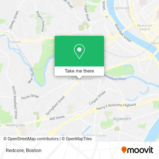
See Redcore, Boston, on the map
Public Transit to Redcore in Boston
Wondering how to get to Redcore in Boston? Moovit helps you find the best way to get to Redcore with step-by-step directions from the nearest public transit station.
Moovit provides free maps and live directions to help you navigate through your city. View schedules, routes, timetables, and find out how long does it take to get to Redcore in real time.
Looking for the nearest stop or station to Redcore? Check out this list of stops closest to your destination: Springfield / Chapin.
Bus: R14.
Want to see if there’s another route that gets you there at an earlier time? Moovit helps you find alternative routes or times. Get directions from and directions to Redcore easily from the Moovit App or Website.
We make riding to Redcore easy, which is why over 1.7 million users, including users in Boston, trust Moovit as the best app for public transit. You don’t need to download an individual bus app or train app, Moovit is your all-in-one transit app that helps you find the best bus time or train time available.
For information on prices of bus, costs and ride fares to Redcore, please check the Moovit app.
Use the app to navigate to popular places including to the airport, hospital, stadium, grocery store, mall, coffee shop, school, college, and university.
Redcore Address: 321 Springfield St street in Boston
- King of Cuts Barbershop in Agawam Ma,
- O'Briens Corner,
- Highlands Card Gift,
- Wrap It Up Sports,
- Mcgrath's Park,
- Gomes Improving Homes,
- Santander,
- Rhino Linings Vehicle Protection,
- Esperanza,
- Commonwealth of Massachusetts,
- Massachusetts Dept of Environmental Protctn,
- Robinson Park School,
- M.A.S. Electronics,
- Federal Technology,
- Bancroft Bridals,
- Shea Field,
- Ccdetail Services,
- Gerald J Mason Memorial Swimming Pool,
- Agawam Switch Yard,
- Owner of Dog Obedience Guidance School
Places Near Redcore (Boston)
- Faneuil Hall, Boston,
- Boston Medical Center, Boston,
- Boston Children's Hospital, Boston,
- Museum Of Science, Boston,
- Wang Theater, Boston,
- Cheers, Boston,
- North End, Boston,
- House Of Blues, Boston,
- Seaport District, Boston,
- Boston Convention & Exhibition Center, Boston,
- Castle Island, Boston,
- Quincy Market, Boston,
- Boston Common, Boston,
- Prudential Center, Boston,
- Leader Bank Pavilion (Leader Bank Pavillion), Boston,
- Massachusetts General Hospital, Boston,
- Wilbur Theatre, Boston,
- Td Garden, Boston,
- Mgm Music Hall, Boston,
- Isabella Stewart Gardner Museum, Boston
How to get to popular places in Boston with public transit
Get around Boston by public transit!
Traveling around Boston has never been so easy. See step by step directions as you travel to any attraction, street or major public transit station. View bus and train schedules, arrival times, service alerts and detailed routes on a map, so you know exactly how to get to anywhere in Boston.
When traveling to any destination around Boston use Moovit's Live Directions with Get Off Notifications to know exactly where and how far to walk, how long to wait for your line, and how many stops are left. Moovit will alert you when it's time to get off — no need to constantly re-check whether yours is the next stop.
Wondering how to use public transit in Boston or how to pay for public transit in Boston? Moovit public transit app can help you navigate your way with public transit easily, and at minimum cost. It includes public transit fees, ticket prices, and costs. Looking for a map of Boston public transit lines? Moovit public transit app shows all public transit maps in Boston with all Bus, Train, Subway and Ferry routes and stops on an interactive map.
Boston has 4 transit type(s), including: Bus, Train, Subway and Ferry, operated by several transit agencies, including MBTA, Southeastern Regional Transit Authority, MetroWest Regional Transit Authority, Rhode Island Public Transit Authority, WRTA, Lowell Regional Transit Authority, Merrimack Valley Transit, Montachusett Regional Transit Authority, Cape Cod Regional Transit Authority, Brockton Area Transit Authority, Martha's Vineyard Transit Authority, the WAVE - Nantucket Regional Transit Authority, GATRA, Cape Ann Transportation Authority and Massport