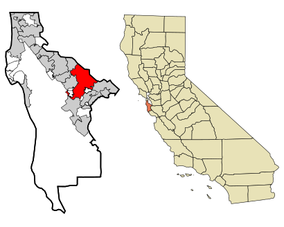
See Redwood City on the map
Directions to Redwood City with public transportation
The following transit lines have routes that pass near Redwood City
 Bus:
Bus: - Train:
How to get to Redwood City by bus?
Click on the bus route to see step by step directions with maps, line arrival times and updated time schedules.
How to get to Redwood City by train?
Click on the train route to see step by step directions with maps, line arrival times and updated time schedules.
Bus stations near Redwood City
- El Camino Real & Jefferson Ave,3 min walk,
- Jefferson Ave at Adams St,4 min walk,
- El Camino Real & Winklebleck St,4 min walk,
- Redwood City Caltrain Station,5 min walk,
- Redwood City Station,5 min walk,
- Winslow St & Broadway St,5 min walk,
Train stations near Redwood City
- Redwood City,47 min walk,
Bus lines to Redwood City
- ECR,Palo Alto Transit Center,
- 278,Redwood City Transit Center,
- 295,San Mateo,
- 397,San Francisco,
- RWC,On Broadway @ Cardinal Hall,
- MPT SHUTTLE,Redwood City Caltrain Station,
- SEA,Galveston,
- FLIXBUS N2002,Richmond (Richmond BART Station),
- EPX,Salesforce Transit Center,
- 270,Redwood City Caltrain - Florence/17th loop,
- 276,Redwood City Transit Ctr - Bohannon/Campbell,
- 296,Redwood City Transit Center - Bayshore/Donohoe,
- 296O,Redwood City TC- Palo Alto TC,
What are the closest stations to Redwood City?
The closest stations to Redwood City are:
- El Camino Real & Jefferson Ave is 213 yards away, 3 min walk.
- Jefferson Ave at Adams St is 273 yards away, 4 min walk.
- El Camino Real & Winklebleck St is 317 yards away, 4 min walk.
- Redwood City Caltrain Station is 351 yards away, 5 min walk.
- Redwood City Station is 367 yards away, 5 min walk.
- Winslow St & Broadway St is 390 yards away, 5 min walk.
- Redwood City is 3913 yards away, 47 min walk.
Which bus line stops near Redwood City?
ECR
Which train lines stop near Redwood City?
These train lines stop near Redwood City: BULLET, LOCAL, LTD 3.
What’s the nearest bus stop to Redwood City?
The nearest bus stop to Redwood City is El Camino Real & Jefferson Ave. It’s a 3 min walk away.
What time is the first train to Redwood City?
The LOCAL is the first train that goes to Redwood City. It stops nearby at 5:08 AM.
What time is the last train to Redwood City?
The LOCAL is the last train that goes to Redwood City. It stops nearby at 12:54 AM.
What time is the first bus to Redwood City?
The FLIXBUS N2002 is the first bus that goes to Redwood City. It stops nearby at 3:05 AM.
What time is the last bus to Redwood City?
The FLIXBUS N2002 is the last bus that goes to Redwood City. It stops nearby at 9:15 AM.
How much is the train fare to Redwood City?
The train fare to Redwood City costs about $3.20 - $14.45.
See Redwood City on the map
Public Transportation to Redwood City
Wondering how to get to Redwood City, United States? Moovit helps you find the best way to get to Redwood City with step-by-step directions from the nearest public transit station.
Moovit provides free maps and live directions to help you navigate through your city. View schedules, routes, timetables, and find out how long does it take to get to Redwood City in real time.
Looking for the nearest stop or station to Redwood City? Check out this list of stops closest to your destination: El Camino Real & Jefferson Ave; Jefferson Ave at Adams St; El Camino Real & Winklebleck St; Redwood City Caltrain Station; Redwood City Station; Winslow St & Broadway St; Redwood City.
Bus:Train:
Want to see if there’s another route that gets you there at an earlier time? Moovit helps you find alternative routes or times. Get directions from and directions to Redwood City easily from the Moovit App or Website.
We make riding to Redwood City easy, which is why over 1.5 million users, including users in San Francisco - San Jose, CA, trust Moovit as the best app for public transit. You don’t need to download an individual bus app or train app, Moovit is your all-in-one transit app that helps you find the best bus time or train time available.
For information on prices of bus and train, costs and ride fares to Redwood City, please check the Moovit app.
Use the app to navigate to popular places including to the airport, hospital, stadium, grocery store, mall, coffee shop, school, college, and university.
Location: San Francisco - San Jose, CA
Popular routes to Redwood City
Popular routes from Redwood City
Attractions near Redwood City
Redwood City TRANSIT Center,Redwood City Caltrain Station,On Your Mind,TSG Capital Holdings, LLC,Redwood,Ogiku,Tactile,1047 Startup Space,Fresh Carpet Care,Flixbus - Redwood City,Jamba,Perfect 10 Nails,Connect Community Charter School,American Airport and Limousine Services,Alnation Realty Investments,Aquatech Swimming Pools,Gryphon Publishing,Percom Consulting,Cheryl Vistnes Interiors,StarshipHow to get to popular attractions in San Francisco - San Jose, CA with public transit
City of Fremont, Fremont,Safeway Corporate Headquarters, Pleasanton,Apple Valley Fair, San Jose,Nordstrom Broadway Plaza in Walnut Creek, Walnut Creek,McCarthy Ranch, Milpitas,Daly City BART, Daly City,Costco Wholesale, Sunnyvale,Tesla Motors, Fremont,PayPal, San Jose,eBay Headquarters, San Jose,California's Great America, Santa Clara,Old Navy Inc Headquarters, Soma, Sf,The Home Depot, Concord,Charles M. Schulz - Sonoma County Airport (STS),Japantown, Western Addition, Sf,San Antonio Caltrain Station,Stonestown Galleria Mall, Lakeshore, Sf,Golden Gate Park, Golden Gate Park, Sf,San Francisco-Oakland Bay Bridge, Treasure Island, Sf,Costco WholesaleGet around San Francisco - San Jose, CA by public transit!
Traveling around San Francisco - San Jose, CA has never been so easy. See step by step directions as you travel to any attraction, street or major public transit station. View bus and train schedules, arrival times, service alerts and detailed routes on a map, so you know exactly how to get to anywhere in San Francisco - San Jose, CA.
When traveling to any destination around San Francisco - San Jose, CA use Moovit's Live Directions with Get Off Notifications to know exactly where and how far to walk, how long to wait for your line, and how many stops are left. Moovit will alert you when it's time to get off — no need to constantly re-check whether yours is the next stop.
Wondering how to use public transit in San Francisco - San Jose, CA or how to pay for public transit in San Francisco - San Jose, CA? Moovit public transit app can help you navigate your way with public transit easily, and at minimum cost. It includes public transit fees, ticket prices, and costs. Looking for a map of San Francisco - San Jose, CA public transit lines? Moovit public transit app shows all public transit maps in San Francisco - San Jose, CA with all bus or train routes and stops on an interactive map.
San Francisco - San Jose, CA has 2 transit type(s), including: bus or train, operated by several transit agencies, including BART, Bay Area Rapid Transit, Muni Metro, Caltrain, VTA, Capitol Corridor, Sonoma Marin Area Rail Transit, MUNI, VTA, SF Cable Car, AC Transit, Dumbarton Express, Golden Gate Transit, County Connection and SamTrans