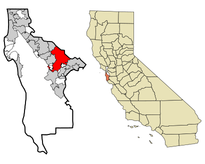
See Redwood City on the map
Directions to Redwood City with public transportation
The following transit lines have routes that pass near Redwood City
Bus:
Train:
How to get to Redwood City by Bus?
Click on the Bus route to see step by step directions with maps, line arrival times and updated time schedules.
How to get to Redwood City by Train?
Click on the Train route to see step by step directions with maps, line arrival times and updated time schedules.
Bus stations near Redwood City
- Redwood City Caltrain-Bay,2 min walk,
Train stations near Redwood City
- Redwood City,2 min walk,
Bus lines to Redwood City
- ECR,Daly City BART - Palo Alto Transit Ctr,
- 270,Redwood City Caltrain - Florence/17th loop,
- 276,Redwood City Transit Ctr - Bohannon/Campbell,
- 278,Redwood City Caltrain - Canada College,
- 295,Hillsdale Mall - Redwood City Transit Center,
- 296,Redwood City Transit Center - Bayshore/Donohoe,
- 296O,Redwood City TC- Palo Alto TC,
- 397,San Francisco - Palo Alto Transit Ctr,
What are the closest stations to Redwood City?
The closest stations to Redwood City are:
- Redwood City Caltrain-Bay is 98 yards away, 2 min walk.
- Redwood City is 109 yards away, 2 min walk.
Which Bus lines stop near Redwood City?
These Bus lines stop near Redwood City: ECR
Which Train lines stop near Redwood City?
These Train lines stop near Redwood City: BABY BULLET, LIMITED
What’s the nearest train station to Redwood City?
The nearest train station to Redwood City is Redwood City. It’s a 2 min walk away.
What’s the nearest bus stop to Redwood City?
The nearest bus stop to Redwood City is Redwood City Caltrain-Bay. It’s a 2 min walk away.
See Redwood City on the map

Public Transportation to Redwood City
Wondering how to get to Redwood City, United States? Moovit helps you find the best way to get to Redwood City with step-by-step directions from the nearest public transit station.
Moovit provides free maps and live directions to help you navigate through your city. View schedules, routes, timetables, and find out how long does it take to get to Redwood City in real time.
Looking for the nearest stop or station to Redwood City? Check out this list of stops closest to your destination: Redwood City Caltrain-Bay; Redwood City.
Bus:Train:
Want to see if there’s another route that gets you there at an earlier time? Moovit helps you find alternative routes or times. Get directions from and directions to Redwood City easily from the Moovit App or Website.
We make riding to Redwood City easy, which is why over 1.5 million users, including users in Redwood City, trust Moovit as the best app for public transit. You don’t need to download an individual bus app or train app, Moovit is your all-in-one transit app that helps you find the best bus time or train time available.
For information on prices of Bus and Train, costs and ride fares to Redwood City, please check the Moovit app.
Use the app to navigate to popular places including to the airport, hospital, stadium, grocery store, mall, coffee shop, school, college, and university.
Redwood City Address: Marshall Street street in Redwood City

Attractions near Redwood City
- Caltrain 218
- Arguello Plaza
- A1 Party Rental And Events
- Kristi Marie's
- Aili Ice Designs
- Gym @ 201 Marshall
- Curry Wrapper's Delight
- La Fiesta
- Zipcar
- Nikko's Mexican Grill
- 34 California Street
- Luann's Salon
- Golden Time Jewelers
- 201 Marshall
- Peacebank Yoga
- Spruce Salon
- The Sandwich Spot
- Active Aggie
- Eastwick Movie Premiere
- Peet's Coffee & Tea
How to get to popular attractions in Redwood City with public transit
- AMC Saratoga 14, San Jose
- Fry's Electronics, Sunnyvale
- Whole Foods Market, Walnut Creek
- Stonestown Galleria Mall, Lakeshore, Sf
- Mountain View VTA Light Rail Station
- Nordstrom Valley Fair, San Jose
- Microsoft SVC
- Kaiser Permanente Medical Center, Santa Clara
- Fremont BART Station, Fremont
- San Antonio Caltrain Station
- Googleplex - 43
- Mountain View, CA
- Tesla Motors, Fremont
- I-80, Emeryville
- Safeway, Hayward
- Sonoma County Fairgrounds, Santa Rosa
- IKEA, East Palo Alto
- City of Fremont, Fremont
- Union City BART Station, Union City
- Mansion Grove Apartments, Santa Clara