How to get to Reed Jeep by bus?
Click on the bus route to see step by step directions with maps, line arrival times and updated time schedules.
Bus stop near Reed Jeep in Overland Park
- On Metcalf at 91st St Sb, 6 min walk,VIEW
What are the closest stations to Reed Jeep?
The closest stations to Reed Jeep are:
- On Metcalf at 91st St Sb is 465 yards away, 6 min walk.
Which bus lines stop near Reed Jeep?
These bus lines stop near Reed Jeep: 401, 487.
What’s the nearest bus station to Reed Jeep in Overland Park?
The nearest bus station to Reed Jeep in Overland Park is On Metcalf at 91st St Sb. It’s a 6 min walk away.
What time is the first bus to Reed Jeep in Overland Park?
The 404 is the first bus that goes to Reed Jeep in Overland Park. It stops nearby at 5:11 AM.
What time is the last bus to Reed Jeep in Overland Park?
The 401 is the last bus that goes to Reed Jeep in Overland Park. It stops nearby at 10:35 PM.
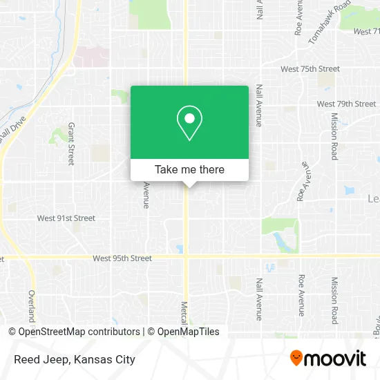
See Reed Jeep, Overland Park, on the map
Public Transit to Reed Jeep in Overland Park
Wondering how to get to Reed Jeep in Overland Park? Moovit helps you find the best way to get to Reed Jeep with step-by-step directions from the nearest public transit station.
Moovit provides free maps and live directions to help you navigate through your city. View schedules, routes, timetables, and find out how long does it take to get to Reed Jeep in real time.
Looking for the nearest stop or station to Reed Jeep? Check out this list of stops closest to your destination: On Metcalf at 91st St Sb.
Bus: 401, 487, 404.
Want to see if there’s another route that gets you there at an earlier time? Moovit helps you find alternative routes or times. Get directions from and directions to Reed Jeep easily from the Moovit App or Website.
We make riding to Reed Jeep easy, which is why over 1.5 million users, including users in Overland Park, trust Moovit as the best app for public transit. You don’t need to download an individual bus app or train app, Moovit is your all-in-one transit app that helps you find the best bus time or train time available.
For information on prices of bus, costs and ride fares to Reed Jeep, please check the Moovit app.
Use the app to navigate to popular places including to the airport, hospital, stadium, grocery store, mall, coffee shop, school, college, and university.
Reed Jeep Address: 8775 Metcalf Ave Overland Park, KS 66212 street in Overland Park
- MRS. Okturia Ross,
- JQ's Bfit2 Gym,
- Rock Steady Boxing Johnson County,
- STARBUCKS,
- Johnson County Art And Heritage Center,
- Upgrade Group Training,
- A MF Northland Lanes,
- Baby Nails and Wax 3 I,
- Eye Associates of North Overland Park,
- Blissful Honeymoons & Destination Weddings,
- Pre'Cis Nails by Shameca,
- Blu Bird Spa,
- Christopher Sogas,
- Sogasworks,
- Curious Sofa,
- Unique Collectables From Monahan,
- Glenwood Antique Mall,
- Keyme Locksmiths,
- Western Union,
- Servfun
Places Near Reed Jeep (Overland Park)
- Kansas City Zoo,
- Country Club Plaza,
- Worlds of Fun,
- Legends Outlets Kansas City, Kansas City,
- Liberty, MO, Liberty,
- The Glory Hole,
- Walmart, Kansas City,
- Grandview, MO, Grandview,
- Stans Glory Hole,
- Ku Medical Center, Kansas City,
- GEHA Field at Arrowhead Stadium,
- Arrowhead Stadium,
- Harrah's Casino, North Kansas City,
- Truman Medical Center,
- T-Mobile Center,
- Walmart Supercenter,
- Kauffman Stadium,
- Kansas City International Airport (MCI) (Kansas City International Airport),
- Amazon Fulfilment Center-MKC6, Kansas City,
- St. Luke's Hospital - Medical Plaza I
How to get to popular places in Kansas City with public transit
Get around Overland Park by public transit!
Traveling around Overland Park has never been so easy. See step by step directions as you travel to any attraction, street or major public transit station. View bus and train schedules, arrival times, service alerts and detailed routes on a map, so you know exactly how to get to anywhere in Overland Park.
When traveling to any destination around Overland Park use Moovit's Live Directions with Get Off Notifications to know exactly where and how far to walk, how long to wait for your line, and how many stops are left. Moovit will alert you when it's time to get off — no need to constantly re-check whether yours is the next stop.
Wondering how to use public transit in Overland Park or how to pay for public transit in Overland Park? Moovit public transit app can help you navigate your way with public transit easily, and at minimum cost. It includes public transit fees, ticket prices, and costs. Looking for a map of Overland Park public transit lines? Moovit public transit app shows all public transit maps in Overland Park with all Bus, Train and Light Rail routes and stops on an interactive map.
Kansas City has 3 transit type(s), including: Bus, Train and Light Rail, operated by several transit agencies, including Kansas City Area Transportation Authority, Lawrence Transit, Topeka Metro, RideKC Johnson County, Amtrak, Greyhound-us and FlixBus-us