See Reedville Creek Park, Hillsboro, on the map
Directions to Reedville Creek Park (Hillsboro) with public transportation
The following transit lines have routes that pass near Reedville Creek Park
 Bus:
Bus:
How to get to Reedville Creek Park by bus?
Click on the bus route to see step by step directions with maps, line arrival times and updated time schedules.
Light Rail stations near Reedville Creek Park in Hillsboro
- Quatama/NW 205th Ave,35 min walk,
What are the closest stations to Reedville Creek Park?
The closest stations to Reedville Creek Park are:
- Quatama/NW 205th Ave is 2951 yards away, 35 min walk.
Which bus lines stop near Reedville Creek Park?
These bus lines stop near Reedville Creek Park: 47, 57.
What time is the first light rail to Reedville Creek Park in Hillsboro?
The BLUE is the first light rail that goes to Reedville Creek Park in Hillsboro. It stops nearby at 4:03 AM.
What time is the last light rail to Reedville Creek Park in Hillsboro?
The BLUE is the last light rail that goes to Reedville Creek Park in Hillsboro. It stops nearby at 2:13 AM.
See Reedville Creek Park, Hillsboro, on the map
Public Transit to Reedville Creek Park in Hillsboro
Wondering how to get to Reedville Creek Park in Hillsboro, United States? Moovit helps you find the best way to get to Reedville Creek Park with step-by-step directions from the nearest public transit station.
Moovit provides free maps and live directions to help you navigate through your city. View schedules, routes, timetables, and find out how long does it take to get to Reedville Creek Park in real time.
Looking for the nearest stop or station to Reedville Creek Park? Check out this list of stops closest to your destination: Quatama/NW 205th Ave.
Bus:
Want to see if there’s another route that gets you there at an earlier time? Moovit helps you find alternative routes or times. Get directions from and directions to Reedville Creek Park easily from the Moovit App or Website.
We make riding to Reedville Creek Park easy, which is why over 1.5 million users, including users in Hillsboro, trust Moovit as the best app for public transit. You don’t need to download an individual bus app or train app, Moovit is your all-in-one transit app that helps you find the best bus time or train time available.
For information on prices of bus and light rail, costs and ride fares to Reedville Creek Park, please check the Moovit app.
Use the app to navigate to popular places including to the airport, hospital, stadium, grocery store, mall, coffee shop, school, college, and university.
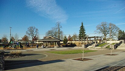
Reedville Creek Park Address: Southeast Cornelius Pass Road street in Hillsboro
Attractions near Reedville Creek Park
1786 SW Cornelius Pass Rd,Frances Park Open Space,R.A. Brown Middle School,Frances Park,The Hole,Hacienda Circle,Reimers Field,Quail Pointe Village,Chien,Copperleaf,Knoll West,Hemenway Field,Copperleaf,Hemenway Field,Brisban Farms,Langwood Crossing,SW Cornelius Pass Rd / SE Lois St,Lexington Village,Mohawk Meadows,Reedville MeadowsHow to get to popular attractions in Hillsboro with public transit
TriMet SE Fuller Rd MAX Station,Portland Streetcar SE Water & OMSI, Portland,Bob's Red Mill Whole Grain Store, Milwaukie,McCormick & Schmick's Harborside at the Marina, Portland,Fred Meyer Gas Station - Cornelius, Cornelius,Ringlers Pub, Portland,TriMet E 162nd Ave MAX Station, Gresham,Clark College, Vancouver,Clark County Courthouse, Vancouver,Burger King, Hillsboro,Cedar Mill, Beaverton,Oregon City Transit Center, Oregon City,Nike - Dan Fouts Building,Saburo's Sushi House, Portland,Fishers Landing, Vancouver,TriMet SE Flavel St MAX Station, Portland,IHOP, Portland,Hwy 26 at Cornelius Pass Rd, Hillsboro,TriMet E 181st Ave MAX Station, Gresham,Mt. Tabor Neighborhood, PortlandGet around Hillsboro by public transit!
Traveling around Hillsboro has never been so easy. See step by step directions as you travel to any attraction, street or major public transit station. View bus and train schedules, arrival times, service alerts and detailed routes on a map, so you know exactly how to get to anywhere in Hillsboro.
When traveling to any destination around Hillsboro use Moovit's Live Directions with Get Off Notifications to know exactly where and how far to walk, how long to wait for your line, and how many stops are left. Moovit will alert you when it's time to get off — no need to constantly re-check whether yours is the next stop.
Wondering how to use public transit in Hillsboro or how to pay for public transit in Hillsboro? Moovit public transit app can help you navigate your way with public transit easily, and at minimum cost. It includes public transit fees, ticket prices, and costs. Looking for a map of Hillsboro public transit lines? Moovit public transit app shows all public transit maps in Hillsboro with all bus or light rail routes and stops on an interactive map.
Hillsboro has 2 transit type(s), including: bus or light rail, operated by several transit agencies, including Mount Adams Transportation Service, RiverCities Transit, TriMet , TriMet , TriMet, Portland Streetcar, Portland Aerial Tram, C-TRAN, Multnomah County Job Connector Shuttles, Washington Park Shuttle, SMART, Canby Area Transit, South Clackamas Transportation District, The Wave and Lincoln County Transit