Directions to Regal Commercial Real Estate (Boston) with public transportation
The following transit lines have routes that pass near Regal Commercial Real Estate
 Bus: 14.
How to get to Regal Commercial Real Estate by bus?
Click on the bus route to see step by step directions with maps, line arrival times and updated time schedules.
Bus stop near Regal Commercial Real Estate in Boston
- Post After Neptune, 13 min walk,VIEW
Bus lines to Regal Commercial Real Estate in Boston
- 14, Newport Via Jamestown,VIEW
What are the closest stations to Regal Commercial Real Estate?
The closest stations to Regal Commercial Real Estate are:
- Post After Neptune is 1016 yards away, 13 min walk.
Which bus line stops near Regal Commercial Real Estate?
14 (Newport Via Jamestown)
What’s the nearest bus station to Regal Commercial Real Estate in Boston?
The nearest bus station to Regal Commercial Real Estate in Boston is Post After Neptune. It’s a 13 min walk away.
What time is the first bus to Regal Commercial Real Estate in Boston?
The 14 is the first bus that goes to Regal Commercial Real Estate in Boston. It stops nearby at 5:22 AM.
What time is the last bus to Regal Commercial Real Estate in Boston?
The 14 is the last bus that goes to Regal Commercial Real Estate in Boston. It stops nearby at 9:15 PM.
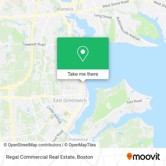
See Regal Commercial Real Estate, Boston, on the map
Public Transit to Regal Commercial Real Estate in Boston
Wondering how to get to Regal Commercial Real Estate in Boston? Moovit helps you find the best way to get to Regal Commercial Real Estate with step-by-step directions from the nearest public transit station.
Moovit provides free maps and live directions to help you navigate through your city. View schedules, routes, timetables, and find out how long does it take to get to Regal Commercial Real Estate in real time.
Looking for the nearest stop or station to Regal Commercial Real Estate? Check out this list of stops closest to your destination: Post After Neptune.
Bus: 14.
Want to see if there’s another route that gets you there at an earlier time? Moovit helps you find alternative routes or times. Get directions from and directions to Regal Commercial Real Estate easily from the Moovit App or Website.
We make riding to Regal Commercial Real Estate easy, which is why over 1.7 million users, including users in Boston, trust Moovit as the best app for public transit. You don’t need to download an individual bus app or train app, Moovit is your all-in-one transit app that helps you find the best bus time or train time available.
For information on prices of bus, costs and ride fares to Regal Commercial Real Estate, please check the Moovit app.
Use the app to navigate to popular places including to the airport, hospital, stadium, grocery store, mall, coffee shop, school, college, and university.
Regal Commercial Real Estate Address: Greenwich Mills, 42 Ladd St street in Boston
- Sherri Ann Boisvert, Warwick Realtor, Rhode Island,
- Mother's Milk Bank,
- Crystal Cleansers,
- Scrub-A-Pup,
- Thrive Wellness Collaborative,
- Angelhawk Reiki,
- Ryan Defond Holist,
- Spill the Tea,
- The Beauty Grind,
- Fisher Unitech,
- Communcation Infrastructure,
- Tiger Rug,
- Hitt Productions-Photography by Karen,
- Rutledge Recovery,
- Michael McMahon Realtor,
- Dockside Maid Service,
- Jorcan Fabrications,
- Melnick, Simon Dr - Ocean State Primary Care of East Greenwich,
- Sparkle & Shine Cleaning Services,
- Search Agency
Places Near Regal Commercial Real Estate (Boston)
- Boston Common, Boston,
- Boston Medical Center, Boston,
- North End, Boston,
- Td Garden, Boston,
- Boston Children's Hospital, Boston,
- Cheers, Boston,
- Seaport District, Boston,
- Museum Of Science, Boston,
- Isabella Stewart Gardner Museum, Boston,
- Faneuil Hall, Boston,
- Wang Theater, Boston,
- Prudential Center, Boston,
- Massachusetts General Hospital, Boston,
- Castle Island, Boston,
- Wilbur Theatre, Boston,
- Boston Convention & Exhibition Center, Boston,
- Mgm Music Hall, Boston,
- House Of Blues, Boston,
- Quincy Market, Boston,
- Leader Bank Pavilion (Leader Bank Pavillion), Boston
How to get to popular places in Boston with public transit
Get around Boston by public transit!
Traveling around Boston has never been so easy. See step by step directions as you travel to any attraction, street or major public transit station. View bus and train schedules, arrival times, service alerts and detailed routes on a map, so you know exactly how to get to anywhere in Boston.
When traveling to any destination around Boston use Moovit's Live Directions with Get Off Notifications to know exactly where and how far to walk, how long to wait for your line, and how many stops are left. Moovit will alert you when it's time to get off — no need to constantly re-check whether yours is the next stop.
Wondering how to use public transit in Boston or how to pay for public transit in Boston? Moovit public transit app can help you navigate your way with public transit easily, and at minimum cost. It includes public transit fees, ticket prices, and costs. Looking for a map of Boston public transit lines? Moovit public transit app shows all public transit maps in Boston with all Bus, Train, Subway and Ferry routes and stops on an interactive map.
Boston has 4 transit type(s), including: Bus, Train, Subway and Ferry, operated by several transit agencies, including MBTA, Southeastern Regional Transit Authority, MetroWest Regional Transit Authority, Rhode Island Public Transit Authority, WRTA, Lowell Regional Transit Authority, Merrimack Valley Transit, Montachusett Regional Transit Authority, Cape Cod Regional Transit Authority, Brockton Area Transit Authority, Martha's Vineyard Transit Authority, the WAVE - Nantucket Regional Transit Authority, GATRA, Cape Ann Transportation Authority and Massport