Directions to Regus (Newton) with public transportation
The following transit lines have routes that pass near Regus
 Bus: 57, 86, GREEN LINE B SHUTTLE, SHUTTLE, GREEN LINE B SHUTTLE.
- Train: FRAMINGHAM/WORCESTER.
- Subway: GREEN LINE B, GREEN LINE D.
How to get to Regus by bus?
Click on the bus route to see step by step directions with maps, line arrival times and updated time schedules.
From The Black Rose, Boston
70 minFrom Bos17 - Amazon, Boston
70 minFrom Intercontinental Boston, Boston
69 minFrom Brigham and Women's Hospital, Boston
48 minFrom Hebrew Rehab Center, Boston
57 minFrom Fairfield Inn Suites by Marriott Boston Cambridge, Cambridge
72 minFrom La Famiglia Giorgio's, Boston
73 minFrom Boston Tea Party - Ships And Museum, Boston
61 minFrom Biogen, Cambridge
64 minFrom Myers + Chang (Myers & Chang), Boston
58 min
How to get to Regus by train?
Click on the train route to see step by step directions with maps, line arrival times and updated time schedules.
How to get to Regus by subway?
Click on the subway route to see step by step directions with maps, line arrival times and updated time schedules.
From The Black Rose, Boston
63 minFrom Bos17 - Amazon, Boston
67 minFrom Intercontinental Boston, Boston
68 minFrom Brigham and Women's Hospital, Boston
47 minFrom Hebrew Rehab Center, Boston
96 minFrom Fairfield Inn Suites by Marriott Boston Cambridge, Cambridge
71 minFrom La Famiglia Giorgio's, Boston
64 minFrom Boston Tea Party - Ships And Museum, Boston
67 minFrom Biogen, Cambridge
71 minFrom Myers + Chang (Myers & Chang), Boston
65 min
Bus stops near Regus in Newton
Bus lines to Regus in Newton
- GREEN LINE B SHUTTLE, Back Bay (Shuttle),VIEW
- SHUTTLE, Kenmore (Shuttle),VIEW
- GREEN LINE B SHUTTLE, Boston College - Blandford Street,VIEW
- GREEN LINE B SHUTTLE, Boston College - Babcock Street,VIEW
- GREEN LINE B SHUTTLE, Boston College - Washington Street,VIEW
- GREEN LINE B SHUTTLE, Boston College - Packard's Corner,VIEW
What are the closest stations to Regus?
The closest stations to Regus are:
- Chestnut Hill is 855 yards away, 10 min walk.
- Boston College - Commonwealth Ave @ St Thomas More Rd is 995 yards away, 12 min walk.
- Boston College - Commonwealth Ave @ Lake St is 1002 yards away, 12 min walk.
- Boston College is 2410 yards away, 29 min walk.
Which bus lines stop near Regus?
These bus lines stop near Regus: 57, 86.
Which train line stops near Regus?
FRAMINGHAM/WORCESTER (#530 | South Station)
Which subway line stops near Regus?
GREEN LINE B (Boston College)
What’s the nearest subway station to Regus in Newton?
The nearest subway station to Regus in Newton is Chestnut Hill. It’s a 10 min walk away.
What’s the nearest bus station to Regus in Newton?
The nearest bus stations to Regus in Newton are Boston College - Commonwealth Ave @ St Thomas More Rd and Boston College - Commonwealth Ave @ Lake St. The closest one is a 12 min walk away.
What time is the first subway to Regus in Newton?
The GREEN LINE D is the first subway that goes to Regus in Newton. It stops nearby at 4:57 AM.
What time is the last subway to Regus in Newton?
The GREEN LINE B is the last subway that goes to Regus in Newton. It stops nearby at 2:39 AM.
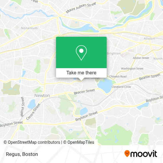
See Regus, Newton, on the map
Public Transit to Regus in Newton
Wondering how to get to Regus in Newton? Moovit helps you find the best way to get to Regus with step-by-step directions from the nearest public transit station.
Moovit provides free maps and live directions to help you navigate through your city. View schedules, routes, timetables, and find out how long does it take to get to Regus in real time.
Looking for the nearest stop or station to Regus? Check out this list of stops closest to your destination: Chestnut Hill; Boston College - Commonwealth Ave @ St Thomas More Rd; Boston College - Commonwealth Ave @ Lake St; Boston College.
Bus: 57, 86, GREEN LINE B SHUTTLE, SHUTTLE, GREEN LINE B SHUTTLE, GREEN LINE B SHUTTLE, GREEN LINE B SHUTTLE, GREEN LINE B SHUTTLE.Train: FRAMINGHAM/WORCESTER.Subway: GREEN LINE B, GREEN LINE D.
Want to see if there’s another route that gets you there at an earlier time? Moovit helps you find alternative routes or times. Get directions from and directions to Regus easily from the Moovit App or Website.
We make riding to Regus easy, which is why over 1.7 million users, including users in Newton, trust Moovit as the best app for public transit. You don’t need to download an individual bus app or train app, Moovit is your all-in-one transit app that helps you find the best bus time or train time available.
For information on prices of subway, bus and train, costs and ride fares to Regus, please check the Moovit app.
Use the app to navigate to popular places including to the airport, hospital, stadium, grocery store, mall, coffee shop, school, college, and university.
Regus Address: 7500 College Blvd street in Newton
- USPS,
- St Mary's Chapel,
- Automobile Shop,
- Alumni Stadium,
- McMullen Musuem,
- ChargePoint,
- Devlin Hall,
- Boston College,
- Dr Barry H Schneider Professor of Psychology,
- Whitney Laboratory,
- The Plex,
- USPS Collection Box - Blue Box,
- Follett,
- The Robsham Theater Arts Center,
- Ignacio Hall,
- The Chocolate Bar,
- Boston College Campus School,
- BC Office of Residential Life,
- Collegiate Press - BOS,
- Flynn Recreation Complex
Places Near Regus (Newton)
- Td Garden, Boston,
- Castle Island, Boston,
- Wilbur Theatre, Boston,
- Prudential Center, Boston,
- North End, Boston,
- Faneuil Hall, Boston,
- Massachusetts General Hospital, Boston,
- Seaport District, Boston,
- Boston Medical Center, Boston,
- House Of Blues, Boston,
- Boston Common, Boston,
- Boston Convention & Exhibition Center, Boston,
- Museum Of Science, Boston,
- Cheers, Boston,
- Boston Children's Hospital, Boston,
- Mgm Music Hall, Boston,
- Quincy Market, Boston,
- Isabella Stewart Gardner Museum, Boston,
- Wang Theater, Boston,
- Leader Bank Pavilion (Leader Bank Pavillion), Boston
How to get to popular places in Boston with public transit
Get around Newton by public transit!
Traveling around Newton has never been so easy. See step by step directions as you travel to any attraction, street or major public transit station. View bus and train schedules, arrival times, service alerts and detailed routes on a map, so you know exactly how to get to anywhere in Newton.
When traveling to any destination around Newton use Moovit's Live Directions with Get Off Notifications to know exactly where and how far to walk, how long to wait for your line, and how many stops are left. Moovit will alert you when it's time to get off — no need to constantly re-check whether yours is the next stop.
Wondering how to use public transit in Newton or how to pay for public transit in Newton? Moovit public transit app can help you navigate your way with public transit easily, and at minimum cost. It includes public transit fees, ticket prices, and costs. Looking for a map of Newton public transit lines? Moovit public transit app shows all public transit maps in Newton with all Bus, Train, Subway and Ferry routes and stops on an interactive map.
Boston has 4 transit type(s), including: Bus, Train, Subway and Ferry, operated by several transit agencies, including MBTA, Southeastern Regional Transit Authority, MetroWest Regional Transit Authority, Rhode Island Public Transit Authority, WRTA, Lowell Regional Transit Authority, Merrimack Valley Transit, Montachusett Regional Transit Authority, Cape Cod Regional Transit Authority, Brockton Area Transit Authority, Martha's Vineyard Transit Authority, the WAVE - Nantucket Regional Transit Authority, GATRA, Cape Ann Transportation Authority and Massport