Directions to Rei Do Funk (Somerville) with public transportation
The following transit lines have routes that pass near Rei Do Funk
 Bus: 101, 109, 85, 89, 89/93.
- Train: FITCHBURG.
- Subway: GREEN LINE E, GREEN LINE B, GREEN LINE C, ORANGE LINE.
How to get to Rei Do Funk by bus?
Click on the bus route to see step by step directions with maps, line arrival times and updated time schedules.
From Dartmouth, Boston
56 minFrom JFK Library, Boston
106 minFrom Harvard Vanguard - Kenmore, Boston
47 minFrom UMass Boston Campus Center, Boston
107 minFrom Castle Island, Boston
76 minFrom Heartbreak Hill, Newton
83 minFrom Kowloon Restaurant, Saugus
55 minFrom Boston Marriott Long Wharf Hotel Boston, Boston
40 minFrom Beth Israel Hospital, Boston
48 minFrom Dorchester, Boston
109 min
How to get to Rei Do Funk by train?
Click on the train route to see step by step directions with maps, line arrival times and updated time schedules.
How to get to Rei Do Funk by subway?
Click on the subway route to see step by step directions with maps, line arrival times and updated time schedules.
From Dartmouth, Boston
44 minFrom JFK Library, Boston
70 minFrom Harvard Vanguard - Kenmore, Boston
56 minFrom UMass Boston Campus Center, Boston
70 minFrom Heartbreak Hill, Newton
82 minFrom Boston Marriott Long Wharf Hotel Boston, Boston
34 minFrom Beth Israel Hospital, Boston
61 minFrom Dorchester, Boston
62 min
Bus stops near Rei Do Funk in Somerville
Subway stations near Rei Do Funk in Somerville
Bus lines to Rei Do Funk in Somerville
- 89, Sullivan,VIEW
- 101, Malden,VIEW
- 89/93, Haymarket Via Sullivan,VIEW
- 95, Arlington Center,VIEW
- 80, Lechmere - Arlington Center,VIEW
- GREEN LINE E SHUTTLE, Government Center - Medford/Tufts (Shuttle),VIEW
- GREEN LINE E SHUTTLE, North Station - Medford/Tufts (Shuttle),VIEW
- GREEN LINE E SHUTTLE, Medford/Tufts - North Station,VIEW
- GREEN LINE SHUTTLE, Medford/Tufts - Government Center via Union Square,VIEW
What are the closest stations to Rei Do Funk?
The closest stations to Rei Do Funk are:
- Broadway @ Marshall St is 77 yards away, 2 min walk.
- Mystic Ave @ Wheatland St is 572 yards away, 7 min walk.
- Medford St @ School St is 603 yards away, 8 min walk.
- Gilman Square is 2068 yards away, 25 min walk.
- Assembly is 3237 yards away, 38 min walk.
Which bus lines stop near Rei Do Funk?
These bus lines stop near Rei Do Funk: 101, 109, 85, 89.
Which train line stops near Rei Do Funk?
FITCHBURG (#409 | Wachusett)
Which subway line stops near Rei Do Funk?
GREEN LINE E (Lechmere)
What’s the nearest subway station to Rei Do Funk in Somerville?
The nearest subway station to Rei Do Funk in Somerville is Gilman Square. It’s a 25 min walk away.
What’s the nearest bus station to Rei Do Funk in Somerville?
The nearest bus station to Rei Do Funk in Somerville is Broadway @ Marshall St. It’s a 2 min walk away.
What time is the first subway to Rei Do Funk in Somerville?
The GREEN LINE E is the first subway that goes to Rei Do Funk in Somerville. It stops nearby at 4:49 AM.
What time is the last subway to Rei Do Funk in Somerville?
The GREEN LINE E is the last subway that goes to Rei Do Funk in Somerville. It stops nearby at 2:38 AM.
What time is the first bus to Rei Do Funk in Somerville?
The 89/93 is the first bus that goes to Rei Do Funk in Somerville. It stops nearby at 4:39 AM.
What time is the last bus to Rei Do Funk in Somerville?
The 89 is the last bus that goes to Rei Do Funk in Somerville. It stops nearby at 1:46 AM.
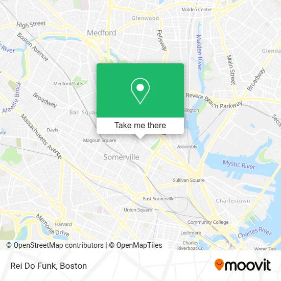
See Rei Do Funk, Somerville, on the map
Public Transit to Rei Do Funk in Somerville
Wondering how to get to Rei Do Funk in Somerville? Moovit helps you find the best way to get to Rei Do Funk with step-by-step directions from the nearest public transit station.
Moovit provides free maps and live directions to help you navigate through your city. View schedules, routes, timetables, and find out how long does it take to get to Rei Do Funk in real time.
Looking for the nearest stop or station to Rei Do Funk? Check out this list of stops closest to your destination: Broadway @ Marshall St; Mystic Ave @ Wheatland St; Medford St @ School St; Gilman Square; Assembly.
Bus: 101, 109, 85, 89, 89/93, 95, 80, GREEN LINE E SHUTTLE, GREEN LINE E SHUTTLE, GREEN LINE E SHUTTLE, GREEN LINE SHUTTLE.Train: FITCHBURG.Subway: GREEN LINE E, GREEN LINE B, GREEN LINE C, ORANGE LINE.
Want to see if there’s another route that gets you there at an earlier time? Moovit helps you find alternative routes or times. Get directions from and directions to Rei Do Funk easily from the Moovit App or Website.
We make riding to Rei Do Funk easy, which is why over 1.7 million users, including users in Somerville, trust Moovit as the best app for public transit. You don’t need to download an individual bus app or train app, Moovit is your all-in-one transit app that helps you find the best bus time or train time available.
For information on prices of bus, subway and train, costs and ride fares to Rei Do Funk, please check the Moovit app.
Use the app to navigate to popular places including to the airport, hospital, stadium, grocery store, mall, coffee shop, school, college, and university.
Rei Do Funk Address: 311 Broadway street in Somerville
- Adt Security Services,
- Daniel's Painting,
- Wellisandra Boutique,
- Mejia Tree Service,
- Broadway Dollar,
- Winter Hill Brewery,
- Scott Brothers Kitchen & Market,
- Sewall Commons,
- Gaurab Basu, MD,
- Matthew Corey, MD,
- Daphne Schneider, MD,
- Bonni Stahl, MD,
- Rachel Stark, MD,
- Sion Sda Church,
- Bontronics,
- Walgreens,
- Sneaker Barn,
- Cryptobase Bitcoin ATM,
- Carewell Urgent Care,
- Elisha Hopkins House
Places Near Rei Do Funk (Somerville)
- Boston Children's Hospital, Boston,
- North End, Boston,
- Isabella Stewart Gardner Museum, Boston,
- Museum Of Science, Boston,
- Massachusetts General Hospital, Boston,
- House Of Blues, Boston,
- Seaport District, Boston,
- Leader Bank Pavilion (Leader Bank Pavillion), Boston,
- Mgm Music Hall, Boston,
- Faneuil Hall, Boston,
- Wang Theater, Boston,
- Boston Convention & Exhibition Center, Boston,
- Quincy Market, Boston,
- Td Garden, Boston,
- Cheers, Boston,
- Prudential Center, Boston,
- Wilbur Theatre, Boston,
- Castle Island, Boston,
- Boston Medical Center, Boston,
- Boston Common, Boston
How to get to popular places in Boston with public transit
Get around Somerville by public transit!
Traveling around Somerville has never been so easy. See step by step directions as you travel to any attraction, street or major public transit station. View bus and train schedules, arrival times, service alerts and detailed routes on a map, so you know exactly how to get to anywhere in Somerville.
When traveling to any destination around Somerville use Moovit's Live Directions with Get Off Notifications to know exactly where and how far to walk, how long to wait for your line, and how many stops are left. Moovit will alert you when it's time to get off — no need to constantly re-check whether yours is the next stop.
Wondering how to use public transit in Somerville or how to pay for public transit in Somerville? Moovit public transit app can help you navigate your way with public transit easily, and at minimum cost. It includes public transit fees, ticket prices, and costs. Looking for a map of Somerville public transit lines? Moovit public transit app shows all public transit maps in Somerville with all Bus, Train, Subway and Ferry routes and stops on an interactive map.
Boston has 4 transit type(s), including: Bus, Train, Subway and Ferry, operated by several transit agencies, including MBTA, Southeastern Regional Transit Authority, MetroWest Regional Transit Authority, Rhode Island Public Transit Authority, WRTA, Lowell Regional Transit Authority, Merrimack Valley Transit, Montachusett Regional Transit Authority, Cape Cod Regional Transit Authority, Brockton Area Transit Authority, Martha's Vineyard Transit Authority, the WAVE - Nantucket Regional Transit Authority, GATRA, Cape Ann Transportation Authority and Massport