Directions to Reign Fire Church (Boston) with public transportation
The following transit lines have routes that pass near Reign Fire Church
 Bus: B6.
How to get to Reign Fire Church by bus?
Click on the bus route to see step by step directions with maps, line arrival times and updated time schedules.
From Dcu Center, Worcester
120 minFrom South High Community School, Worcester
215 minFrom Foxwoods, Worcester
148 minFrom Registry Of Motor Vehicles (Rmv) Branch Office, Worcester
122 minFrom Walmart Supercenter, Worcester
177 minFrom Polar Park, Worcester
120 minFrom Worcester, MA, Worcester
118 minFrom Palladium, Worcester
123 min
Bus stop near Reign Fire Church in Boston
- Main / Oak, 1 min walk,VIEW
Bus lines to Reign Fire Church in Boston
- B6, Ludlow Big Y Via Bay/Berkshire,VIEW
What are the closest stations to Reign Fire Church?
The closest stations to Reign Fire Church are:
- Main / Oak is 67 yards away, 1 min walk.
Which bus line stops near Reign Fire Church?
B6 (Ludlow Big Y Via Bay/Berkshire/Pasco)
What’s the nearest bus station to Reign Fire Church in Boston?
The nearest bus station to Reign Fire Church in Boston is Main / Oak. It’s a 1 min walk away.
What time is the first bus to Reign Fire Church in Boston?
The B6 is the first bus that goes to Reign Fire Church in Boston. It stops nearby at 5:31 AM.
What time is the last bus to Reign Fire Church in Boston?
The B6 is the last bus that goes to Reign Fire Church in Boston. It stops nearby at 10:16 PM.
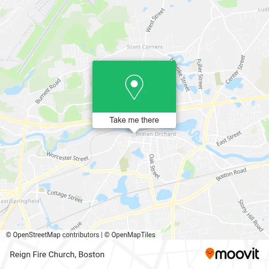
See Reign Fire Church, Boston, on the map
Public Transit to Reign Fire Church in Boston
Wondering how to get to Reign Fire Church in Boston? Moovit helps you find the best way to get to Reign Fire Church with step-by-step directions from the nearest public transit station.
Moovit provides free maps and live directions to help you navigate through your city. View schedules, routes, timetables, and find out how long does it take to get to Reign Fire Church in real time.
Looking for the nearest stop or station to Reign Fire Church? Check out this list of stops closest to your destination: Main / Oak.
Bus: B6.
Want to see if there’s another route that gets you there at an earlier time? Moovit helps you find alternative routes or times. Get directions from and directions to Reign Fire Church easily from the Moovit App or Website.
We make riding to Reign Fire Church easy, which is why over 1.7 million users, including users in Boston, trust Moovit as the best app for public transit. You don’t need to download an individual bus app or train app, Moovit is your all-in-one transit app that helps you find the best bus time or train time available.
For information on prices of bus, costs and ride fares to Reign Fire Church, please check the Moovit app.
Use the app to navigate to popular places including to the airport, hospital, stadium, grocery store, mall, coffee shop, school, college, and university.
Reign Fire Church Address: 1060 Worcester St street in Boston
- Saint Jude Church,
- Saint Matthews Church,
- La Familia Portuguesa,
- Goodwin Park,
- Youthful Expressions,
- Blue X Solutions,
- Orchard Substation,
- Auto Motion,
- Friendly Auto Repair,
- Nick's Auto & Truck,
- All American Masonry & Sweeps,
- Aquatic Diving Adventures,
- New Beginnings Transportation,
- Indian Orchard Hydro,
- Puppet Pelts,
- Guidance Pathway Systems,
- Giclee Printing & Framing of New England,
- Grand Prix International,
- Jasm Enterprises,
- Art Diversified
Places Near Reign Fire Church (Boston)
- Leader Bank Pavilion (Leader Bank Pavillion), Boston,
- Seaport District, Boston,
- Boston Convention & Exhibition Center, Boston,
- Boston Common, Boston,
- Td Garden, Boston,
- Cheers, Boston,
- Quincy Market, Boston,
- North End, Boston,
- Faneuil Hall, Boston,
- Isabella Stewart Gardner Museum, Boston,
- Wang Theater, Boston,
- Museum Of Science, Boston,
- Mgm Music Hall, Boston,
- Boston Children's Hospital, Boston,
- Boston Medical Center, Boston,
- Castle Island, Boston,
- Prudential Center, Boston,
- Wilbur Theatre, Boston,
- Massachusetts General Hospital, Boston,
- House Of Blues, Boston
How to get to popular places in Boston with public transit
Get around Boston by public transit!
Traveling around Boston has never been so easy. See step by step directions as you travel to any attraction, street or major public transit station. View bus and train schedules, arrival times, service alerts and detailed routes on a map, so you know exactly how to get to anywhere in Boston.
When traveling to any destination around Boston use Moovit's Live Directions with Get Off Notifications to know exactly where and how far to walk, how long to wait for your line, and how many stops are left. Moovit will alert you when it's time to get off — no need to constantly re-check whether yours is the next stop.
Wondering how to use public transit in Boston or how to pay for public transit in Boston? Moovit public transit app can help you navigate your way with public transit easily, and at minimum cost. It includes public transit fees, ticket prices, and costs. Looking for a map of Boston public transit lines? Moovit public transit app shows all public transit maps in Boston with all Bus, Train, Subway and Ferry routes and stops on an interactive map.
Boston has 4 transit type(s), including: Bus, Train, Subway and Ferry, operated by several transit agencies, including MBTA, Southeastern Regional Transit Authority, MetroWest Regional Transit Authority, Rhode Island Public Transit Authority, WRTA, Lowell Regional Transit Authority, Merrimack Valley Transit, Montachusett Regional Transit Authority, Cape Cod Regional Transit Authority, Brockton Area Transit Authority, Martha's Vineyard Transit Authority, the WAVE - Nantucket Regional Transit Authority, GATRA, Cape Ann Transportation Authority and Massport