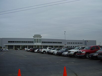
See Reliant Center, Houston, on the map
Directions to Reliant Center (Houston) with public transportation
The following transit lines have routes that pass near Reliant Center
 Bus:
Bus: - Light Rail:
How to get to Reliant Center by bus?
Click on the bus route to see step by step directions with maps, line arrival times and updated time schedules.
Light Rail stations near Reliant Center in Houston
- Reliant Park,5 min walk,
Bus stations near Reliant Center in Houston
- Kirby Dr @ MC Nee Rd,9 min walk,
- Knight Rd @ Holly Hall St,11 min walk,
Bus lines to Reliant Center in Houston
- 84,Northwest Tc - Northbound,
- 60,El Camino St - Southbound,
What are the closest stations to Reliant Center?
The closest stations to Reliant Center are:
- Reliant Park is 350 yards away, 5 min walk.
- Kirby Dr @ MC Nee Rd is 748 yards away, 9 min walk.
- Knight Rd @ Holly Hall St is 871 yards away, 11 min walk.
Which bus lines stop near Reliant Center?
These bus lines stop near Reliant Center: 41, 60, 84.
Which light rail line stops near Reliant Center?
700
What’s the nearest light rail station to Reliant Center in Houston?
The nearest light rail station to Reliant Center in Houston is Reliant Park. It’s a 5 min walk away.
What’s the nearest bus stop to Reliant Center in Houston?
The nearest bus stop to Reliant Center in Houston is Kirby Dr @ MC Nee Rd. It’s a 9 min walk away.
See Reliant Center, Houston, on the map
Public Transit to Reliant Center in Houston
Wondering how to get to Reliant Center in Houston, United States? Moovit helps you find the best way to get to Reliant Center with step-by-step directions from the nearest public transit station.
Moovit provides free maps and live directions to help you navigate through your city. View schedules, routes, timetables, and find out how long does it take to get to Reliant Center in real time.
Looking for the nearest stop or station to Reliant Center? Check out this list of stops closest to your destination: Reliant Park; Kirby Dr @ MC Nee Rd; Knight Rd @ Holly Hall St.
Bus:Light Rail:
Want to see if there’s another route that gets you there at an earlier time? Moovit helps you find alternative routes or times. Get directions from and directions to Reliant Center easily from the Moovit App or Website.
We make riding to Reliant Center easy, which is why over 1.5 million users, including users in Houston, trust Moovit as the best app for public transit. You don’t need to download an individual bus app or train app, Moovit is your all-in-one transit app that helps you find the best bus time or train time available.
For information on prices of bus and light rail, costs and ride fares to Reliant Center, please check the Moovit app.
Use the app to navigate to popular places including to the airport, hospital, stadium, grocery store, mall, coffee shop, school, college, and university.
Location: Houston
Attractions near Reliant Center
Public Storage,Bellaire United Methodist Church,Evelyn’S Park,Little Woodrow'S In Bellaire,Iburn,Black Eyed Pea,Moeller'S Bakery,Willow Meadows Baptist Church,North Junction,Simon Printing,Congregation Adath Emeth,Woodshire,Shearn School,Shearn Elementary School,Preferred Bank,Discount Tire Co,O'Reilly Auto Parts,Brake Check,Woodside,Sellers BrosHow to get to popular attractions in Houston with public transit
METRO Missouri City Park & Ride, Houston,Exxonmobil, Houston,Aldine Westfield Road at FM 1960, Houston,Treebeards - The Tunnel, Houston,Ecopark Shuttle Bus, Houston,Houston Community College West Loop Campus, Houston,I-10 & Studemont St, Houston,Hard Rock Cafe Houston Airport, Houston,SHEPHERD AND LITTLE YORK, Houston,I-610 South Loop & 288 South Fwy, Houston,288 South Freeway and Airport Blvd., Houston,Golden Corral, Houston,Beltway 8 & Hwy 59, Houston,Bechtel OG&C, Houston,METRO Acres Homes Transit Center, Houston,Memorial Hermann Medical Group Southeast Beamer, Houston,610 & McCarty, Houston,Interstate 10 Exit 753, Houston,Ho Chi Minh: Memorial Park Mountain Bike Trails, Houston,610 North Loop Freeway, HoustonGet around Houston by public transit!
Traveling around Houston has never been so easy. See step by step directions as you travel to any attraction, street or major public transit station. View bus and train schedules, arrival times, service alerts and detailed routes on a map, so you know exactly how to get to anywhere in Houston.
When traveling to any destination around Houston use Moovit's Live Directions with Get Off Notifications to know exactly where and how far to walk, how long to wait for your line, and how many stops are left. Moovit will alert you when it's time to get off — no need to constantly re-check whether yours is the next stop.
Wondering how to use public transit in Houston or how to pay for public transit in Houston? Moovit public transit app can help you navigate your way with public transit easily, and at minimum cost. It includes public transit fees, ticket prices, and costs. Looking for a map of Houston public transit lines? Moovit public transit app shows all public transit maps in Houston with all bus or light rail routes and stops on an interactive map.
Houston has 2 transit type(s), including: bus or light rail, operated by several transit agencies, including METRO, METRO, Greyhound-us, FlixBus-us and Megabus