Directions to Remanso De Paz (Boston) with public transportation
The following transit lines have routes that pass near Remanso De Paz
 Bus: 10, 15, 41, 45, FAIRMOUNT LINE SHUTTLE.
- Train: FAIRMOUNT, NEEDHAM, FRANKLIN/FOXBORO, PROVIDENCE/STOUGHTON, FALL RIVER/NEW BEDFORD.
- Subway: ORANGE LINE, RED LINE.
How to get to Remanso De Paz by bus?
Click on the bus route to see step by step directions with maps, line arrival times and updated time schedules.
From MBTA / Alewife #6, Cambridge
91 minFrom Boston College, Boston
74 minFrom Roslindale, Boston
43 minFrom MBTA Alewife Station, Cambridge
87 minFrom Suffolk Downs, Boston
90 minFrom Biogen, Cambridge
52 minFrom Newton, MA, Newton
66 minFrom Heartbreak Hill, Newton
66 minFrom Warren St, Boston
69 minFrom Encore Boston Harbor, Everett
93 min
How to get to Remanso De Paz by train?
Click on the train route to see step by step directions with maps, line arrival times and updated time schedules.
How to get to Remanso De Paz by subway?
Click on the subway route to see step by step directions with maps, line arrival times and updated time schedules.
From MBTA / Alewife #6, Cambridge
58 minFrom Boston College, Boston
94 minFrom Roslindale, Boston
65 minFrom MBTA Alewife Station, Cambridge
57 minFrom Suffolk Downs, Boston
72 minFrom Biogen, Cambridge
53 minFrom Newton, MA, Newton
92 minFrom Heartbreak Hill, Newton
92 minFrom Warren St, Boston
81 minFrom Encore Boston Harbor, Everett
73 min
Bus stops near Remanso De Paz in Boston
Subway station near Remanso De Paz in Boston
- Andrew, 23 min walk,VIEW
Bus lines to Remanso De Paz in Boston
What are the closest stations to Remanso De Paz?
The closest stations to Remanso De Paz are:
- Dudley St @ E Cottage St is 46 yards away, 1 min walk.
- Blue Hill Ave @ Moreland St is 222 yards away, 3 min walk.
- Dudley St @ Uphams Corner Station is 481 yards away, 6 min walk.
- Newmarket is 1446 yards away, 18 min walk.
- Andrew is 1892 yards away, 23 min walk.
- Jfk/Umass is 1909 yards away, 23 min walk.
Which bus lines stop near Remanso De Paz?
These bus lines stop near Remanso De Paz: 10, 15, 41.
Which train lines stop near Remanso De Paz?
These train lines stop near Remanso De Paz: FAIRMOUNT, NEEDHAM.
Which subway lines stop near Remanso De Paz?
These subway lines stop near Remanso De Paz: ORANGE LINE, RED LINE.
What’s the nearest subway station to Remanso De Paz in Boston?
The nearest subway station to Remanso De Paz in Boston is Andrew. It’s a 23 min walk away.
What’s the nearest train station to Remanso De Paz in Boston?
The nearest train station to Remanso De Paz in Boston is Newmarket. It’s a 18 min walk away.
What’s the nearest bus station to Remanso De Paz in Boston?
The nearest bus station to Remanso De Paz in Boston is Dudley St @ E Cottage St. It’s a 1 min walk away.
What time is the first subway to Remanso De Paz in Boston?
The RED LINE is the first subway that goes to Remanso De Paz in Boston. It stops nearby at 5:23 AM.
What time is the last subway to Remanso De Paz in Boston?
The RED LINE is the last subway that goes to Remanso De Paz in Boston. It stops nearby at 1:55 AM.
What time is the first train to Remanso De Paz in Boston?
The FAIRMOUNT is the first train that goes to Remanso De Paz in Boston. It stops nearby at 4:47 AM.
What time is the last train to Remanso De Paz in Boston?
The FAIRMOUNT is the last train that goes to Remanso De Paz in Boston. It stops nearby at 11:57 PM.
What time is the first bus to Remanso De Paz in Boston?
The 15 is the first bus that goes to Remanso De Paz in Boston. It stops nearby at 3:36 AM.
What time is the last bus to Remanso De Paz in Boston?
The 15 is the last bus that goes to Remanso De Paz in Boston. It stops nearby at 1:17 AM.
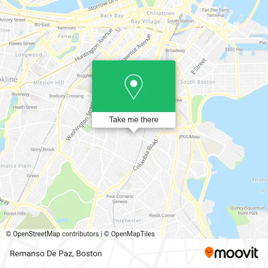
See Remanso De Paz, Boston, on the map
Public Transit to Remanso De Paz in Boston
Wondering how to get to Remanso De Paz in Boston? Moovit helps you find the best way to get to Remanso De Paz with step-by-step directions from the nearest public transit station.
Moovit provides free maps and live directions to help you navigate through your city. View schedules, routes, timetables, and find out how long does it take to get to Remanso De Paz in real time.
Looking for the nearest stop or station to Remanso De Paz? Check out this list of stops closest to your destination: Dudley St @ E Cottage St; Blue Hill Ave @ Moreland St; Dudley St @ Uphams Corner Station; Newmarket; Andrew; Jfk/Umass.
Bus: 10, 15, 41, 45, FAIRMOUNT LINE SHUTTLE.Train: FAIRMOUNT, NEEDHAM, FRANKLIN/FOXBORO, PROVIDENCE/STOUGHTON, FALL RIVER/NEW BEDFORD, GREENBUSH, KINGSTON.Subway: ORANGE LINE, RED LINE.
Want to see if there’s another route that gets you there at an earlier time? Moovit helps you find alternative routes or times. Get directions from and directions to Remanso De Paz easily from the Moovit App or Website.
We make riding to Remanso De Paz easy, which is why over 1.7 million users, including users in Boston, trust Moovit as the best app for public transit. You don’t need to download an individual bus app or train app, Moovit is your all-in-one transit app that helps you find the best bus time or train time available.
For information on prices of bus, subway and train, costs and ride fares to Remanso De Paz, please check the Moovit app.
Use the app to navigate to popular places including to the airport, hospital, stadium, grocery store, mall, coffee shop, school, college, and university.
Remanso De Paz Address: 5 Howard Ave street in Boston
- Dudley Park,
- Advanced Realty,
- Joe Abner Tax and Financial Service,
- Salvation Army Kroc Community Center,
- Salvation Army Kroc Center,
- Boston Tees Factory,
- Restoration City Church,
- Ministerios Ebenezer Boston, Guerreros de Jehova,
- Project Hope Boston,
- U-Haul,
- Davis Concrete Leveling,
- La Borilla Grocery,
- Ujam Records,
- Locks Rekey,
- Long Distance Movers,
- Flores Electrical,
- Gus & Gus General Contracting,
- S.A.K. Laundromat,
- Workspace,
- Darro Chea - Guitarist
Places Near Remanso De Paz (Boston)
- Boston Convention & Exhibition Center, Boston,
- Faneuil Hall, Boston,
- Boston Medical Center, Boston,
- North End, Boston,
- Massachusetts General Hospital, Boston,
- Td Garden, Boston,
- Museum Of Science, Boston,
- Castle Island, Boston,
- Cheers, Boston,
- House Of Blues, Boston,
- Boston Children's Hospital, Boston,
- Leader Bank Pavilion (Leader Bank Pavillion), Boston,
- Prudential Center, Boston,
- Boston Common, Boston,
- Isabella Stewart Gardner Museum, Boston,
- Quincy Market, Boston,
- Seaport District, Boston,
- Wilbur Theatre, Boston,
- Mgm Music Hall, Boston,
- Wang Theater, Boston
How to get to popular places in Boston with public transit
Get around Boston by public transit!
Traveling around Boston has never been so easy. See step by step directions as you travel to any attraction, street or major public transit station. View bus and train schedules, arrival times, service alerts and detailed routes on a map, so you know exactly how to get to anywhere in Boston.
When traveling to any destination around Boston use Moovit's Live Directions with Get Off Notifications to know exactly where and how far to walk, how long to wait for your line, and how many stops are left. Moovit will alert you when it's time to get off — no need to constantly re-check whether yours is the next stop.
Wondering how to use public transit in Boston or how to pay for public transit in Boston? Moovit public transit app can help you navigate your way with public transit easily, and at minimum cost. It includes public transit fees, ticket prices, and costs. Looking for a map of Boston public transit lines? Moovit public transit app shows all public transit maps in Boston with all Bus, Train, Subway and Ferry routes and stops on an interactive map.
Boston has 4 transit type(s), including: Bus, Train, Subway and Ferry, operated by several transit agencies, including MBTA, Southeastern Regional Transit Authority, MetroWest Regional Transit Authority, Rhode Island Public Transit Authority, WRTA, Lowell Regional Transit Authority, Merrimack Valley Transit, Montachusett Regional Transit Authority, Cape Cod Regional Transit Authority, Brockton Area Transit Authority, Martha's Vineyard Transit Authority, the WAVE - Nantucket Regional Transit Authority, GATRA, Cape Ann Transportation Authority and Massport