Directions to Removery (Framingham) with public transportation
The following transit lines have routes that pass near Removery
 Bus: 03, 07, 10, MWES, 04N.
- Train: FRAMINGHAM/WORCESTER, LAKE SHORE LIMITED.
How to get to Removery by bus?
Click on the bus route to see step by step directions with maps, line arrival times and updated time schedules.
From Boston Marriott Newton, Newton
100 minFrom Marlborough, MA, Marlborough
94 minFrom Bose Corp, Framingham
63 minFrom Hopkinton, MA, Hopkinton
80 minFrom Staples Corporate HQ, Framingham
60 minFrom Babson College, Wellesley
68 minFrom Wellesley, MA, Wellesley
71 minFrom I-95 / Route 128 & Route 16 Interchange (Exit 21), Newton
73 min
How to get to Removery by train?
Click on the train route to see step by step directions with maps, line arrival times and updated time schedules.
Train stations near Removery in Framingham
Bus lines to Removery in Framingham
What are the closest stations to Removery?
The closest stations to Removery are:
- Walmart is 1401 yards away, 17 min walk.
- Super Stop And Shop is 1742 yards away, 21 min walk.
- West Natick is 4498 yards away, 53 min walk.
- Framingham Amtrak is 5109 yards away, 60 min walk.
Which bus lines stop near Removery?
These bus lines stop near Removery: 03, 07, 10, MWES.
Which train line stops near Removery?
FRAMINGHAM/WORCESTER (#521 | Worcester)
What time is the first train to Removery in Framingham?
The FRAMINGHAM/WORCESTER is the first train that goes to Removery in Framingham. It stops nearby at 4:54 AM.
What time is the last train to Removery in Framingham?
The LAKE SHORE LIMITED is the last train that goes to Removery in Framingham. It stops nearby at 8:00 PM.
What time is the first bus to Removery in Framingham?
The 03 is the first bus that goes to Removery in Framingham. It stops nearby at 6:44 AM.
What time is the last bus to Removery in Framingham?
The 04N is the last bus that goes to Removery in Framingham. It stops nearby at 10:39 PM.
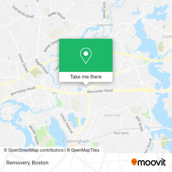
See Removery, Framingham, on the map
Public Transit to Removery in Framingham
Wondering how to get to Removery in Framingham? Moovit helps you find the best way to get to Removery with step-by-step directions from the nearest public transit station.
Moovit provides free maps and live directions to help you navigate through your city. View schedules, routes, timetables, and find out how long does it take to get to Removery in real time.
Looking for the nearest stop or station to Removery? Check out this list of stops closest to your destination: Walmart; Super Stop And Shop; West Natick; Framingham Amtrak.
Bus: 03, 07, 10, MWES, 04N, 02.Train: FRAMINGHAM/WORCESTER, LAKE SHORE LIMITED.
Want to see if there’s another route that gets you there at an earlier time? Moovit helps you find alternative routes or times. Get directions from and directions to Removery easily from the Moovit App or Website.
We make riding to Removery easy, which is why over 1.7 million users, including users in Framingham, trust Moovit as the best app for public transit. You don’t need to download an individual bus app or train app, Moovit is your all-in-one transit app that helps you find the best bus time or train time available.
For information on prices of bus and train, costs and ride fares to Removery, please check the Moovit app.
Use the app to navigate to popular places including to the airport, hospital, stadium, grocery store, mall, coffee shop, school, college, and university.
Removery Address: 160 Speen Street Suite 300 street in Framingham
- Peixoto Building Service,
- Gutierrez Multi Service,
- Gardner Thomas H Chirprtr,
- Top Level Landscaping,
- SRS Construction & Landscape,
- Hydronic Heating Service Repair,
- TACO BELL,
- RR Improvement,
- Susanne Stevens Massage Therap,
- Coiffeurs International,
- Angry Ham's Garage (Beacon Street Bar and Grill),
- 24 Hour 7 Day Emerg A Locksmith A 1,
- Fiori Day Spa,
- Sarahs House,
- Route 9 & Route 126 Interchange,
- Tennessee's Real BBQ Real Fast,
- EV Connect,
- Framingham, MA,
- Bathroom Remodel Financing,
- United States Government
Places Near Removery (Framingham)
- North End, Boston,
- Boston Children's Hospital, Boston,
- Cheers, Boston,
- Leader Bank Pavilion (Leader Bank Pavillion), Boston,
- Wang Theater, Boston,
- Prudential Center, Boston,
- Wilbur Theatre, Boston,
- Td Garden, Boston,
- House Of Blues, Boston,
- Boston Medical Center, Boston,
- Boston Convention & Exhibition Center, Boston,
- Mgm Music Hall, Boston,
- Faneuil Hall, Boston,
- Massachusetts General Hospital, Boston,
- Seaport District, Boston,
- Quincy Market, Boston,
- Museum Of Science, Boston,
- Castle Island, Boston,
- Boston Common, Boston,
- Isabella Stewart Gardner Museum, Boston
How to get to popular places in Boston with public transit
Get around Framingham by public transit!
Traveling around Framingham has never been so easy. See step by step directions as you travel to any attraction, street or major public transit station. View bus and train schedules, arrival times, service alerts and detailed routes on a map, so you know exactly how to get to anywhere in Framingham.
When traveling to any destination around Framingham use Moovit's Live Directions with Get Off Notifications to know exactly where and how far to walk, how long to wait for your line, and how many stops are left. Moovit will alert you when it's time to get off — no need to constantly re-check whether yours is the next stop.
Wondering how to use public transit in Framingham or how to pay for public transit in Framingham? Moovit public transit app can help you navigate your way with public transit easily, and at minimum cost. It includes public transit fees, ticket prices, and costs. Looking for a map of Framingham public transit lines? Moovit public transit app shows all public transit maps in Framingham with all Bus, Train, Subway and Ferry routes and stops on an interactive map.
Boston has 4 transit type(s), including: Bus, Train, Subway and Ferry, operated by several transit agencies, including MBTA, Southeastern Regional Transit Authority, MetroWest Regional Transit Authority, Rhode Island Public Transit Authority, WRTA, Lowell Regional Transit Authority, Merrimack Valley Transit, Montachusett Regional Transit Authority, Cape Cod Regional Transit Authority, Brockton Area Transit Authority, Martha's Vineyard Transit Authority, the WAVE - Nantucket Regional Transit Authority, GATRA, Cape Ann Transportation Authority and Massport