Directions to Renaissance Manor Of Westfield (Boston) with public transportation
The following transit lines have routes that pass near Renaissance Manor Of Westfield
 Bus: R10.
How to get to Renaissance Manor Of Westfield by bus?
Click on the bus route to see step by step directions with maps, line arrival times and updated time schedules.
From Palladium, Worcester
143 minFrom Foxwoods, Worcester
168 minFrom Walmart Supercenter, Worcester
197 minFrom Polar Park, Worcester
140 minFrom Worcester, MA, Worcester
138 minFrom Dcu Center, Worcester
140 minFrom South High Community School, Worcester
235 minFrom Registry Of Motor Vehicles (Rmv) Branch Office, Worcester
142 min
Bus stop near Renaissance Manor Of Westfield in Boston
- Springfield / Mountain, 10 min walk,VIEW
Bus lines to Renaissance Manor Of Westfield in Boston
- R10, Westfield State University,VIEW
What are the closest stations to Renaissance Manor Of Westfield?
The closest stations to Renaissance Manor Of Westfield are:
- Springfield / Mountain is 861 yards away, 10 min walk.
Which bus line stops near Renaissance Manor Of Westfield?
R10 (Westfield State University)
What’s the nearest bus station to Renaissance Manor Of Westfield in Boston?
The nearest bus station to Renaissance Manor Of Westfield in Boston is Springfield / Mountain. It’s a 10 min walk away.
What time is the first bus to Renaissance Manor Of Westfield in Boston?
The R10 is the first bus that goes to Renaissance Manor Of Westfield in Boston. It stops nearby at 5:52 AM.
What time is the last bus to Renaissance Manor Of Westfield in Boston?
The R10 is the last bus that goes to Renaissance Manor Of Westfield in Boston. It stops nearby at 11:03 PM.
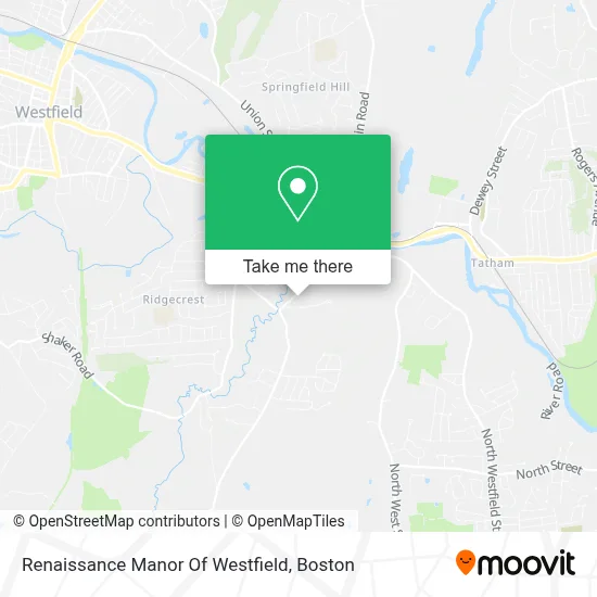
See Renaissance Manor Of Westfield, Boston, on the map
Public Transit to Renaissance Manor Of Westfield in Boston
Wondering how to get to Renaissance Manor Of Westfield in Boston? Moovit helps you find the best way to get to Renaissance Manor Of Westfield with step-by-step directions from the nearest public transit station.
Moovit provides free maps and live directions to help you navigate through your city. View schedules, routes, timetables, and find out how long does it take to get to Renaissance Manor Of Westfield in real time.
Looking for the nearest stop or station to Renaissance Manor Of Westfield? Check out this list of stops closest to your destination: Springfield / Mountain.
Bus: R10.
Want to see if there’s another route that gets you there at an earlier time? Moovit helps you find alternative routes or times. Get directions from and directions to Renaissance Manor Of Westfield easily from the Moovit App or Website.
We make riding to Renaissance Manor Of Westfield easy, which is why over 1.7 million users, including users in Boston, trust Moovit as the best app for public transit. You don’t need to download an individual bus app or train app, Moovit is your all-in-one transit app that helps you find the best bus time or train time available.
For information on prices of bus, costs and ride fares to Renaissance Manor Of Westfield, please check the Moovit app.
Use the app to navigate to popular places including to the airport, hospital, stadium, grocery store, mall, coffee shop, school, college, and university.
Renaissance Manor Of Westfield Address: 37 Feeding Hills Rd street in Boston
- Westfield Properties,
- Westfield Fire Department - Station 2,
- Little River Playground,
- W / S Westfield Properties Lp Agricultural Preservation Restriction,
- USPS Collection Box - Blue Box,
- Walmart Supercenter,
- MoneyGram,
- Minute Key,
- Gift-Ology Westfield,
- Par 4 the Course,
- Bacon Wilson P C,
- Par 4 the Course - Virtual Golf Experience,
- Players Edge,
- Holyoke Health Center,
- Gandara Mental Health Center,
- Kelly's Home & Garden,
- Westfield Medical Building,
- Park Parking,
- Hampshire Orthopedics & Sports Medicine,
- Anne Vaillant Midwife
Places Near Renaissance Manor Of Westfield (Boston)
- North End, Boston,
- Td Garden, Boston,
- House Of Blues, Boston,
- Castle Island, Boston,
- Museum Of Science, Boston,
- Prudential Center, Boston,
- Wang Theater, Boston,
- Quincy Market, Boston,
- Faneuil Hall, Boston,
- Isabella Stewart Gardner Museum, Boston,
- Mgm Music Hall, Boston,
- Boston Common, Boston,
- Boston Medical Center, Boston,
- Cheers, Boston,
- Wilbur Theatre, Boston,
- Leader Bank Pavilion (Leader Bank Pavillion), Boston,
- Massachusetts General Hospital, Boston,
- Boston Convention & Exhibition Center, Boston,
- Seaport District, Boston,
- Boston Children's Hospital, Boston
How to get to popular places in Boston with public transit
Get around Boston by public transit!
Traveling around Boston has never been so easy. See step by step directions as you travel to any attraction, street or major public transit station. View bus and train schedules, arrival times, service alerts and detailed routes on a map, so you know exactly how to get to anywhere in Boston.
When traveling to any destination around Boston use Moovit's Live Directions with Get Off Notifications to know exactly where and how far to walk, how long to wait for your line, and how many stops are left. Moovit will alert you when it's time to get off — no need to constantly re-check whether yours is the next stop.
Wondering how to use public transit in Boston or how to pay for public transit in Boston? Moovit public transit app can help you navigate your way with public transit easily, and at minimum cost. It includes public transit fees, ticket prices, and costs. Looking for a map of Boston public transit lines? Moovit public transit app shows all public transit maps in Boston with all Bus, Train, Subway and Ferry routes and stops on an interactive map.
Boston has 4 transit type(s), including: Bus, Train, Subway and Ferry, operated by several transit agencies, including MBTA, Southeastern Regional Transit Authority, MetroWest Regional Transit Authority, Rhode Island Public Transit Authority, WRTA, Lowell Regional Transit Authority, Merrimack Valley Transit, Montachusett Regional Transit Authority, Cape Cod Regional Transit Authority, Brockton Area Transit Authority, Martha's Vineyard Transit Authority, the WAVE - Nantucket Regional Transit Authority, GATRA, Cape Ann Transportation Authority and Massport