How to get to Rene's Barber Shop by bus?
Click on the bus route to see step by step directions with maps, line arrival times and updated time schedules.
From Marion County Assessor's Office (South), Beech Grove
84 minFrom Q St, Beech Grove
75 minFrom Big Skee's Grill & Variety, Indianapolis City (Balance)
61 minFrom Billy Blades Hair Salon (Unique-N-Favor Black Hair Salon), Indianapolis City (Balance)
55 minFrom N Franklin Rd / E 56th St, Lawrence
60 minFrom Total Praise And Worship Center, Indianapolis City (Balance)
58 minFrom N Franklin Rd / E 42nd St, Indianapolis City (Balance)
33 minFrom RecycleForce, Indianapolis City (Balance)
34 minFrom Machine Co Depend, Indianapolis City (Balance)
54 minFrom N German Church Rd / Pendleton Pike, Lawrence
36 min
Bus stops near Rene's Barber Shop in Indianapolis City (Balance)
Bus lines to Rene's Barber Shop in Indianapolis City (Balance)
What are the closest stations to Rene's Barber Shop?
The closest stations to Rene's Barber Shop are:
- 10th St & Harbison Ave is 17 yards away, 1 min walk.
- Post Rd & 10th St is 575 yards away, 8 min walk.
Which bus line stops near Rene's Barber Shop?
10 (Meijer E. Wash)
What’s the nearest bus station to Rene's Barber Shop in Indianapolis City (Balance)?
The nearest bus station to Rene's Barber Shop in Indianapolis City (Balance) is 10th St & Harbison Ave. It’s a 1 min walk away.
What time is the first bus to Rene's Barber Shop in Indianapolis City (Balance)?
The 87 is the first bus that goes to Rene's Barber Shop in Indianapolis City (Balance). It stops nearby at 4:29 AM.
What time is the last bus to Rene's Barber Shop in Indianapolis City (Balance)?
The 10 is the last bus that goes to Rene's Barber Shop in Indianapolis City (Balance). It stops nearby at 10:37 PM.
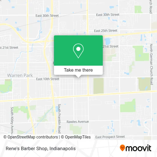
See Rene's Barber Shop, Indianapolis City (Balance), on the map
Public Transit to Rene's Barber Shop in Indianapolis City (Balance)
Wondering how to get to Rene's Barber Shop in Indianapolis City (Balance)? Moovit helps you find the best way to get to Rene's Barber Shop with step-by-step directions from the nearest public transit station.
Moovit provides free maps and live directions to help you navigate through your city. View schedules, routes, timetables, and find out how long does it take to get to Rene's Barber Shop in real time.
Looking for the nearest stop or station to Rene's Barber Shop? Check out this list of stops closest to your destination: 10th St & Harbison Ave; Post Rd & 10th St.
Bus: 10, 87.
Want to see if there’s another route that gets you there at an earlier time? Moovit helps you find alternative routes or times. Get directions from and directions to Rene's Barber Shop easily from the Moovit App or Website.
We make riding to Rene's Barber Shop easy, which is why over 1.5 million users, including users in Indianapolis City (Balance), trust Moovit as the best app for public transit. You don’t need to download an individual bus app or train app, Moovit is your all-in-one transit app that helps you find the best bus time or train time available.
For information on prices of bus, costs and ride fares to Rene's Barber Shop, please check the Moovit app.
Use the app to navigate to popular places including to the airport, hospital, stadium, grocery store, mall, coffee shop, school, college, and university.
Rene's Barber Shop Address: 8649 E 10th St Indianapolis, IN 46219 street in Indianapolis City (Balance)
- Ryan's Hair Care,
- Cornerstone Family Dentistry,
- Lights Out Entertainment,
- Rockitcoin,
- Centro De Recursos Comunitarios Moorhead,
- Moorhead Community Resource Center,
- Dr. J.R. Lindeman, Dds,
- Print & Copy Shop,
- Lindeman J R Dds,
- Remnant Ministries Indy,
- RSC Trucking,
- Tasty Tays Bbq Llc,
- Don't Eat the Bone BBQ,
- Mold Inspection & Testing Indianapolis In,
- Burn One Smoke One Llc,
- Spirit of Excellence BBQ,
- 10th and Post Smoke Shop,
- Custom Auto,
- Henson's Lawn And Landscape,
- A 01 Locksmith
Places Near Rene's Barber Shop (Indianapolis City (Balance))
- Methodist Hospital of Indianapolis, Indianapolis City (Balance),
- Indiana, Indianapolis City (Balance),
- I-465 / I-65 Interchange, Indianapolis City (Balance),
- St. Vincent entrance #1, Indianapolis City (Balance),
- Indianapolis Airport Zone 2, Indianapolis City (Balance),
- Jersey Barn, Indianapolis City (Balance),
- Gainbridge Fieldhouse, Indianapolis City (Balance),
- 119 W 19th St Parking, Indianapolis City (Balance),
- THE BALT, Indianapolis City (Balance),
- Lilly Corporate Center (Eli Lilly & Co), Indianapolis City (Balance),
- Cotter's Massage Parlor With Happy Endings, Indianapolis City (Balance),
- Indianapolis Motor Speedway, Speedway,
- I U Health Methodist Hospital, Indianapolis City (Balance),
- St. Vincent Hospital - Indianapolis, Indianapolis City (Balance),
- Castleton Square Mall, Indianapolis,
- Lucas Oil Stadium, Indianapolis City (Balance),
- Train Ride At Castleton Mall, Indianapolis City (Balance),
- Indiana Convention Center, Indianapolis City (Balance),
- Plainfield, IN, Plainfield,
- Eskenazi Hospital, Indianapolis City (Balance)
How to get to popular places in Indianapolis with public transit
Get around Indianapolis City (Balance) by public transit!
Traveling around Indianapolis City (Balance) has never been so easy. See step by step directions as you travel to any attraction, street or major public transit station. View bus and train schedules, arrival times, service alerts and detailed routes on a map, so you know exactly how to get to anywhere in Indianapolis City (Balance).
When traveling to any destination around Indianapolis City (Balance) use Moovit's Live Directions with Get Off Notifications to know exactly where and how far to walk, how long to wait for your line, and how many stops are left. Moovit will alert you when it's time to get off — no need to constantly re-check whether yours is the next stop.
Wondering how to use public transit in Indianapolis City (Balance) or how to pay for public transit in Indianapolis City (Balance)? Moovit public transit app can help you navigate your way with public transit easily, and at minimum cost. It includes public transit fees, ticket prices, and costs. Looking for a map of Indianapolis City (Balance) public transit lines? Moovit public transit app shows all public transit maps in Indianapolis City (Balance) with all bus routes and stops on an interactive map.
Indianapolis has 1 transit type(s), including: bus, operated by several transit agencies, including IndyGo, FlixBus-us and Greyhound-us