Directions to Renew Worcester with public transportation
The following transit lines have routes that pass near Renew Worcester
 Bus: 14, 15, 33, CLINTON-WORCESTER COMMUTER SHUTTLE, GREYHOUND US0230.
- Train: FRAMINGHAM/WORCESTER.
How to get to Renew Worcester by bus?
Click on the bus route to see step by step directions with maps, line arrival times and updated time schedules.
Bus stops near Renew Worcester
Bus lines to Renew Worcester
What are the closest stations to Renew Worcester?
The closest stations to Renew Worcester are:
- Main St + Fed Court House is 34 yards away, 1 min walk.
- Southbridge St + Old Dmv is 154 yards away, 2 min walk.
- Front St + Commercial St is 197 yards away, 3 min walk.
- Mcgrath Blvd And Mrytle St is 421 yards away, 6 min walk.
- Green St at Goddard is 423 yards away, 6 min walk.
Which bus lines stop near Renew Worcester?
These bus lines stop near Renew Worcester: 14, 15, 33, CLINTON-WORCESTER COMMUTER SHUTTLE, GREYHOUND US0230.
Which train line stops near Renew Worcester?
FRAMINGHAM/WORCESTER (#525 | Worcester)
What’s the nearest bus station to Renew Worcester?
The nearest bus station to Renew Worcester is Main St + Fed Court House. It’s a 1 min walk away.
What time is the first bus to Renew Worcester?
The 27 is the first bus that goes to Renew Worcester. It stops nearby at 5:11 AM.
What time is the last bus to Renew Worcester?
The 11 is the last bus that goes to Renew Worcester. It stops nearby at 10:57 PM.
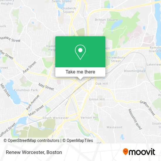
See Renew Worcester on the map
Public Transportation to Renew Worcester
Wondering how to get to Renew Worcester? Moovit helps you find the best way to get to Renew Worcester with step-by-step directions from the nearest public transit station.
Moovit provides free maps and live directions to help you navigate through your city. View schedules, routes, timetables, and find out how long does it take to get to Renew Worcester in real time.
Looking for the nearest stop or station to Renew Worcester? Check out this list of stops closest to your destination: Main St + Fed Court House; Southbridge St + Old Dmv; Front St + Commercial St; Mcgrath Blvd And Mrytle St; Green St at Goddard.
Bus: 14, 15, 33, CLINTON-WORCESTER COMMUTER SHUTTLE, GREYHOUND US0230, 6, 7, 19, 27, 825, 2, 4, 11, 29.Train: FRAMINGHAM/WORCESTER.
Want to see if there’s another route that gets you there at an earlier time? Moovit helps you find alternative routes or times. Get directions from and directions to Renew Worcester easily from the Moovit App or Website.
We make riding to Renew Worcester easy, which is why over 1.7 million users, including users in Worcester, trust Moovit as the best app for public transit. You don’t need to download an individual bus app or train app, Moovit is your all-in-one transit app that helps you find the best bus time or train time available.
For information on prices of bus and train, costs and ride fares to Renew Worcester, please check the Moovit app.
Use the app to navigate to popular places including to the airport, hospital, stadium, grocery store, mall, coffee shop, school, college, and university.
Renew Worcester Address: 44 Portland St street in Worcester
- Worclab,
- Page Authority,
- Conexmedia Services,
- Be Studios,
- Worcester Cleantech Incubator,
- Herbalife Nutrition Center,
- Lush Studio LLC,
- The Haymond Law Firm,
- New England Business Associates,
- Commonwealth of Massachusetts Law Enforcement Div,
- Shekinah Ent,
- Jesus Power Assembly of God,
- Team Link Brazilian Jiu Jitsu,
- Major Taylor Statue,
- Ramp Church Worcester,
- The Verve Jazz Ensemble,
- Hanover Theatre (Hanover Theater, in the Pit),
- Hanover Theatre,
- Jmac,
- Spectrum Worcester
Places Near Renew Worcester
- Faneuil Hall, Boston,
- North End, Boston,
- Cheers, Boston,
- Boston Children's Hospital, Boston,
- Castle Island, Boston,
- Isabella Stewart Gardner Museum, Boston,
- House Of Blues, Boston,
- Boston Convention & Exhibition Center, Boston,
- Td Garden, Boston,
- Massachusetts General Hospital, Boston,
- Wang Theater, Boston,
- Wilbur Theatre, Boston,
- Prudential Center, Boston,
- Mgm Music Hall, Boston,
- Quincy Market, Boston,
- Leader Bank Pavilion (Leader Bank Pavillion), Boston,
- Boston Medical Center, Boston,
- Boston Common, Boston,
- Museum Of Science, Boston,
- Seaport District, Boston
How to get to popular places in Boston with public transit
Get around Worcester by public transit!
Traveling around Worcester has never been so easy. See step by step directions as you travel to any attraction, street or major public transit station. View bus and train schedules, arrival times, service alerts and detailed routes on a map, so you know exactly how to get to anywhere in Worcester.
When traveling to any destination around Worcester use Moovit's Live Directions with Get Off Notifications to know exactly where and how far to walk, how long to wait for your line, and how many stops are left. Moovit will alert you when it's time to get off — no need to constantly re-check whether yours is the next stop.
Wondering how to use public transit in Worcester or how to pay for public transit in Worcester? Moovit public transit app can help you navigate your way with public transit easily, and at minimum cost. It includes public transit fees, ticket prices, and costs. Looking for a map of Worcester public transit lines? Moovit public transit app shows all public transit maps in Worcester with all Bus, Train, Subway and Ferry routes and stops on an interactive map.
Boston has 4 transit type(s), including: Bus, Train, Subway and Ferry, operated by several transit agencies, including MBTA, Southeastern Regional Transit Authority, MetroWest Regional Transit Authority, Rhode Island Public Transit Authority, WRTA, Lowell Regional Transit Authority, Merrimack Valley Transit, Montachusett Regional Transit Authority, Cape Cod Regional Transit Authority, Brockton Area Transit Authority, Martha's Vineyard Transit Authority, the WAVE - Nantucket Regional Transit Authority, GATRA, Cape Ann Transportation Authority and Massport