Directions to Rensauce Llc (Malden) with public transportation
The following transit lines have routes that pass near Rensauce Llc
 Bus: 104, 105.
- Train: NEWBURYPORT/ROCKPORT, HAVERHILL.
- Subway: ORANGE LINE.
How to get to Rensauce Llc by bus?
Click on the bus route to see step by step directions with maps, line arrival times and updated time schedules.
From Boston Children's Hospital, Boston
58 minFrom 98 Binney St, Boston
55 minFrom Hynes Convention Center MBTA Station, Boston
38 minFrom Santarpio's Pizza, Boston
37 minFrom Residence Inn by Marriott Boston Downtown/South End, Boston
77 minFrom Park Plaza Hotel Boston, Boston
58 minFrom Warrior Ice Arena, Boston
81 minFrom Fort Independence, Boston
83 minFrom Trident Booksellers & Cafe, Boston
55 minFrom Old State House, Boston
40 min
How to get to Rensauce Llc by train?
Click on the train route to see step by step directions with maps, line arrival times and updated time schedules.
How to get to Rensauce Llc by subway?
Click on the subway route to see step by step directions with maps, line arrival times and updated time schedules.
From Boston Children's Hospital, Boston
71 minFrom 98 Binney St, Boston
71 minFrom Hynes Convention Center MBTA Station, Boston
38 minFrom Santarpio's Pizza, Boston
54 minFrom Residence Inn by Marriott Boston Downtown/South End, Boston
58 minFrom Park Plaza Hotel Boston, Boston
51 minFrom Warrior Ice Arena, Boston
93 minFrom Trident Booksellers & Cafe, Boston
56 minFrom Old State House, Boston
37 min
Bus stops near Rensauce Llc in Malden
Subway station near Rensauce Llc in Malden
- Wellington, 27 min walk,VIEW
What are the closest stations to Rensauce Llc?
The closest stations to Rensauce Llc are:
- Cross St @ Walnut St is 237 yards away, 3 min walk.
- Ferry St @ Magnolia St is 303 yards away, 4 min walk.
- Chelsea is 1367 yards away, 19 min walk.
- Wellington is 2239 yards away, 27 min walk.
- Oak Grove is 3066 yards away, 36 min walk.
Which bus lines stop near Rensauce Llc?
These bus lines stop near Rensauce Llc: 104, 105.
Which train line stops near Rensauce Llc?
NEWBURYPORT/ROCKPORT (#125 | Newburyport)
Which subway line stops near Rensauce Llc?
ORANGE LINE (Oak Grove)
What’s the nearest subway station to Rensauce Llc in Malden?
The nearest subway station to Rensauce Llc in Malden is Wellington. It’s a 27 min walk away.
What’s the nearest train station to Rensauce Llc in Malden?
The nearest train station to Rensauce Llc in Malden is Chelsea. It’s a 19 min walk away.
What’s the nearest bus station to Rensauce Llc in Malden?
The nearest bus station to Rensauce Llc in Malden is Cross St @ Walnut St. It’s a 3 min walk away.
What time is the first subway to Rensauce Llc in Malden?
The ORANGE LINE is the first subway that goes to Rensauce Llc in Malden. It stops nearby at 5:15 AM.
What time is the last subway to Rensauce Llc in Malden?
The ORANGE LINE is the last subway that goes to Rensauce Llc in Malden. It stops nearby at 1:59 AM.
What time is the first train to Rensauce Llc in Malden?
The HAVERHILL is the first train that goes to Rensauce Llc in Malden. It stops nearby at 5:35 AM.
What time is the last train to Rensauce Llc in Malden?
The NEWBURYPORT/ROCKPORT is the last train that goes to Rensauce Llc in Malden. It stops nearby at 12:06 AM.
What time is the first bus to Rensauce Llc in Malden?
The 104 is the first bus that goes to Rensauce Llc in Malden. It stops nearby at 4:29 AM.
What time is the last bus to Rensauce Llc in Malden?
The 104 is the last bus that goes to Rensauce Llc in Malden. It stops nearby at 1:34 AM.
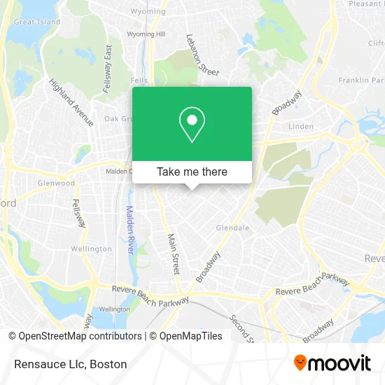
See Rensauce Llc, Malden, on the map
Public Transit to Rensauce Llc in Malden
Wondering how to get to Rensauce Llc in Malden? Moovit helps you find the best way to get to Rensauce Llc with step-by-step directions from the nearest public transit station.
Moovit provides free maps and live directions to help you navigate through your city. View schedules, routes, timetables, and find out how long does it take to get to Rensauce Llc in real time.
Looking for the nearest stop or station to Rensauce Llc? Check out this list of stops closest to your destination: Cross St @ Walnut St; Ferry St @ Magnolia St; Chelsea; Wellington; Oak Grove.
Bus: 104, 105.Train: NEWBURYPORT/ROCKPORT, HAVERHILL.Subway: ORANGE LINE.
Want to see if there’s another route that gets you there at an earlier time? Moovit helps you find alternative routes or times. Get directions from and directions to Rensauce Llc easily from the Moovit App or Website.
We make riding to Rensauce Llc easy, which is why over 1.7 million users, including users in Malden, trust Moovit as the best app for public transit. You don’t need to download an individual bus app or train app, Moovit is your all-in-one transit app that helps you find the best bus time or train time available.
For information on prices of bus, subway and train, costs and ride fares to Rensauce Llc, please check the Moovit app.
Use the app to navigate to popular places including to the airport, hospital, stadium, grocery store, mall, coffee shop, school, college, and university.
Rensauce Llc Address: 384 Ferry St street in Malden
- Artistic Video Productions,
- Thistle Safe and Lock Co Inc,
- Ferryway School,
- Malden Life Insurance,
- Pk Motor Cars,
- Southern Baptist Convention,
- Portillo Brothers Market II,
- Dogs for Days,
- Malden Mobile Locksmith Store,
- Casablanca Services in,
- Cosmos Caribbean Restaurant,
- Amazing Client Reviews,
- C & T Market,
- Lyons Liquors Store,
- City of Malden,
- Nego VIP Cleaning Services,
- North Shore Details,
- Goldman Funeral Chapel,
- World Depot,
- United Auto Repair & Collision Center
Places Near Rensauce Llc (Malden)
- Mgm Music Hall, Boston,
- Quincy Market, Boston,
- Td Garden, Boston,
- Boston Common, Boston,
- House Of Blues, Boston,
- Wilbur Theatre, Boston,
- Isabella Stewart Gardner Museum, Boston,
- Leader Bank Pavilion (Leader Bank Pavillion), Boston,
- Boston Children's Hospital, Boston,
- Boston Medical Center, Boston,
- Wang Theater, Boston,
- Museum Of Science, Boston,
- Massachusetts General Hospital, Boston,
- Castle Island, Boston,
- Prudential Center, Boston,
- Cheers, Boston,
- Faneuil Hall, Boston,
- Seaport District, Boston,
- North End, Boston,
- Boston Convention & Exhibition Center, Boston
How to get to popular places in Boston with public transit
Get around Malden by public transit!
Traveling around Malden has never been so easy. See step by step directions as you travel to any attraction, street or major public transit station. View bus and train schedules, arrival times, service alerts and detailed routes on a map, so you know exactly how to get to anywhere in Malden.
When traveling to any destination around Malden use Moovit's Live Directions with Get Off Notifications to know exactly where and how far to walk, how long to wait for your line, and how many stops are left. Moovit will alert you when it's time to get off — no need to constantly re-check whether yours is the next stop.
Wondering how to use public transit in Malden or how to pay for public transit in Malden? Moovit public transit app can help you navigate your way with public transit easily, and at minimum cost. It includes public transit fees, ticket prices, and costs. Looking for a map of Malden public transit lines? Moovit public transit app shows all public transit maps in Malden with all Bus, Train, Subway and Ferry routes and stops on an interactive map.
Boston has 4 transit type(s), including: Bus, Train, Subway and Ferry, operated by several transit agencies, including MBTA, Southeastern Regional Transit Authority, MetroWest Regional Transit Authority, Rhode Island Public Transit Authority, WRTA, Lowell Regional Transit Authority, Merrimack Valley Transit, Montachusett Regional Transit Authority, Cape Cod Regional Transit Authority, Brockton Area Transit Authority, Martha's Vineyard Transit Authority, the WAVE - Nantucket Regional Transit Authority, GATRA, Cape Ann Transportation Authority and Massport