How to get to Repsol by bus?
Click on the bus route to see step by step directions with maps, line arrival times and updated time schedules.
From Hotel Vértice Roomspace, Madrid
62 minFrom Cementerio Sur, Madrid
72 minFrom Estadio Butarque, Área Metropolitana De Madrid Y Corredor Del Henares
73 minFrom Islazul (Centro Comercial Islazul), Madrid
84 minFrom Caja Mágica, Área Metropolitana De Madrid Y Corredor Del Henares
46 minFrom Tanatorio Servisa Madrid, Área Metropolitana De Madrid Y Corredor Del Henares
59 minFrom Leganes, Leganés
71 minFrom Parla, Madrid, Parla
42 minFrom Avenida del Vivero S/N, Fuenlabrada
73 minFrom Nexum Retail Park, Fuenlabrada
98 min
How to get to Repsol by train?
Click on the train route to see step by step directions with maps, line arrival times and updated time schedules.
Bus stops near Repsol in Getafe
Bus lines to Repsol in Getafe
What are the closest stations to Repsol?
The closest stations to Repsol are:
- Río Odiel - Bembézar is 301 meters away, 5 min walk.
- Río Tinto - Río Odiel is 477 meters away, 8 min walk.
- Galileo Galilei - Miguel Faraday is 1358 meters away, 19 min walk.
- Getafe - Industrial is 3892 meters away, 51 min walk.
Which bus lines stop near Repsol?
These bus lines stop near Repsol: 427, 428.
Which train line stops near Repsol?
C3 (Aranjuez)
What’s the nearest bus station to Repsol in Getafe?
The nearest bus station to Repsol in Getafe is Río Odiel - Bembézar. It’s a 5 min walk away.
What time is the first train to Repsol in Getafe?
The C3 is the first train that goes to Repsol in Getafe. It stops nearby at 5:39 AM.
What time is the last train to Repsol in Getafe?
The C3 is the last train that goes to Repsol in Getafe. It stops nearby at 12:05 AM.
What time is the first bus to Repsol in Getafe?
The N401 is the first bus that goes to Repsol in Getafe. It stops nearby at 3:01 AM.
What time is the last bus to Repsol in Getafe?
The N401 is the last bus that goes to Repsol in Getafe. It stops nearby at 3:02 AM.
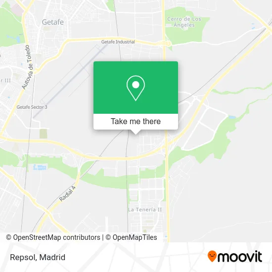
See Repsol, Getafe, on the map
Public Transit to Repsol in Getafe
Wondering how to get to Repsol in Getafe? Moovit helps you find the best way to get to Repsol with step-by-step directions from the nearest public transit station.
Moovit provides free maps and live directions to help you navigate through your city. View schedules, routes, timetables, and find out how long does it take to get to Repsol in real time.
Looking for the nearest stop or station to Repsol? Check out this list of stops closest to your destination: Río Odiel - Bembézar; Río Tinto - Río Odiel; Galileo Galilei - Miguel Faraday; Getafe - Industrial.
Bus: 427, 428, N401, PI2, C3, C3.Train: C3.
Want to see if there’s another route that gets you there at an earlier time? Moovit helps you find alternative routes or times. Get directions from and directions to Repsol easily from the Moovit App or Website.
We make riding to Repsol easy, which is why over 1.5 million users, including users in Getafe, trust Moovit as the best app for public transit. You don’t need to download an individual bus app or train app, Moovit is your all-in-one transit app that helps you find the best bus time or train time available.
For information on prices of bus, metro and train, costs and ride fares to Repsol, please check the Moovit app.
Use the app to navigate to popular places including to the airport, hospital, stadium, grocery store, mall, coffee shop, school, college, and university.
Repsol Address: Calle Río Zújar, 28906 Getafe street in Getafe
- Calle Río Odiel s/n,
- Saltoki Materiales de Construcción,
- Concesionario Bmw Motorrad Getafe,
- Conarpesa Patagonia de Mariscos y Pescados S.L.,
- Decathlon Getafe,
- Calle Río Odiel 11,
- Calle Río Zújar 1,
- Mercadona,
- Almacén Decathlon,
- Sumsol,
- Grupo Mérica Foods,
- Suministros Solares Su,
- Carretera de Andalucía A-4 km 16,5,
- Salvesen Logística,
- Gxo,
- Restaurante La Campa,
- Decathlon,
- Micel,
- C.L.A. Centro Logístico de Abastecimiento,
- Pol. Industrial C.L.A
Places Near Repsol (Getafe)
- Palacio De Vistalegre, Área Metropolitana De Madrid Y Corredor Del Henares,
- Mendez Alvaro, Madrid,
- Hospital Clínico Universitario San Carlos, Madrid,
- Tres Aguas, Alcorcón,
- Centro Comercial La Vaguada, Área Metropolitana De Madrid Y Corredor Del Henares,
- Estadio Wanda Metropolitano, Área Metropolitana De Madrid Y Corredor Del Henares,
- Plaza Mayor, Madrid,
- Centro Comercial Islazul, Área Metropolitana De Madrid Y Corredor Del Henares,
- Estacion de Chamartin, Madrid,
- Sala La Riviera, Madrid,
- Hospital Universitario La Paz, Madrid,
- Centro Comercial La Gavia, Área Metropolitana De Madrid Y Corredor Del Henares,
- Plenilunio, Área Metropolitana De Madrid Y Corredor Del Henares,
- Wizink Center, Madrid,
- Mercadillo de Majadahonda, Majadahonda,
- Rastro De Madrid, Área Metropolitana De Madrid Y Corredor Del Henares,
- Calle de López de Hoyos 169, Madrid,
- Nassica, Área Metropolitana De Madrid Y Corredor Del Henares,
- Hospital Universitario Ramón y Cajal, Madrid,
- Centro Comercial Oasiz Madrid, Área Metropolitana De Madrid Y Corredor Del Henares
How to get to popular places in Madrid with public transit
Get around Getafe by public transit!
Traveling around Getafe has never been so easy. See step by step directions as you travel to any attraction, street or major public transit station. View bus and train schedules, arrival times, service alerts and detailed routes on a map, so you know exactly how to get to anywhere in Getafe.
When traveling to any destination around Getafe use Moovit's Live Directions with Get Off Notifications to know exactly where and how far to walk, how long to wait for your line, and how many stops are left. Moovit will alert you when it's time to get off — no need to constantly re-check whether yours is the next stop.
Wondering how to use public transit in Getafe or how to pay for public transit in Getafe? Moovit public transit app can help you navigate your way with public transit easily, and at minimum cost. It includes public transit fees, ticket prices, and costs. Looking for a map of Getafe public transit lines? Moovit public transit app shows all public transit maps in Getafe with all Bus, Train, Metro and Light Rail routes and stops on an interactive map.
Madrid has 4 transit type(s), including: Bus, Train, Metro and Light Rail, operated by several transit agencies, including Metro de Madrid, Metro Ligero, Tranvía de Parla, Renfe Cercanías - Servicios de Autobús especiales, Renfe Cercanias, Renfe Cercanías, EMT, Interurbanos, Urbanos de Alcalá de Henares, Urbanos de Alcobendas, Urbanos de Alcorcón, Urbanos de Algete, Urbanos de Aranjuez, Urbanos de Arganda del Rey and Urbanos de Arroyomolinos