How to get to Rescue Moving by bus?
Click on the bus route to see step by step directions with maps, line arrival times and updated time schedules.
From McNally School, Edmonton
69 minFrom Matrix Hotel, Edmonton
64 minFrom D R Wellness A B, Edmonton
96 minFrom Chateau Lacombe Hotel, Edmonton
59 minFrom Mayfield Common Shopping Centre, Edmonton
77 minFrom Sir Winston Churchill Square, Edmonton
61 minFrom 109 St NW, Edmonton
56 minFrom Sturgeon County, Edmonton
98 minFrom Glenwood Medical Clinic, Edmonton
65 minFrom Holiday Inn Express, Edmonton
69 min
Bus stops near Rescue Moving in Edmonton
Bus lines to Rescue Moving in Edmonton
- 124, Eaux Claires Transit Centre,VIEW
- 618, 135 Street & 132 Avenue,VIEW
- 683, Castle Downs Transit Centre,VIEW
- 112, Castle Downs Transit Centre,VIEW
- 109, Northgate Transit Centre,VIEW
- 140X, Palisades - Kingsway Express,VIEW
- 625, O'Leary - Palisades,VIEW
- 150X, Government Transit Centre,VIEW
- 613, 90 Street & 132 Avenue,VIEW
What are the closest stations to Rescue Moving?
The closest stations to Rescue Moving are:
- 127 Street & 161 Avenue is 99 meters away, 2 min walk.
- 129 Street & 161 Avenue is 277 meters away, 4 min walk.
- Dunluce Road & 161 Avenue is 329 meters away, 5 min walk.
Which bus lines stop near Rescue Moving?
These bus lines stop near Rescue Moving: 052, 103, 124.
What’s the nearest bus station to Rescue Moving in Edmonton?
The nearest bus station to Rescue Moving in Edmonton is 127 Street & 161 Avenue. It’s a 2 min walk away.
What time is the first bus to Rescue Moving in Edmonton?
The 124 is the first bus that goes to Rescue Moving in Edmonton. It stops nearby at 10:01 AM.
What time is the last bus to Rescue Moving in Edmonton?
The 124 is the last bus that goes to Rescue Moving in Edmonton. It stops nearby at 7:29 PM.
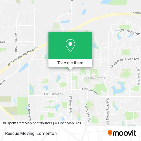
See Rescue Moving, Edmonton, on the map
Public Transit to Rescue Moving in Edmonton
Wondering how to get to Rescue Moving in Edmonton? Moovit helps you find the best way to get to Rescue Moving with step-by-step directions from the nearest public transit station.
Moovit provides free maps and live directions to help you navigate through your city. View schedules, routes, timetables, and find out how long does it take to get to Rescue Moving in real time.
Looking for the nearest stop or station to Rescue Moving? Check out this list of stops closest to your destination: 127 Street & 161 Avenue; 129 Street & 161 Avenue; Dunluce Road & 161 Avenue.
Bus: 052, 103, 124, 618, 683, 112, 109, 140X, 625, 150X, 613.
Want to see if there’s another route that gets you there at an earlier time? Moovit helps you find alternative routes or times. Get directions from and directions to Rescue Moving easily from the Moovit App or Website.
We make riding to Rescue Moving easy, which is why over 1.5 million users, including users in Edmonton, trust Moovit as the best app for public transit. You don’t need to download an individual bus app or train app, Moovit is your all-in-one transit app that helps you find the best bus time or train time available.
For information on prices of bus and light rail, costs and ride fares to Rescue Moving, please check the Moovit app.
Use the app to navigate to popular places including to the airport, hospital, stadium, grocery store, mall, coffee shop, school, college, and university.
Rescue Moving Address: 16127 128 St NW Edmonton, AB T6V 1M8 street in Edmonton
- I Clean Janitorial Services,
- Vape Stop,
- Plis Construction,
- Fanjoy & Associates,
- Confident Consulting First Aid Training,
- Lucky 7 Uphols,
- Ghame Homes,
- Glenridge Mews Condominiums,
- Gracenote Music,
- Klean Kultura,
- Flower Design by Tamam,
- Dream Exterior,
- Squadv Plumbing and Heating,
- Oxford,
- D.A.A Leggings and Fashion,
- A.Awad Professional,
- Herb Link Park,
- Firestone,
- DOLLARAMA,
- Jasem Abou Daher - TD Financial Planner
Places Near Rescue Moving (Edmonton)
- Whyte Avenue, Edmonton,
- Northgate Centre, Edmonton,
- Edmonton EXPO Centre, Edmonton,
- Rogers Place, Edmonton,
- Edmonton VIA Rail Station, Edmonton,
- Canada Place Service Canada Centre, Edmonton,
- Cross Cancer Institute, Edmonton,
- Londonderry Mall, Edmonton,
- Kaye Edmonton Clinic, Edmonton,
- West Edmonton Mall, Edmonton,
- Fort Edmonton Park, Edmonton,
- Kingsway Mall, Edmonton,
- Borden Park, Edmonton,
- Grey Nuns Community Hospital, Edmonton,
- Edmonton Commonwealth Stadium, Edmonton,
- University of Alberta, Edmonton,
- Edmonton Valley Zoo, Edmonton,
- Royal Alexandra Hospital, Edmonton,
- Alberta Legislature Building, Edmonton,
- MacEwan University, Edmonton
How to get to popular places in Edmonton with public transit
Get around Edmonton by public transit!
Traveling around Edmonton has never been so easy. See step by step directions as you travel to any attraction, street or major public transit station. View bus and train schedules, arrival times, service alerts and detailed routes on a map, so you know exactly how to get to anywhere in Edmonton.
When traveling to any destination around Edmonton use Moovit's Live Directions with Get Off Notifications to know exactly where and how far to walk, how long to wait for your line, and how many stops are left. Moovit will alert you when it's time to get off — no need to constantly re-check whether yours is the next stop.
Wondering how to use public transit in Edmonton or how to pay for public transit in Edmonton? Moovit public transit app can help you navigate your way with public transit easily, and at minimum cost. It includes public transit fees, ticket prices, and costs. Looking for a map of Edmonton public transit lines? Moovit public transit app shows all public transit maps in Edmonton with all Bus and Light Rail routes and stops on an interactive map.
Edmonton has 2 transit type(s), including: Bus and Light Rail, operated by several transit agencies, including ETS LRT, ETS, Strathcona County Transit, St. Albert Transit, Spruce Grove Transit, Fort Saskatchewan Transit, Beaumont Transit and Leduc Transit