How to get to Rescuetech by bus?
Click on the bus route to see step by step directions with maps, line arrival times and updated time schedules.
From Red Wing, Bloomington
88 minFrom Life Time Fitness (Lifetime Fitness St Louis Park), St. Louis Park
125 minFrom Allina Health Greenway Clinic (Minneapolis), Minneapolis
77 minFrom Empo, Minneapolis
77 minFrom Aulwood Furniture Polish, Bloomington
95 minFrom Cub Foods, Bloomington
83 minFrom Washburn High School, Minneapolis
115 minFrom Edina, MN, Edina
72 minFrom Fairview Southdale Hospital, Edina
118 min
Bus stop near Rescuetech in Edina
- Washington Ave S & 69th St W, 5 min walk,VIEW
Bus lines to Rescuetech in Edina
- 600, Express / Southdale / Goldtri / Swsta / Ecrk,VIEW
What are the closest stations to Rescuetech?
The closest stations to Rescuetech are:
- Washington Ave S & 69th St W is 376 yards away, 5 min walk.
Which bus lines stop near Rescuetech?
These bus lines stop near Rescuetech: 38, 540.
What’s the nearest bus station to Rescuetech in Edina?
The nearest bus station to Rescuetech in Edina is Washington Ave S & 69th St W. It’s a 5 min walk away.
What time is the first bus to Rescuetech in Edina?
The 600 is the first bus that goes to Rescuetech in Edina. It stops nearby at 7:20 AM.
What time is the last bus to Rescuetech in Edina?
The 600 is the last bus that goes to Rescuetech in Edina. It stops nearby at 4:20 PM.
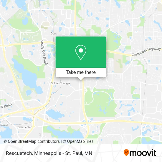
See Rescuetech, Edina, on the map
Public Transit to Rescuetech in Edina
Wondering how to get to Rescuetech in Edina? Moovit helps you find the best way to get to Rescuetech with step-by-step directions from the nearest public transit station.
Moovit provides free maps and live directions to help you navigate through your city. View schedules, routes, timetables, and find out how long does it take to get to Rescuetech in real time.
Looking for the nearest stop or station to Rescuetech? Check out this list of stops closest to your destination: Washington Ave S & 69th St W.
Bus: 38, 540, 600.
Want to see if there’s another route that gets you there at an earlier time? Moovit helps you find alternative routes or times. Get directions from and directions to Rescuetech easily from the Moovit App or Website.
We make riding to Rescuetech easy, which is why over 1.7 million users, including users in Edina, trust Moovit as the best app for public transit. You don’t need to download an individual bus app or train app, Moovit is your all-in-one transit app that helps you find the best bus time or train time available.
For information on prices of bus, costs and ride fares to Rescuetech, please check the Moovit app.
Use the app to navigate to popular places including to the airport, hospital, stadium, grocery store, mall, coffee shop, school, college, and university.
Rescuetech Address: 6975 Washington Ave S Minneapolis, MN 55439 street in Edina
- Gohart Merchandising,
- Airbroom Minnesota,
- Cobblestone Mills,
- Airbroom Minnesota (Air Broom Minnesota),
- Peridot Solutions,
- Tristar Power Solutions,
- Engage Event Centers,
- Benson Property,
- Voice & Data Networks,
- Fish Window Cleaning,
- Zahler Heating & Air Conditioning,
- Minnesota Casters,
- Citilights Lighting,
- Battle Creek Armory,
- Innovative Energy Solutions,
- Painting by Rembrandts,
- National Bank of United States,
- Unity Bank,
- AirMaxx Trampoline Park,
- Vital Volleyball
Places Near Rescuetech (Edina)
- Surly Brewing Co., Minneapolis,
- Abbott Northwestern Piper Building, Minneapolis,
- Mpls. Convention Center, Minneapolis,
- Minnehaha Falls, Minneapolis,
- Grand Casino Hinckley,MN, Minneapolis,
- Orpheum Theatre (Minneapolis, Minnesota), Minneapolis,
- Huntington Bank Stadium, Minneapolis,
- Harriet Island Regional Park, St. Paul,
- St. Paul College, St. Paul,
- Treasure Island Resort & Casino, St. Paul,
- Minnesota State Capitol, St. Paul,
- Bishop Henry Whipple Federal Building,
- Target Center, Minneapolis,
- Target Field, Minneapolis,
- Northrop Auditorium, Minneapolis,
- 3m Arena at Mariucci, Minneapolis,
- Minneapolis Sculpture Garden, Minneapolis,
- Minneapolis Institute of Art, Minneapolis,
- Mystic lake casino bus, Minneapolis,
- Xcel Energy Center, St. Paul
How to get to popular places in Minneapolis - St. Paul, MN with public transit
Get around Edina by public transit!
Traveling around Edina has never been so easy. See step by step directions as you travel to any attraction, street or major public transit station. View bus and train schedules, arrival times, service alerts and detailed routes on a map, so you know exactly how to get to anywhere in Edina.
When traveling to any destination around Edina use Moovit's Live Directions with Get Off Notifications to know exactly where and how far to walk, how long to wait for your line, and how many stops are left. Moovit will alert you when it's time to get off — no need to constantly re-check whether yours is the next stop.
Wondering how to use public transit in Edina or how to pay for public transit in Edina? Moovit public transit app can help you navigate your way with public transit easily, and at minimum cost. It includes public transit fees, ticket prices, and costs. Looking for a map of Edina public transit lines? Moovit public transit app shows all public transit maps in Edina with all Bus, Train and Light Rail routes and stops on an interactive map.
Minneapolis - St. Paul, MN has 3 transit type(s), including: Bus, Train and Light Rail, operated by several transit agencies, including Metro Transit , Metro Transit, MVTA, Plymouth Metrolink, SouthWest Transit, Maple Grove, University of Minnesota, Airport (MAC), Amtrak, Mankato Transit System, SMART, FlixBus-us and Greyhound-us