Directions to Resharp (Quincy) with public transportation
The following transit lines have routes that pass near Resharp
 Bus: 215.
- Train: GREENBUSH.
- Subway: RED LINE, MATTAPAN LINE.
How to get to Resharp by bus?
Click on the bus route to see step by step directions with maps, line arrival times and updated time schedules.
From Boston Latin Academy, Boston
45 minFrom South Boston, Boston
54 minFrom Ramada by Wyndham Boston, Boston
34 minFrom Hebrew Rehab Center, Boston
67 minFrom Haymarket, Boston, Boston
56 minFrom Boston Municipal Court (Roxbury District Court), Boston
53 minFrom Arnold Arboretum, Boston
64 minFrom Jamaica Plain, Boston
48 minFrom 240 Mount Vernon Street, Boston
63 minFrom UMass Boston Campus Center, Boston
91 min
How to get to Resharp by train?
Click on the train route to see step by step directions with maps, line arrival times and updated time schedules.
From Boston Latin Academy, Boston
123 minFrom South Boston, Boston
94 minFrom Hebrew Rehab Center, Boston
102 minFrom Haymarket, Boston, Boston
109 minFrom Boston Municipal Court (Roxbury District Court), Boston
90 minFrom Arnold Arboretum, Boston
95 minFrom Jamaica Plain, Boston
96 minFrom 240 Mount Vernon Street, Boston
85 minFrom UMass Boston Campus Center, Boston
104 min
How to get to Resharp by subway?
Click on the subway route to see step by step directions with maps, line arrival times and updated time schedules.
From Boston Latin Academy, Boston
97 minFrom South Boston, Boston
59 minFrom Ramada by Wyndham Boston, Boston
82 minFrom Hebrew Rehab Center, Boston
104 minFrom Haymarket, Boston, Boston
61 minFrom Boston Municipal Court (Roxbury District Court), Boston
87 minFrom Arnold Arboretum, Boston
96 minFrom Jamaica Plain, Boston
87 minFrom 240 Mount Vernon Street, Boston
57 minFrom UMass Boston Campus Center, Boston
75 min
Bus stop near Resharp in Quincy
- Willard St @ Copeland St, 1 min walk,VIEW
Bus lines to Resharp in Quincy
- 215, North Quincy,VIEW
What are the closest stations to Resharp?
The closest stations to Resharp are:
- Willard St @ Copeland St is 35 yards away, 1 min walk.
- Wollaston is 1704 yards away, 20 min walk.
- Milton is 4038 yards away, 48 min walk.
Which bus line stops near Resharp?
215 (Quincy Center)
Which train line stops near Resharp?
GREENBUSH (#1063 | Greenbush)
Which subway line stops near Resharp?
RED LINE (Ashmont/Braintree)
What’s the nearest subway station to Resharp in Quincy?
The nearest subway station to Resharp in Quincy is Wollaston. It’s a 20 min walk away.
What’s the nearest bus station to Resharp in Quincy?
The nearest bus station to Resharp in Quincy is Willard St @ Copeland St. It’s a 1 min walk away.
What time is the first subway to Resharp in Quincy?
The MATTAPAN LINE is the first subway that goes to Resharp in Quincy. It stops nearby at 5:06 AM.
What time is the last subway to Resharp in Quincy?
The MATTAPAN LINE is the last subway that goes to Resharp in Quincy. It stops nearby at 2:35 AM.
What time is the first bus to Resharp in Quincy?
The 215 is the first bus that goes to Resharp in Quincy. It stops nearby at 5:12 AM.
What time is the last bus to Resharp in Quincy?
The 215 is the last bus that goes to Resharp in Quincy. It stops nearby at 1:11 AM.
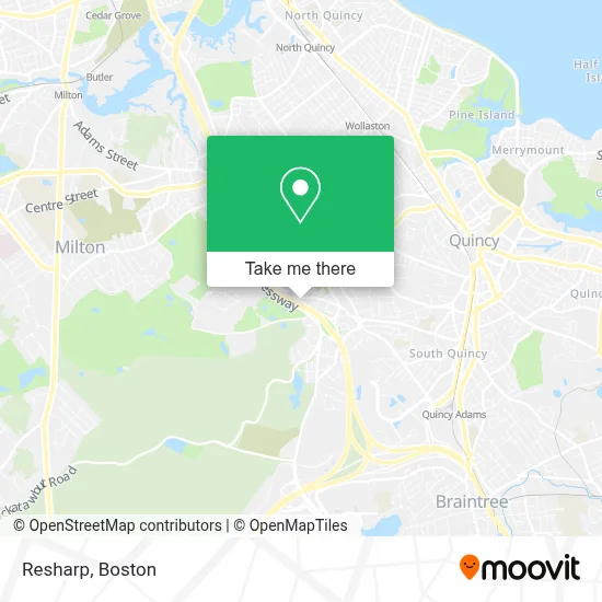
See Resharp, Quincy, on the map
Public Transit to Resharp in Quincy
Wondering how to get to Resharp in Quincy? Moovit helps you find the best way to get to Resharp with step-by-step directions from the nearest public transit station.
Moovit provides free maps and live directions to help you navigate through your city. View schedules, routes, timetables, and find out how long does it take to get to Resharp in real time.
Looking for the nearest stop or station to Resharp? Check out this list of stops closest to your destination: Willard St @ Copeland St; Wollaston; Milton.
Bus: 215.Train: GREENBUSH.Subway: RED LINE, MATTAPAN LINE.
Want to see if there’s another route that gets you there at an earlier time? Moovit helps you find alternative routes or times. Get directions from and directions to Resharp easily from the Moovit App or Website.
We make riding to Resharp easy, which is why over 1.7 million users, including users in Quincy, trust Moovit as the best app for public transit. You don’t need to download an individual bus app or train app, Moovit is your all-in-one transit app that helps you find the best bus time or train time available.
For information on prices of bus, subway and train, costs and ride fares to Resharp, please check the Moovit app.
Use the app to navigate to popular places including to the airport, hospital, stadium, grocery store, mall, coffee shop, school, college, and university.
Resharp Address: 370 COPELAND St street in Quincy
- Fraternal Diplomas Certificates of Recognition,
- J R Rosen Studio,
- 24 Hour Emergencylocksmith,
- Shred Nations,
- Enterprise Rent-A-Car,
- Select Home Improvements,
- Wards of Wisdom,
- Erie Environmental,
- Express Locksmith Inc,
- Quincy Smoke Shop,
- NPH USA-Mid-Atlantic,
- Toast To That Entertainment,
- MC Gowan Income Tax,
- Chocolate Factory,
- ATM,
- Rt 93 South exit 8,
- Quincy Quarries,
- Boston Marine in S,
- Trust 1 Services,
- Laila Maalouf Law Offices
Places Near Resharp (Quincy)
- Seaport District, Boston,
- Museum Of Science, Boston,
- Faneuil Hall, Boston,
- Boston Common, Boston,
- Boston Convention & Exhibition Center, Boston,
- Boston Children's Hospital, Boston,
- Leader Bank Pavilion (Leader Bank Pavillion), Boston,
- Td Garden, Boston,
- Wilbur Theatre, Boston,
- House Of Blues, Boston,
- Isabella Stewart Gardner Museum, Boston,
- Wang Theater, Boston,
- Massachusetts General Hospital, Boston,
- Castle Island, Boston,
- Cheers, Boston,
- Boston Medical Center, Boston,
- Prudential Center, Boston,
- Quincy Market, Boston,
- North End, Boston,
- Mgm Music Hall, Boston
How to get to popular places in Boston with public transit
Get around Quincy by public transit!
Traveling around Quincy has never been so easy. See step by step directions as you travel to any attraction, street or major public transit station. View bus and train schedules, arrival times, service alerts and detailed routes on a map, so you know exactly how to get to anywhere in Quincy.
When traveling to any destination around Quincy use Moovit's Live Directions with Get Off Notifications to know exactly where and how far to walk, how long to wait for your line, and how many stops are left. Moovit will alert you when it's time to get off — no need to constantly re-check whether yours is the next stop.
Wondering how to use public transit in Quincy or how to pay for public transit in Quincy? Moovit public transit app can help you navigate your way with public transit easily, and at minimum cost. It includes public transit fees, ticket prices, and costs. Looking for a map of Quincy public transit lines? Moovit public transit app shows all public transit maps in Quincy with all Bus, Train, Subway and Ferry routes and stops on an interactive map.
Boston has 4 transit type(s), including: Bus, Train, Subway and Ferry, operated by several transit agencies, including MBTA, Southeastern Regional Transit Authority, MetroWest Regional Transit Authority, Rhode Island Public Transit Authority, WRTA, Lowell Regional Transit Authority, Merrimack Valley Transit, Montachusett Regional Transit Authority, Cape Cod Regional Transit Authority, Brockton Area Transit Authority, Martha's Vineyard Transit Authority, the WAVE - Nantucket Regional Transit Authority, GATRA, Cape Ann Transportation Authority and Massport